:::

China's Southwest Borders before the Mid-Qing Dynasty

Before the mid-Qing dynasty - that is, prior to France and Great Britain taking control of Vietnam and Burma, respectively - the Chinese government saw its two southern neighbors as vassals, and under the imperial worldview that "Under the whole heaven, every spot is the sovereign's ground," the concept of national borders was very vague. As the Qing government never formally demarcated borders with Vietnam and Burma or signed any boundary treaties with them, the Museum's collection of historical documents and cartographic materials produced before the Daoguang reign do not carry precise descriptions of Sino-Vietnamese and Sino-Burmese borders.

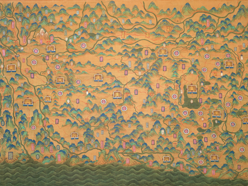
Map of Yunnan Province

Map of Yunnan Province

  1. Qing dynasty
  2. Colors on silk
  3. 60.5 x 100.5 cm
This map shows an orientation with north at the top, south at the bottom, west at the left, and east at the right. There is no indication of a border separating Yunnan from Vietnam and Burma. In the lower right-hand side is a pass named Jiaoshangang, with the Kaihua Prefecture to its north, and to the right a notation reading "Border with Cochin" is seen, which is the boundary between Yunnan and Vietnam. The border between Yunnan and Burma is marked by the locations of various offices, bureaus, and native chieftainships in the borderland. The map also shows Burma's Ava, Zikkam, Toungoo, and Bago, the former capital of the Burmese kingdom.
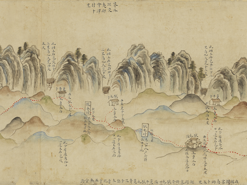
Hand-drawn Map of Border Fortifications

Hand-drawn Map of Border Fortifications

  1. Qing dynasty
  2. Colors on paper
  3. 29 x 700 cm
Mounted in hand-scroll format, this map was broken when the Museum acquired it, and after repair and restoration it was found to be incomplete. The original is likely to have included the border passes in the departments and sub-prefectures under the prefectures of Nanning, Zhenan, and Taiping in Guangxi, along the boundary with Vietnam. However, its present state only shows the border passes of the departments of Leitu and Guishun and the town of Dongrun under the prefecture of Zhenan, and border passes in the other two prefectures are all missing. The map is oriented with south at the top, north at the bottom, east at the left, and west at the right; the area behind the hill is Vietnam. The Qing court set up walls, trenches, and fences between hills, which were likely measures to prevent border crossing. Under the hill along the border towards the top of the map are a number of passes, with specifications of the number of soldiers and militiamen stationed at each pass. The passes and villages were connected by roads (represented by red dotted lines), and the names and dimensions of each wall, trench, and fence are also marked. This elaborately produced map is an important historical document for research into border defenses and passes along the Sino-Vietnamese border before the mid-Qing dynasty.