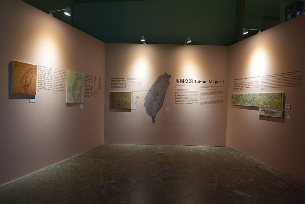
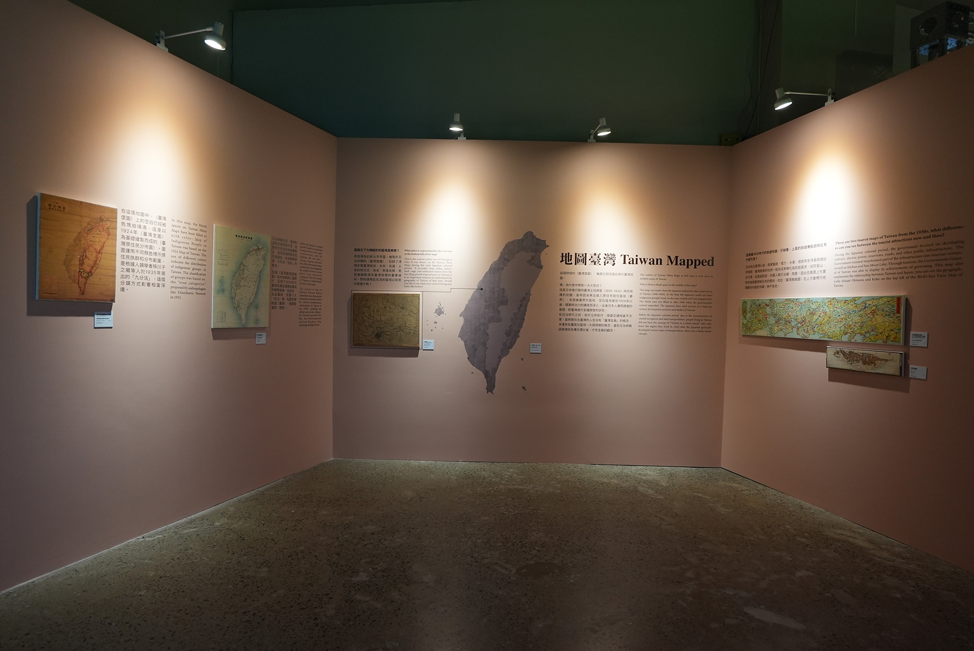
Taiwan Mapped
This section presents the changes in Taiwan's appearance after the 17th century, using the maps of Taiwan and surrounding waters drawn by different political powers such as the Dutch East India Company, the Qing dynasty, and the Empire of Japan. From the Earth history or geological perspective, there may not be much change in Taiwan's physical environment during these hundreds of years. However, the understanding and appearance in map of Taiwan have been changed many times from the perspective of cartography and human geography.
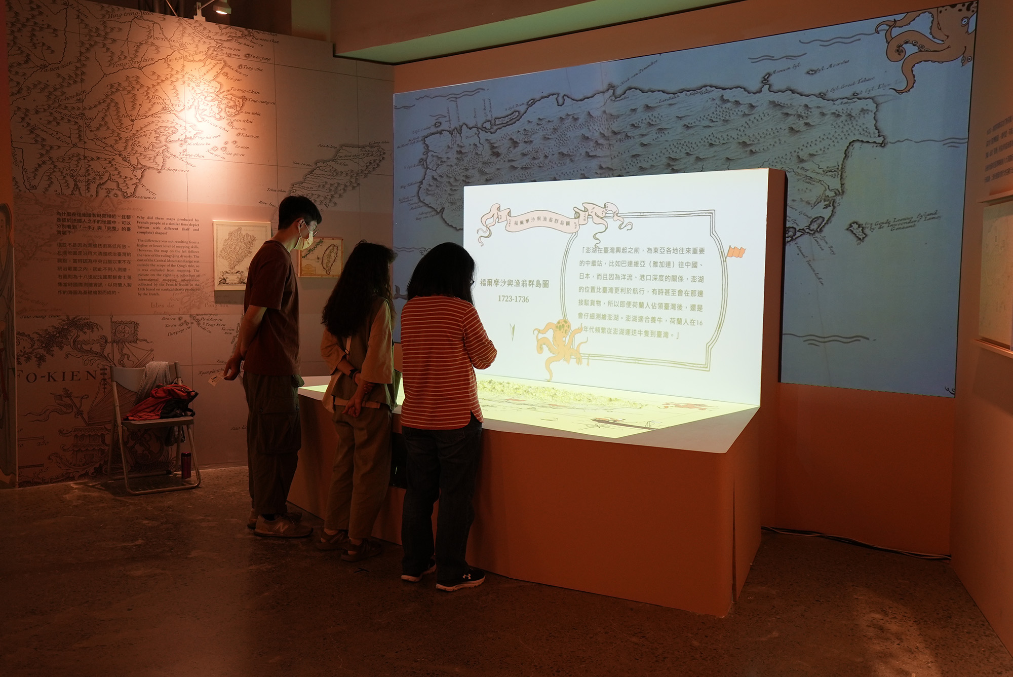
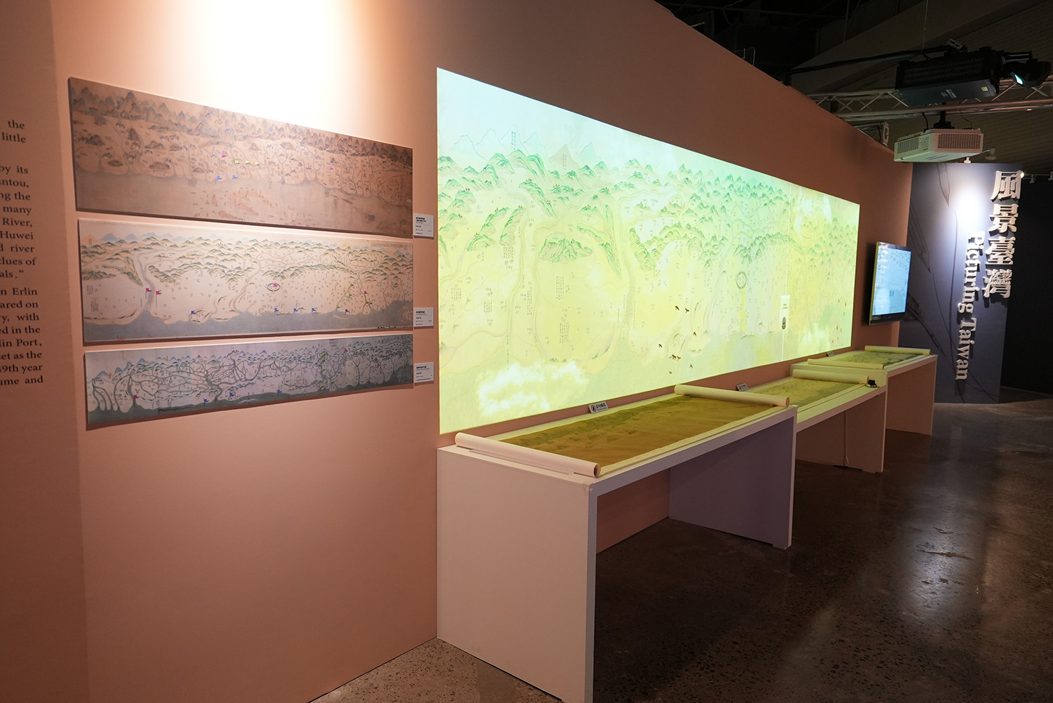
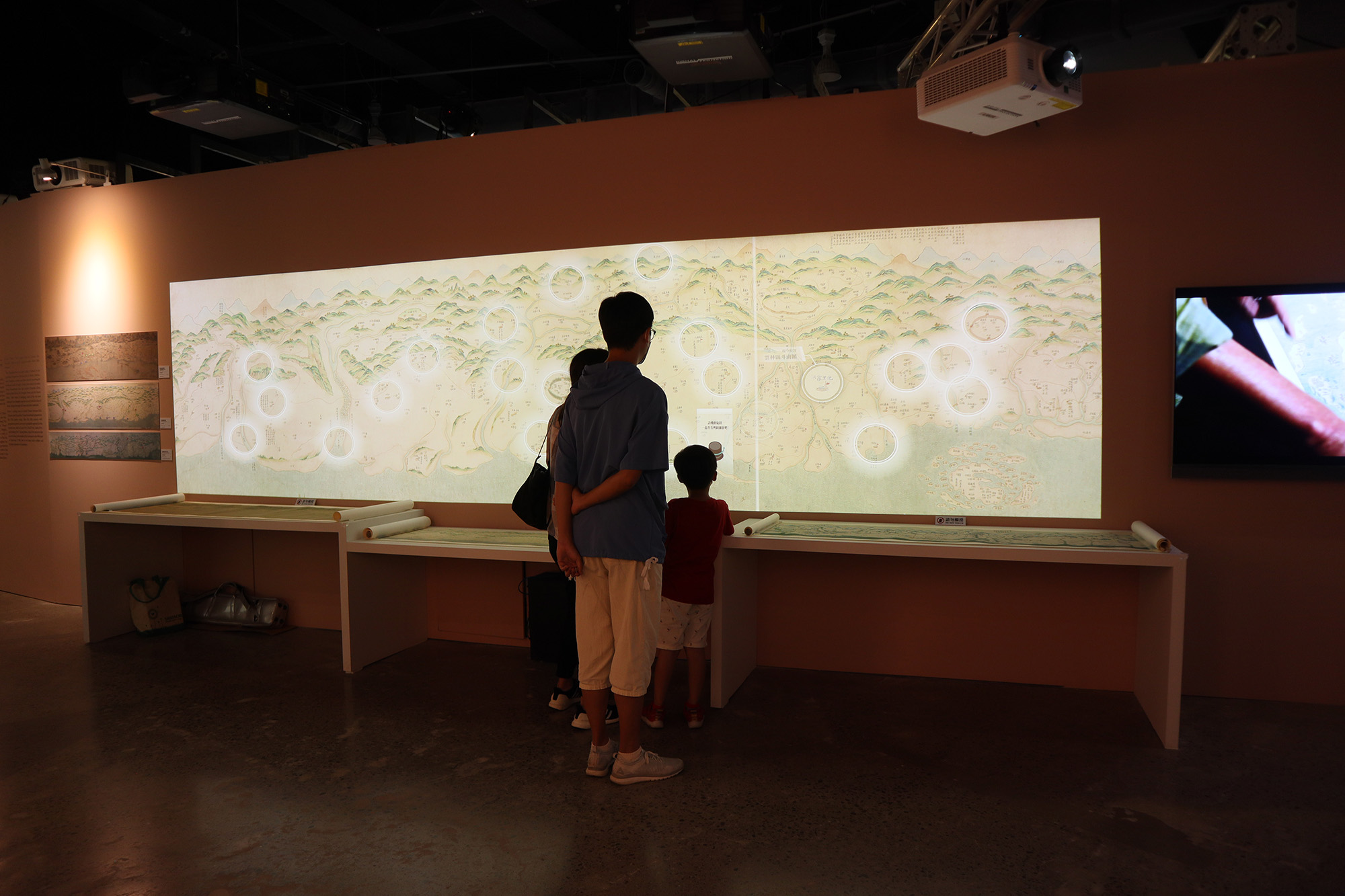
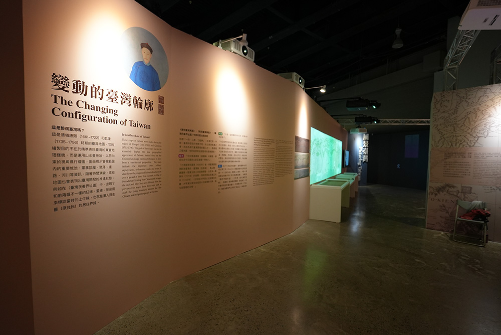
For example, during the Qing's rule, although the government was aware of modern cartography, most maps were still drawn in a freehand-style. Labeling important places such as the Tuniu Ditch (a boundary to delineate between the Han Chinese and indigenous people's settlements), barracks, settlements, and government offices mark an important political function on these maps.
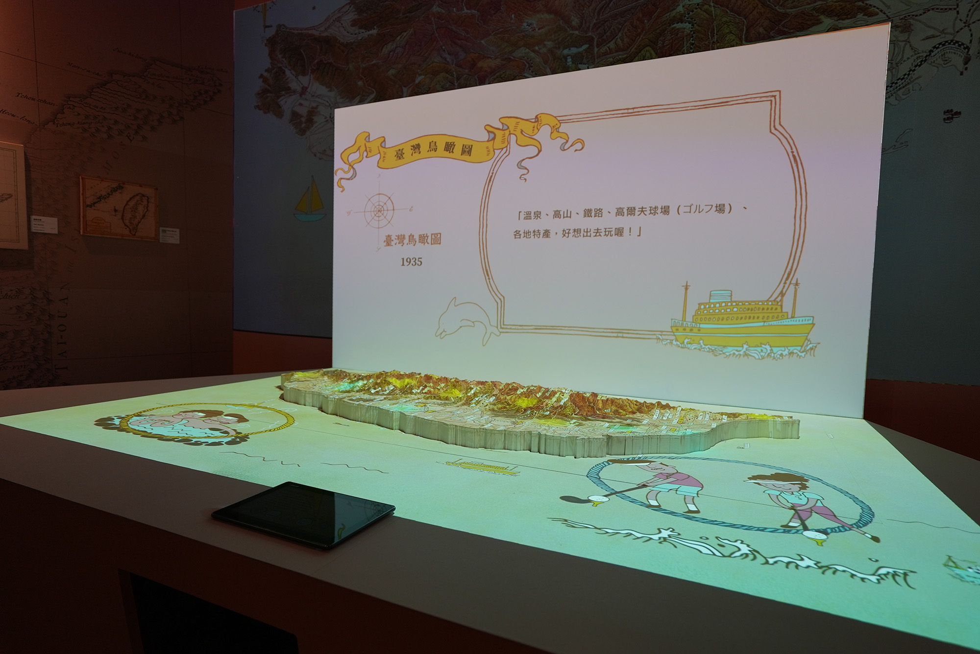
During the Japanese colonization, many surveys and mapping were dconducted in order to govern Taiwan. Various thematic maps such as Administractive Maps , bird's-eye view maps and traffic route maps were also developed with styles and different functions.
Those maps also visually showed the empire's ambition of exploring resource and governing Taiwan.
More importantly, the establishment of infrastructure such as transportation network also created Taiwanese common consciousness──which gradually engaged the whole island as one.
- Taiwan Mapping Mechanical Interactive Installation

- Map of Taiwan, Qing Dynasty Interactive Installation

- Taiwan Mapping Mechanical Interactive Installation
- Map of Taiwan, Qing Dynasty Interactive Installation
- Exhibition Pictures 04
- Exhibition Pictures 01

- Exhibition Pictures 02
- Exhibition Pictures 02
- Exhibition Pictures 04
- Exhibition Pictures 01


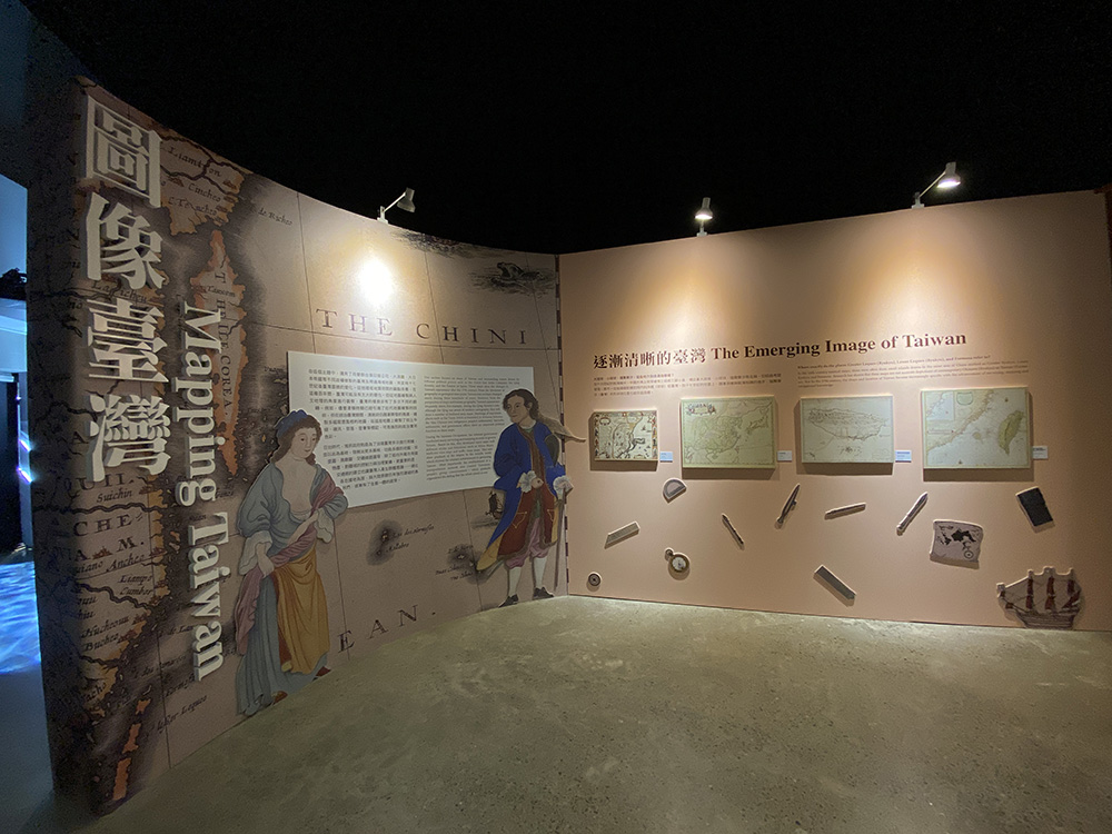
The Image of Taiwan Gradually Becomes Clearer
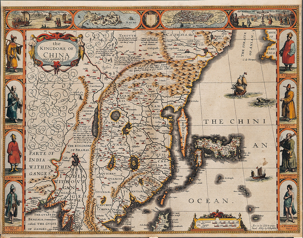
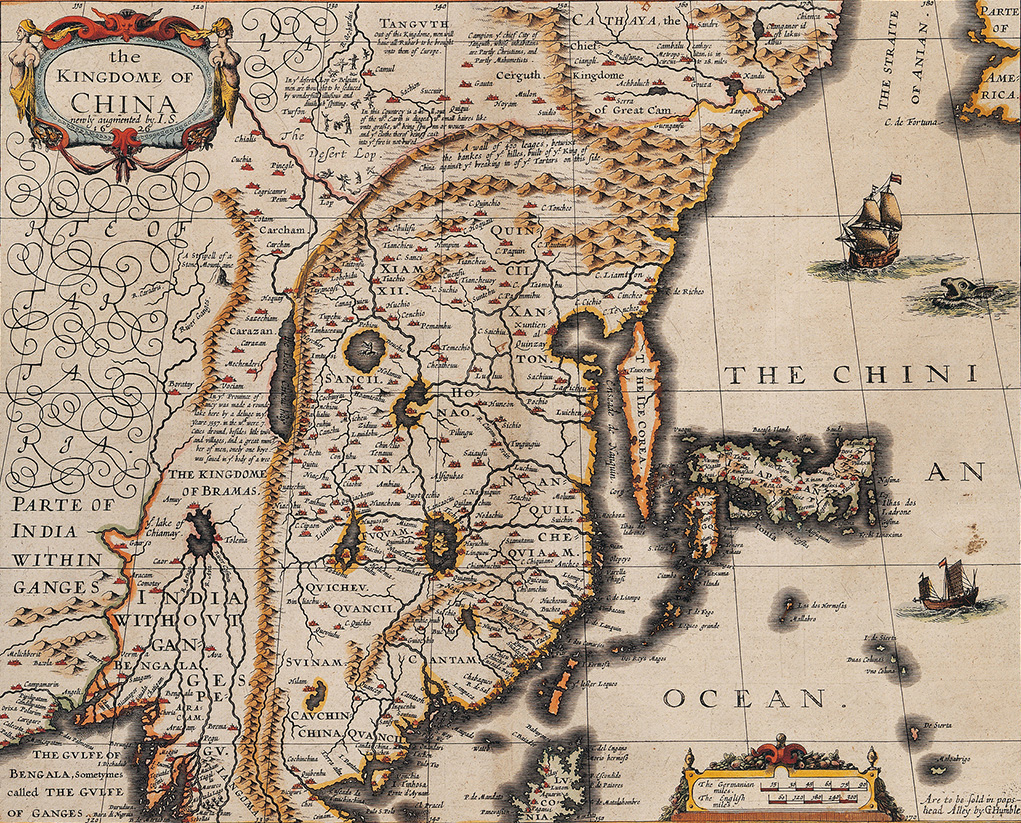 The Kingdome of China
- Dimensions: 41.2X51.3 cm
- Historical Period(s): 1627
- Maker(s)/Artist: John Speed
- Provenance: A Prospect of the Most Famous Parts of the World
- Collection: National Museum of Taiwan History
"Kingdom of China Atlas" was included in the first world atlas published by the British. The map was made to depict East Asia, taking China as its main subject, and also includes Taiwan, Joseon (Korea), Japan, and adjecent areas.
The map provided information of major cities, nation boundaries, and country names, Chinese provinces (but no provincial boundaries), the Great Wall, rivers, and a simple illustration of the topography. Taiwan was depicted as three small islands: Formosa, Lesser Lequeo (Ryukyu), and another unnamed island.
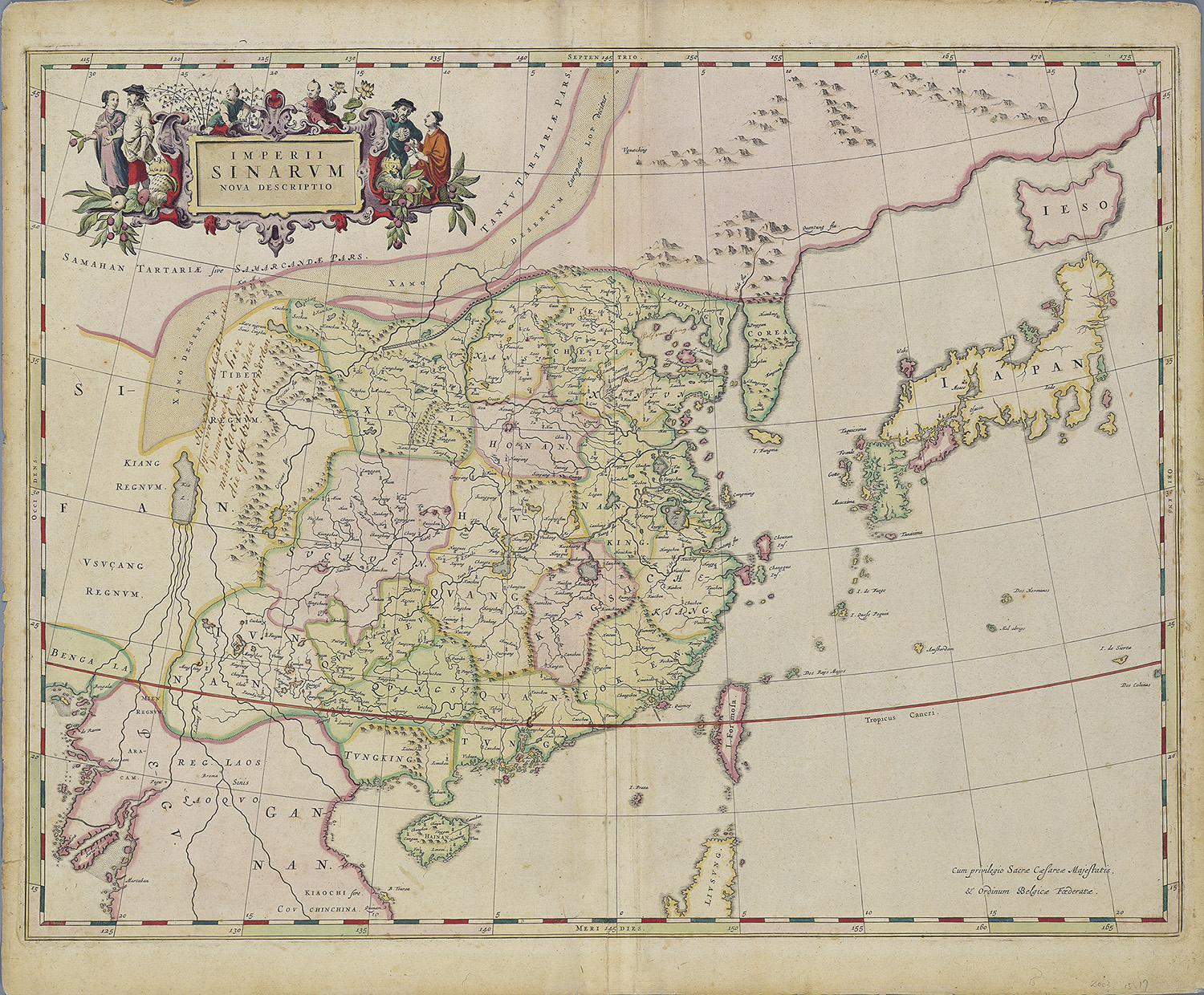
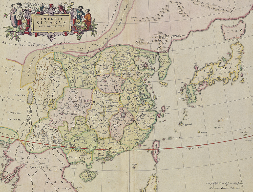 Imperii Sinarum nova descriptio
- Dimensions: 54.1X63.7 cm
- Historical Period(s): 1655
- Maker(s)/Artist: Jean Blaeu
- Provenance: Le Théâtre du Mondea ou Nouvel Atlas
- Collection: National Museum of Taiwan History
This map was drawn by a Dutchman, Jean Bleau in 1653 after exchanging data about China's history and geography with Italian Jesuit Martino Martini and Martini's experience of visiting various parts of China. In the map (I. Formosa), Taiwan was depicted as a long and narrow island; Kinmen (Quemoy) and Penghu islands also were drawn in the map.
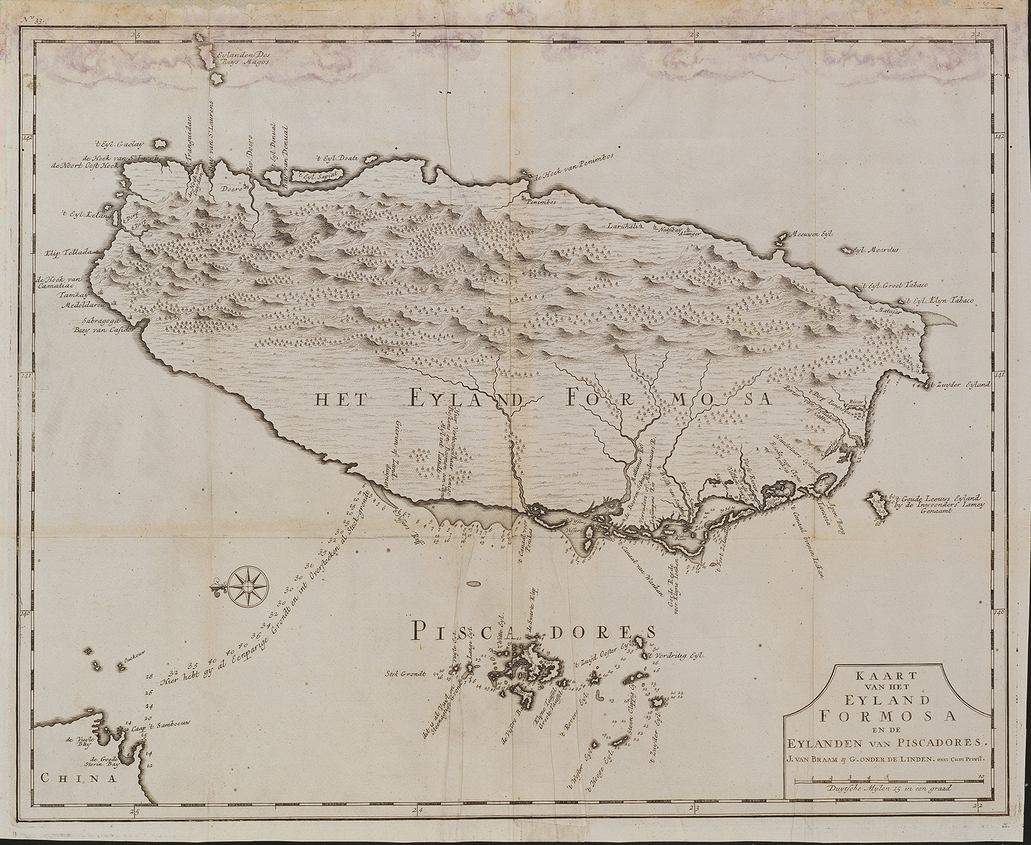
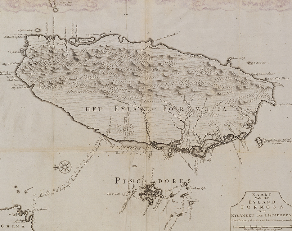 Kaart van het Eyland Formosa en de Eylanden van Piscadores
- Dimensions: 47.4X57.8 cm
- Historical Period(s): 1726
- Maker(s)/Artist: Francois Valentijn
- Provenance: Oud en Nieuw Oost-Indien
- Collection: National Museum of Taiwan History
This printed map made by Dutch priest Francois Valentijn was based on a manuscript drawn by the Dutch cartographer Johannes Vingboones around 1640, and published it in 1726. From the perspective of a navigator looking at Taiwan Island from the sea, this map is one of the earliest extant maps in the West depicting the entire island of Taiwan.
In addition to showing the geography of Taiwan, this map also recorded in detail the navigation route between the southwest coast of Taiwan and Quanzhou, coastline, shoals, reefs, and places of frequently visited locations. It provided great practical value to navigators at the time.
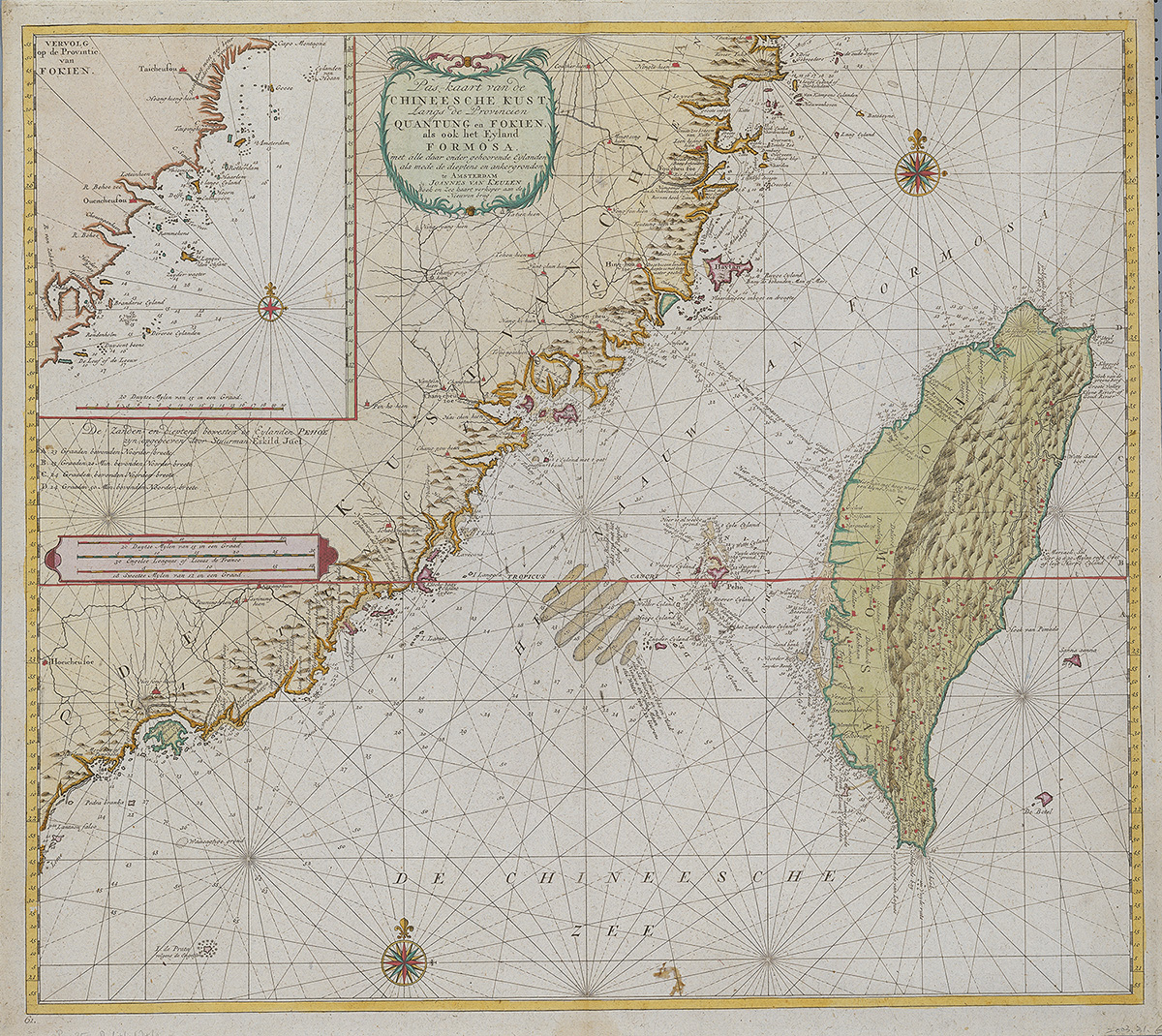
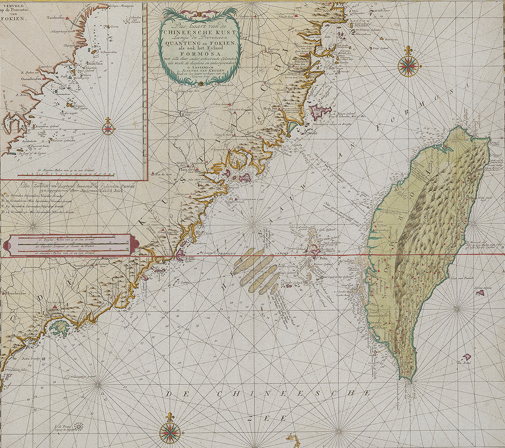 Pas-kaart van de Chineesche Kust, Langs de Provincien Quantung en Fokien, als ook het Eyland Formosa, met alle daar onder gehoorende eylanden als mede de dieptens en ankergronden
- Dimensions: 53.6X60.4 cm
- Historical Period(s): 1728
- Maker(s)/Artist: Johannes van Keulen II
- Provenance: Zee-Fakkel
- Collection: National Museum of Taiwan History
This map was used for nautical navigation; bearing lines, latitude, longitude were clearly marked.
The content recorded in the map included coastlines, sandbanks, bathymetry data, rivers, landforms and vegetation descriptions.
The depiction of Taiwan's coast in this map was already quite close to its modern measurements.