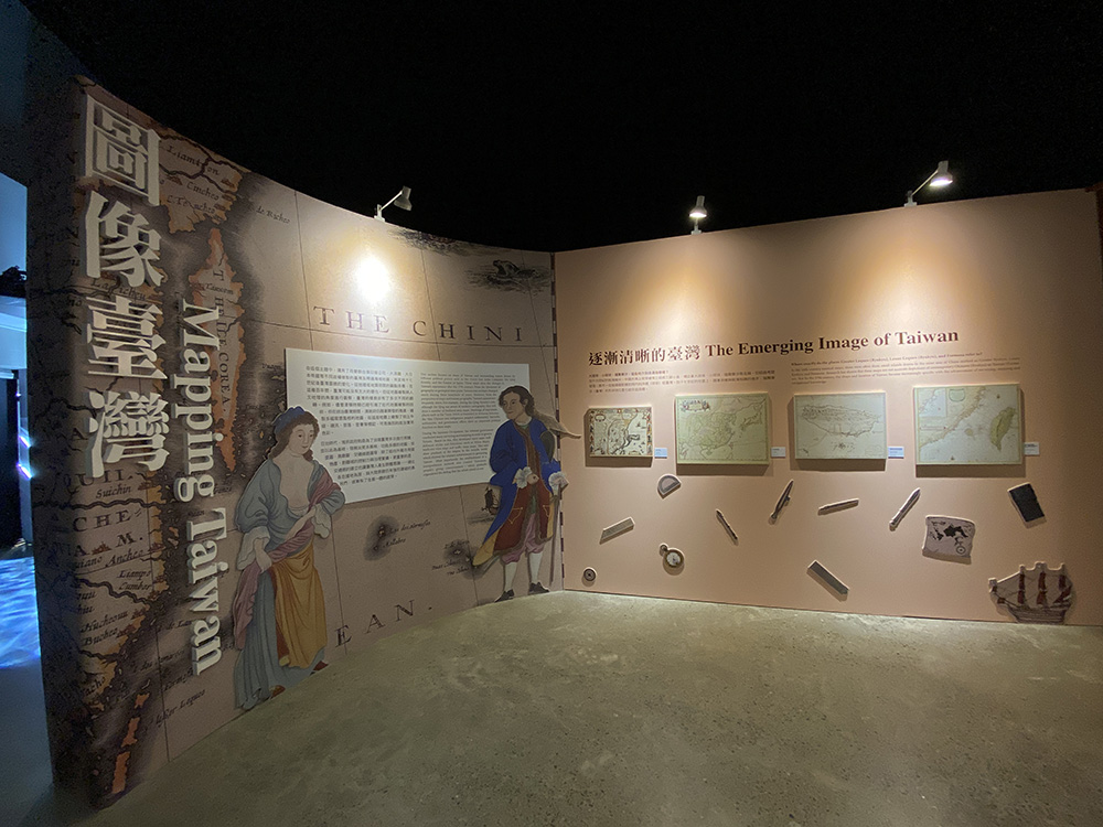
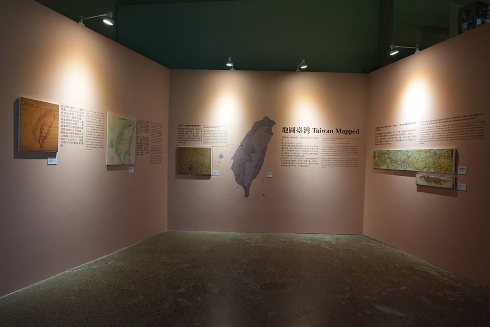
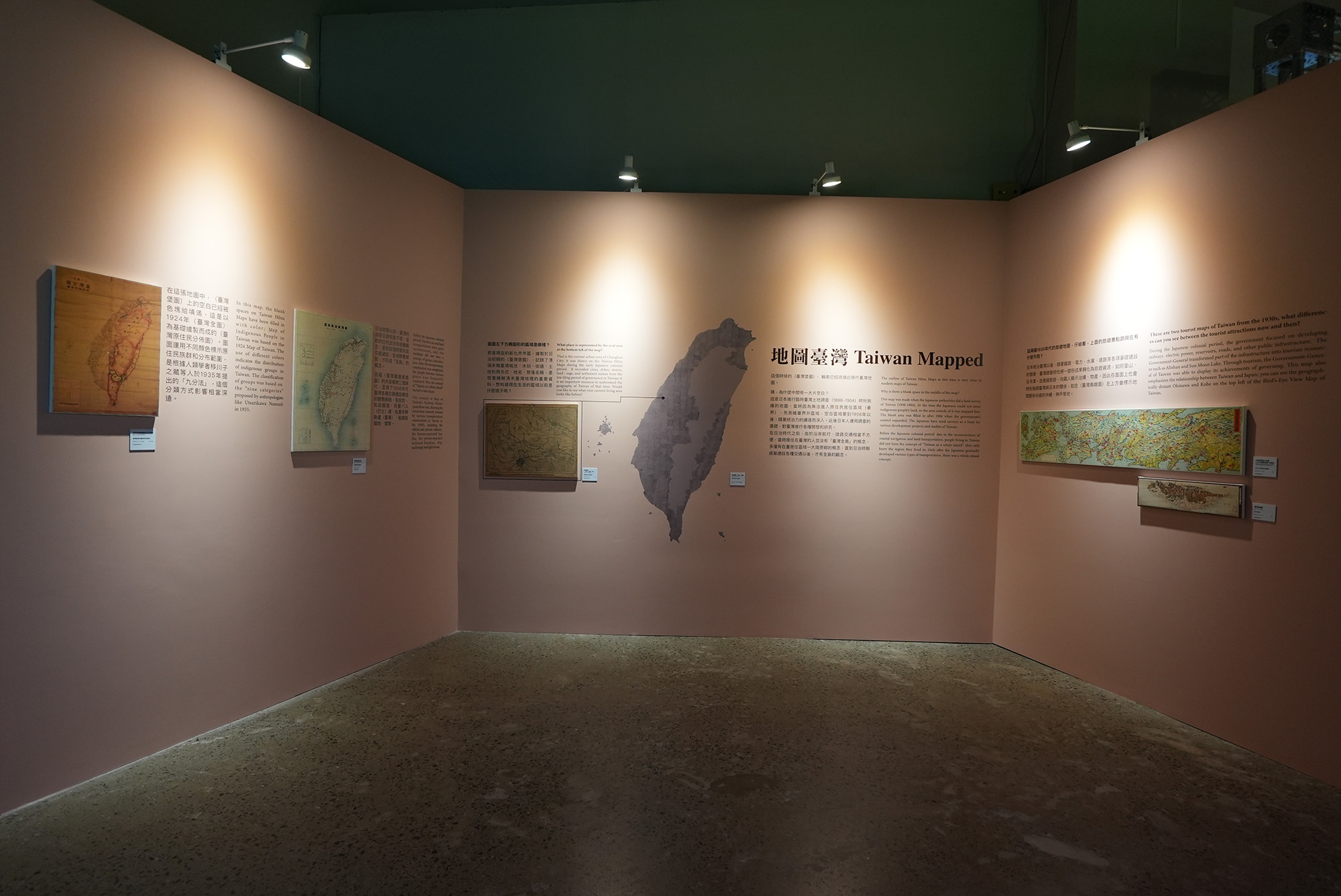
Taiwan Mapped
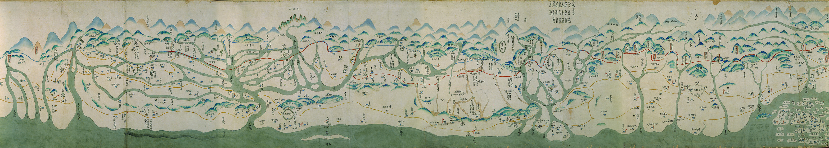
This section presents the changes in Taiwan's appearance after the 17th century, using the maps of Taiwan and surrounding waters drawn by different political powers such as the Dutch East India Company, the Qing dynasty, and the Empire of Japan. From the Earth history or geological perspective, there may not be much change in Taiwan's physical environment during these hundreds of years. However, the understanding and appearance in map of Taiwan have been changed many times from the perspective of cartography and human geography.
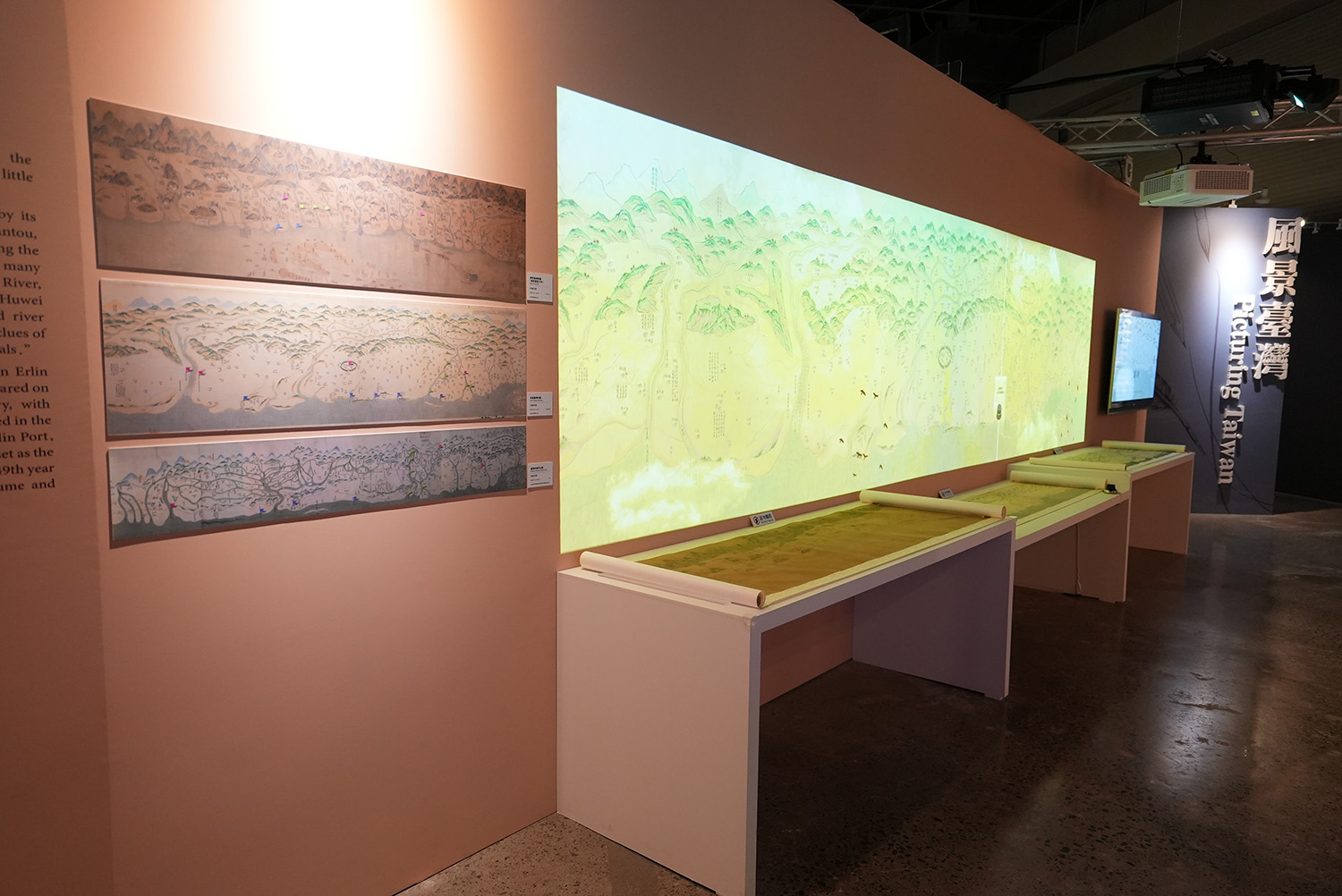
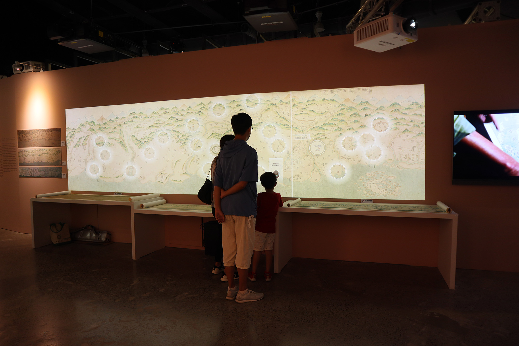
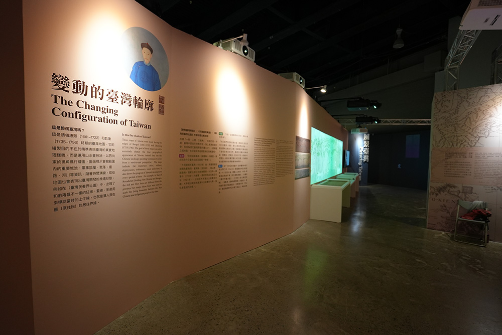
For example, during the Qing's rule, although the government was aware of modern cartography, most maps were still drawn in a freehand-style. Labeling important places such as the Tuniu Ditch (a boundary to delineate between the Han Chinese and indigenous people's settlements), barracks, settlements, and government offices mark an important political function on these maps.
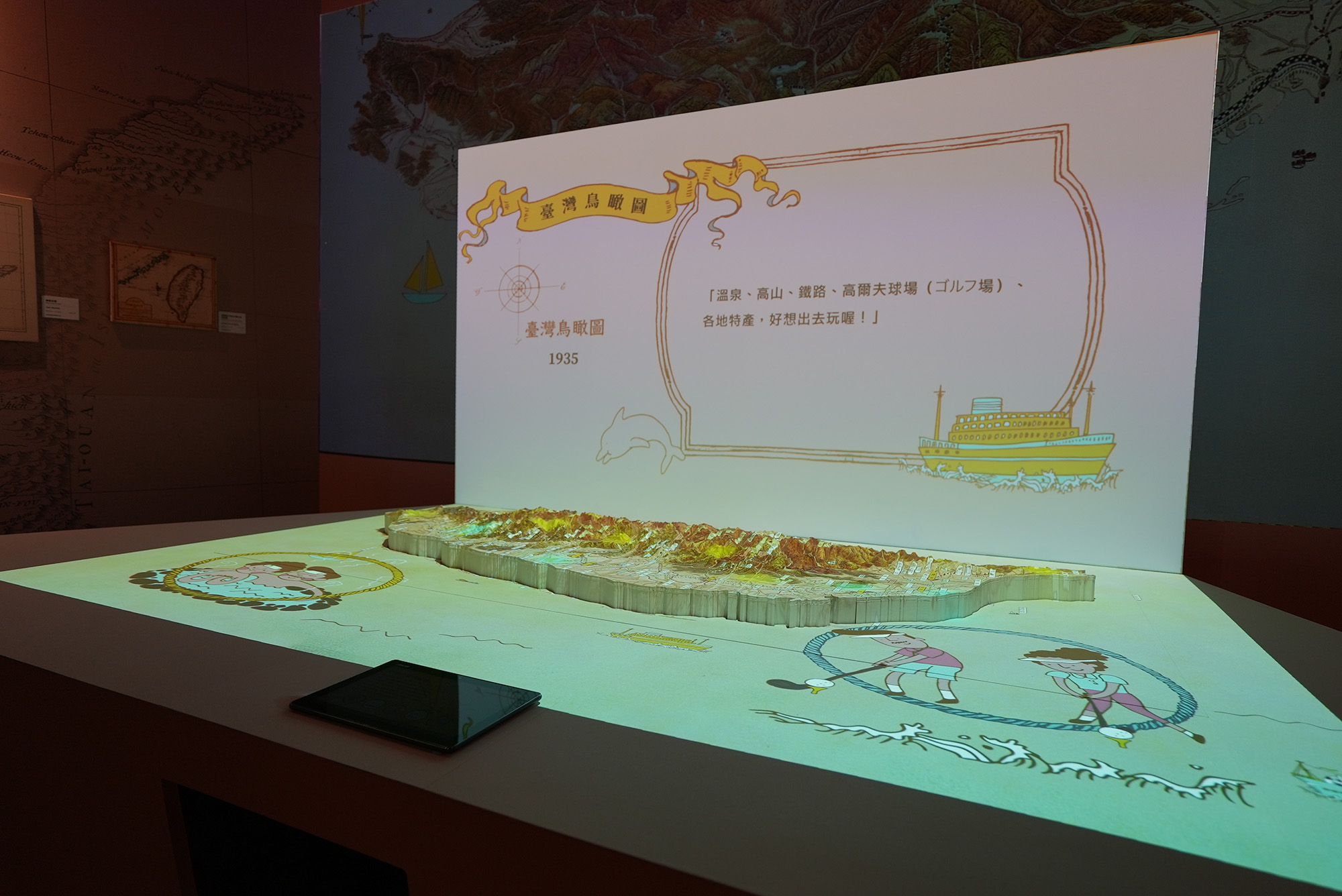
During the Japanese colonization, many surveys and mapping were dconducted in order to govern Taiwan. Various thematic maps such as Administractive Maps , bird's-eye view maps and traffic route maps were also developed with styles and different functions.
Those maps also visually showed the empire's ambition of exploring resource and governing Taiwan.
More importantly, the establishment of infrastructure such as transportation network also created Taiwanese common consciousness──which gradually engaged the whole island as one.
- Map of Taiwan, Qing Dynasty Interactive Installation

- Taiwan Mapping Mechanical Interactive Installation

- Exhibition Pictures 01

- Exhibition Pictures 02
- Exhibition Pictures 02
- Exhibition Pictures 04


Taiwan's Changing Profile
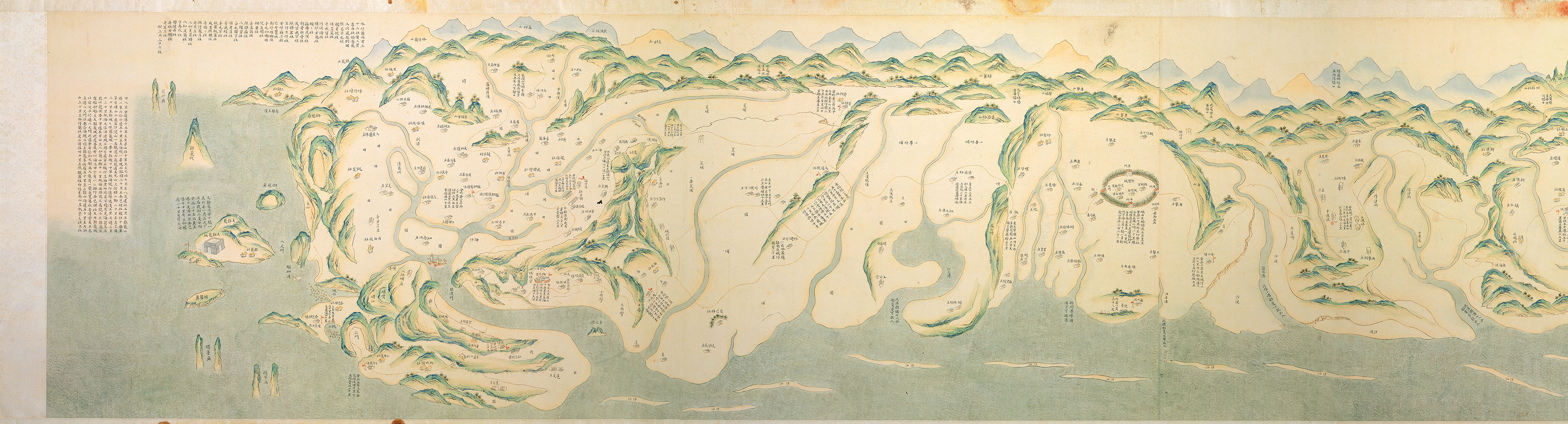
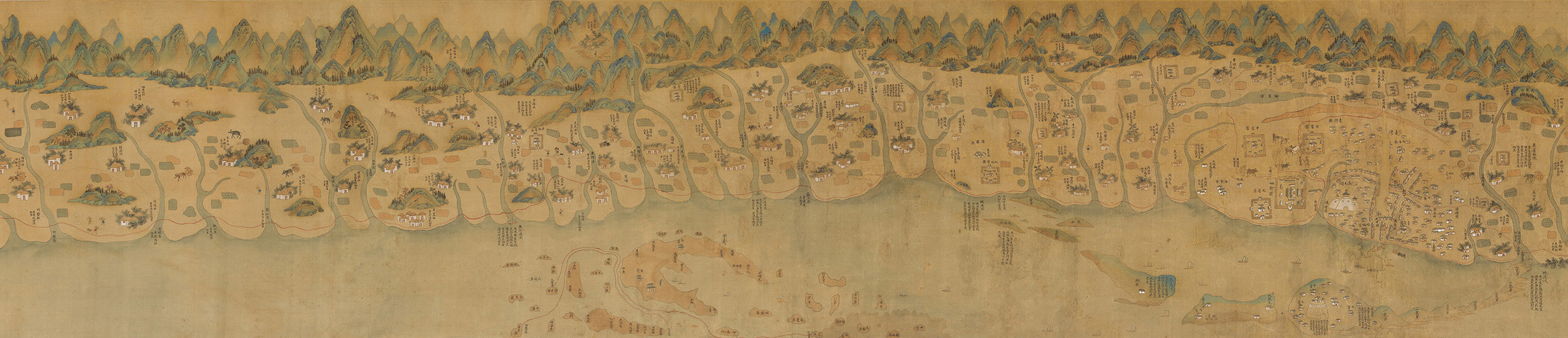 Kangxi Taiwan Maps
- Dimensions: 66X536 cm
- Historical Period(s): 1699-1704
- Maker(s)/Artist: Anonymous
- Collection: National Taiwan Museum
Kangxi Taiwan Map is painted in the shanshui style of landscape painting. It shows the topography of the mountains and rivers, administrative and military deployments, the roads, and urban and rural life in the western part of Taiwan from the south to the north at the turn of the 17th and 18th centuries. The map also shows the impact of development on people's living spaces and traces of their lifestyles from the time of the Dutch, Zheng Chenggong, and the Qing dynasty. This is not only informative but also has artistic value.
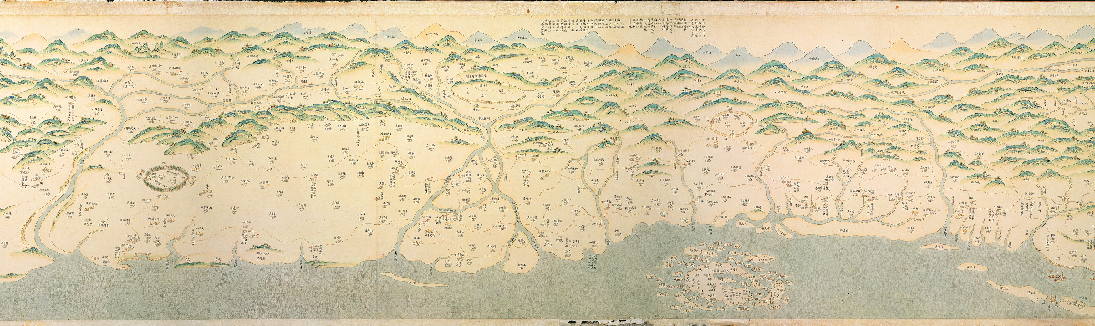
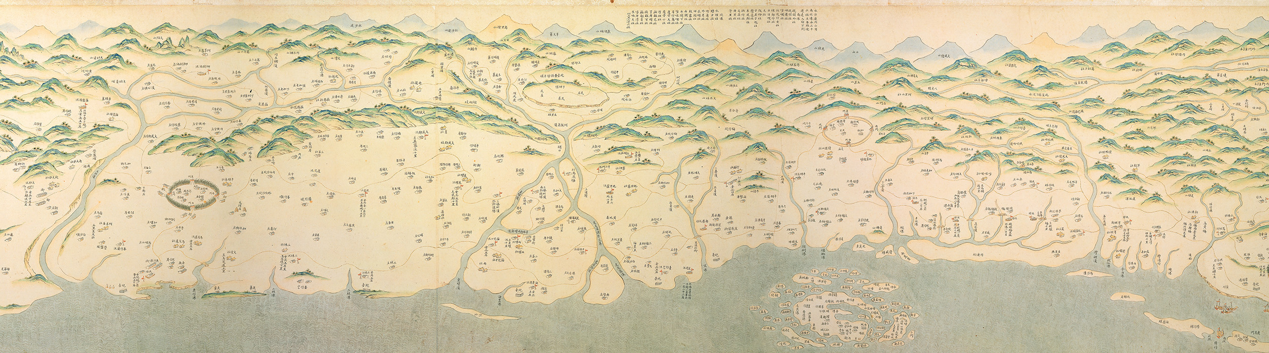 Map of Taiwan
- Dimensions: 46X667 cm
- Historical Period(s): Qing Dynasty (1644-1911)
- Maker(s)/Artist: Anonymous
- Collection: National Palace Museum
This map was painted around the mid-Qianlong period, using the traditional blue-green style of shanshui landscape painting; the orientation is up east down west, left north right south.
The map depicts mountains in the east, overlooks the sea in the west, Huaan Islet in the north, and Shamajitou (today Cape Eluanbi) in the south.
In addition to the real-life symbols used to draw the western landscape, words were written on the blank space to mark the indigenous people's settlements. Text on the most northern part of the map describe in detail the water and land transportation routes from north Taiwan to the east.
Compared with the maps of Kangxi and Yongzheng periods, the number of Han and aboriginal settlements in this map has greatly increased, and the use of graphics and text to distinguish settlements and facility locations presents rich techniques.
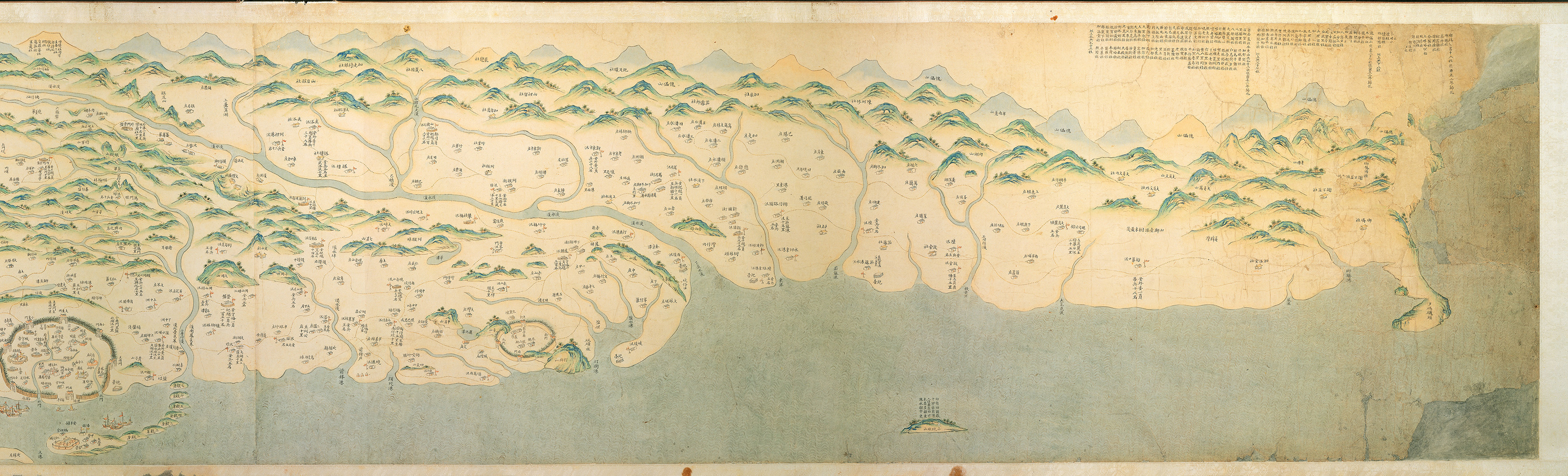
 Map of Boundaries Dividing Han Chinese and Savages
- Dimensions: 48X666 cm
- Historical Period(s):1760
- Maker(s)/Artist: Anonymous
- Collection: Institute of History and Philology, Academia Sinica
This painting was commissioned by Yang Tingzhang, governor of Fujian and Zhejiang, in 1760. The cultivation of land by Han Chinese people impacted the living space of indigenous people. The Qing dynasty's officials built mounds from mud to form the "Tuniu Ditch," marking the boundary between the Han Chinese and indigenous territory. Han Chinese people were prohibited from crossing this boundary. Compared with other maps, this map has added more red (old boundaries) and blue (new boundaries) lines marking the Tuniu Ditch. The new lines move further into the inner mountains, showing Han Chinese people were constantly moving to indigenous people's territory.