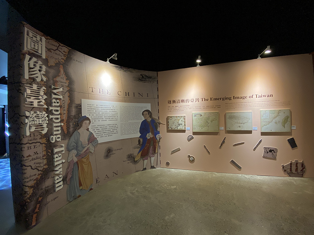
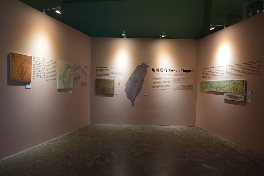
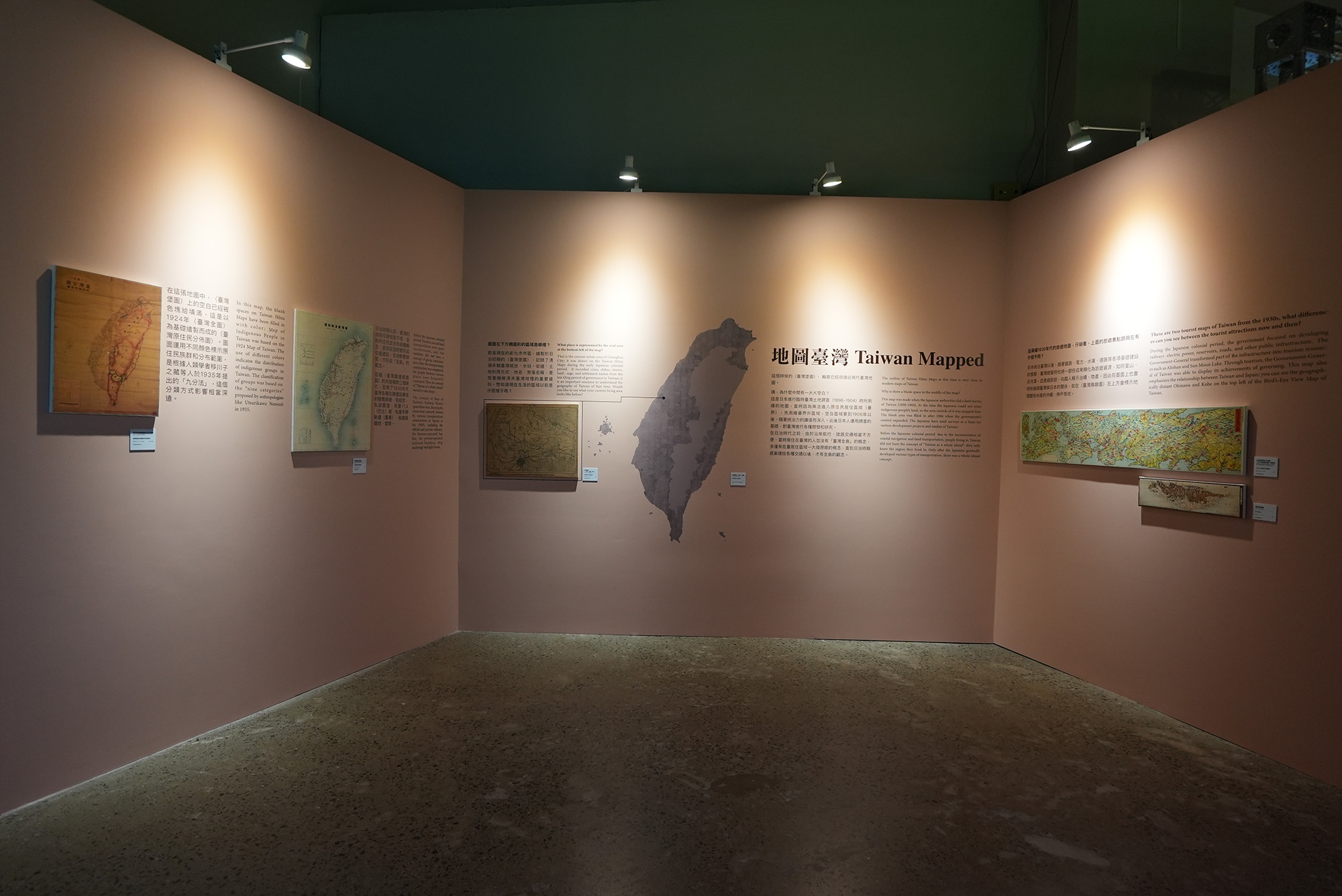
Taiwan Mapped
This section presents the changes in Taiwan's appearance after the 17th century, using the maps of Taiwan and surrounding waters drawn by different political powers such as the Dutch East India Company, the Qing dynasty, and the Empire of Japan. From the Earth history or geological perspective, there may not be much change in Taiwan's physical environment during these hundreds of years. However, the understanding and appearance in map of Taiwan have been changed many times from the perspective of cartography and human geography.
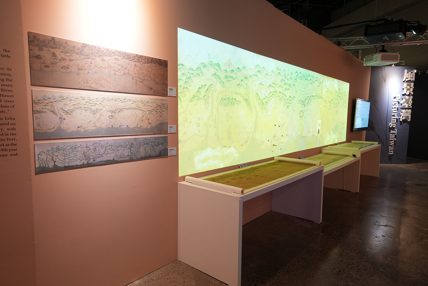
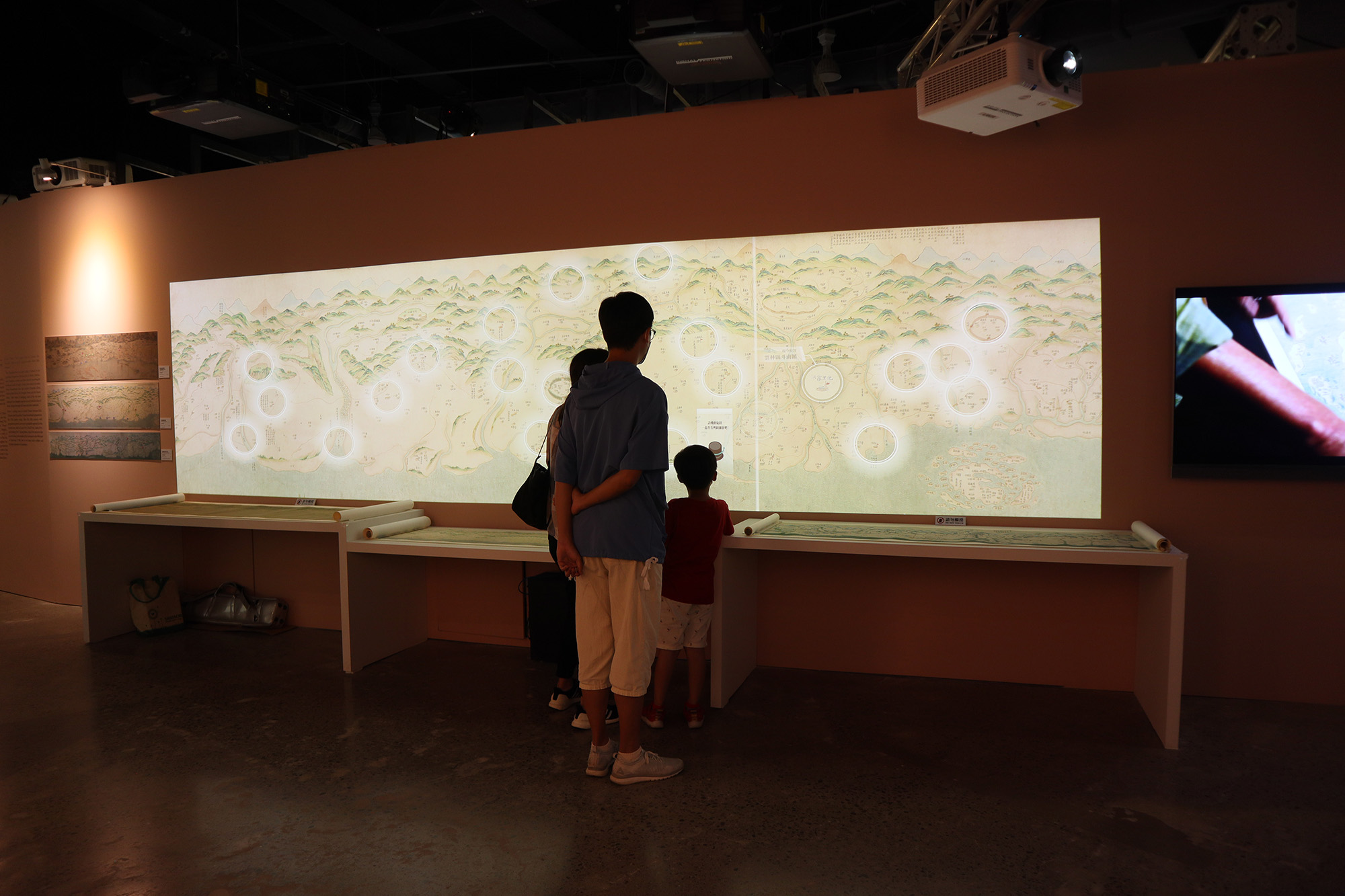
For example, during the Qing's rule, although the government was aware of modern cartography, most maps were still drawn in a freehand-style. Labeling important places such as the Tuniu Ditch (a boundary to delineate between the Han Chinese and indigenous people's settlements), barracks, settlements, and government offices mark an important political function on these maps.
During the Japanese colonization, many surveys and mapping were dconducted in order to govern Taiwan. Various thematic maps such as Administractive Maps , bird's-eye view maps and traffic route maps were also developed with styles and different functions.
Those maps also visually showed the empire's ambition of exploring resource and governing Taiwan.
More importantly, the establishment of infrastructure such as transportation network also created Taiwanese common consciousness──which gradually engaged the whole island as one.
- Map of Taiwan, Qing Dynasty Interactive Installation

- Taiwan Mapping Mechanical Interactive Installation

- Exhibition Pictures 01

- Exhibition Pictures 02
- Exhibition Pictures 02
- Exhibition Pictures 04


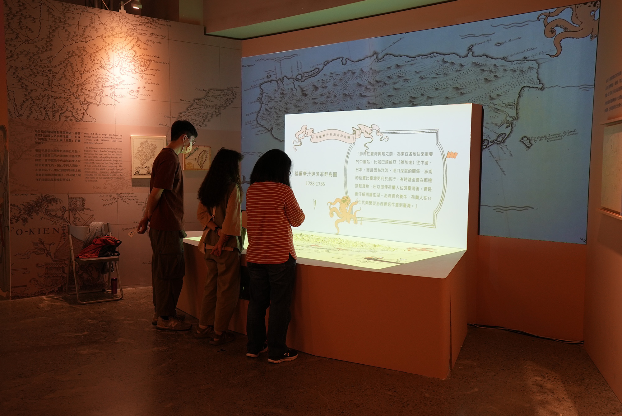
Images of Taiwan in Colonial Surveys
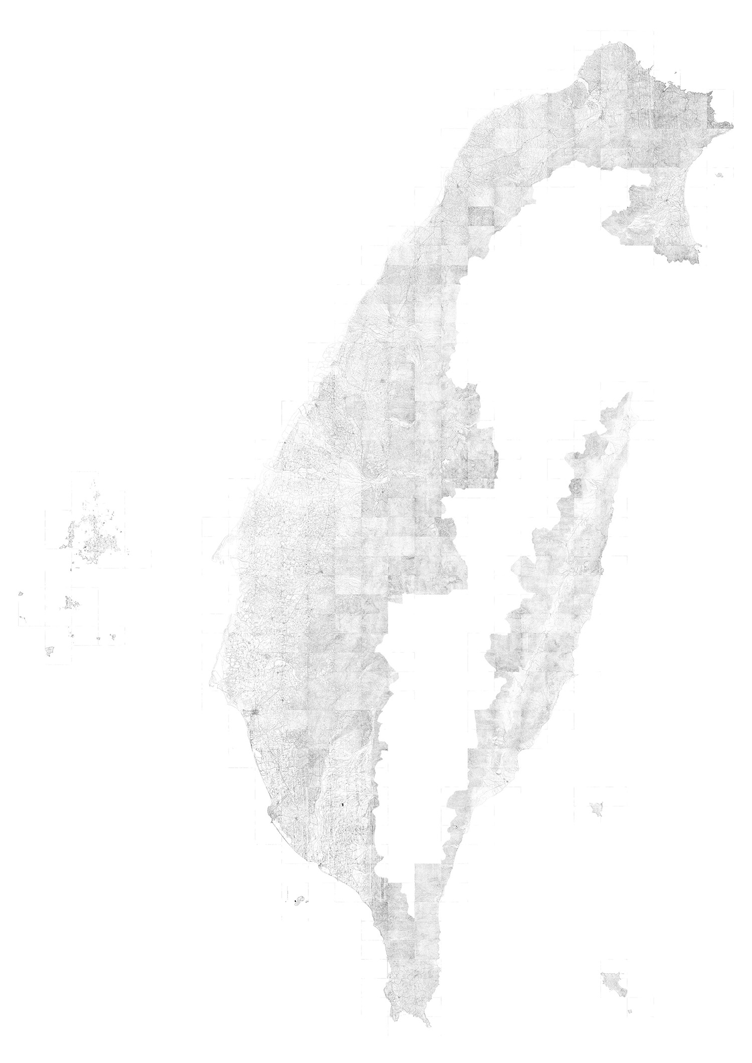
 Taiwan Hōzu Maps
- Historical Period(s):1904
- Maker(s)/Artist: Provisional Bureau of Land Survey
- Collection: Center for GIS, RCHSS, Academia Sinica
The outline of Taiwan Hōzu Maps at this time is very close to modern maps of Taiwan.
This map was made when the Japanese authorities did a land survey of Taiwan (1898-1904). At the time the Japanese could not enter indigenous people's land, so the area outside of it was mapped first. The blank area was filled in after 1906 when the government's control expanded. The Japanese have used surveys as a basis for various development projects and studies of Taiwan.
Before the Japanese colonial period, due to the inconvenience of coastal navigation and land transportation, people living in Taiwan did not have the concept of "Taiwan as a whole island"; they only knew the region they lived in. Only after the Japanese gradually developed various types of transportation, there was a whole-island concept.
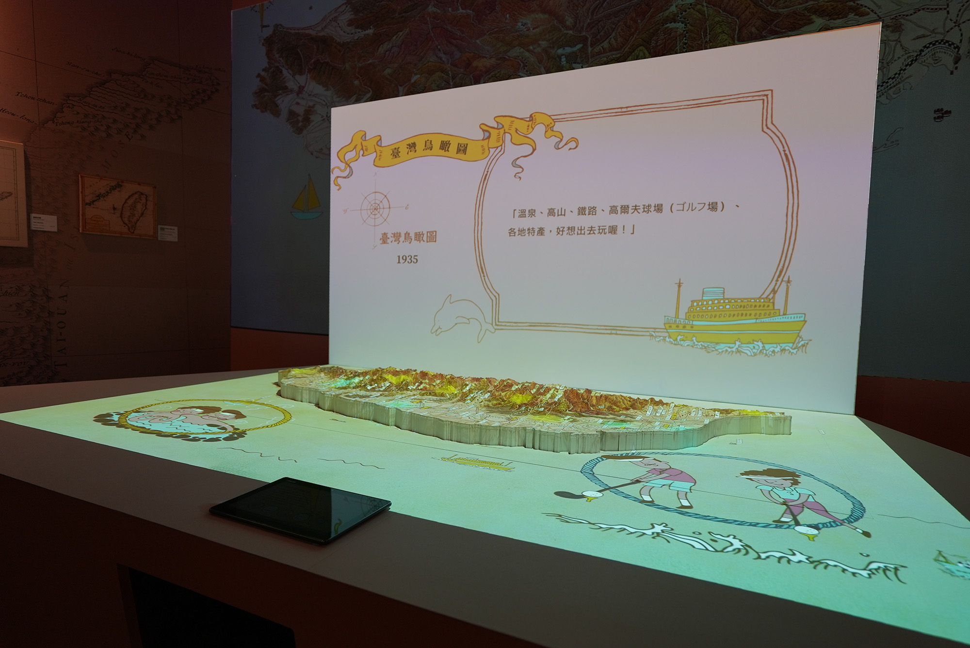
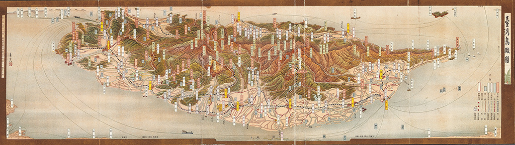 Aerial view of Taiwan
- Dimensions: 14.7X52.4 cm
- Historical Period(s): 1935
- Maker(s)/Artist:Kaneko Tsunemitsu
- collection:National Museum of Taiwan History
The author of this painting is the famous bird's-eye view artist Kaneko Tsunemitsu. He once drew bird's-eye views of cities of Japanese-occupied Taiwan. This map is drawn from the west-to-east perspective, looking from the Taiwan Strait to the Central Mountain Range. Okinawa, Kobe, and Tokyo appear on the upper left corner; the main city names, famous products, scenic spots, and important public facilities are marked, and fishery products are drawn on the sea.
