Go To Main Content Area
:::

World's End: Ancient Maps of Land and Water Transport

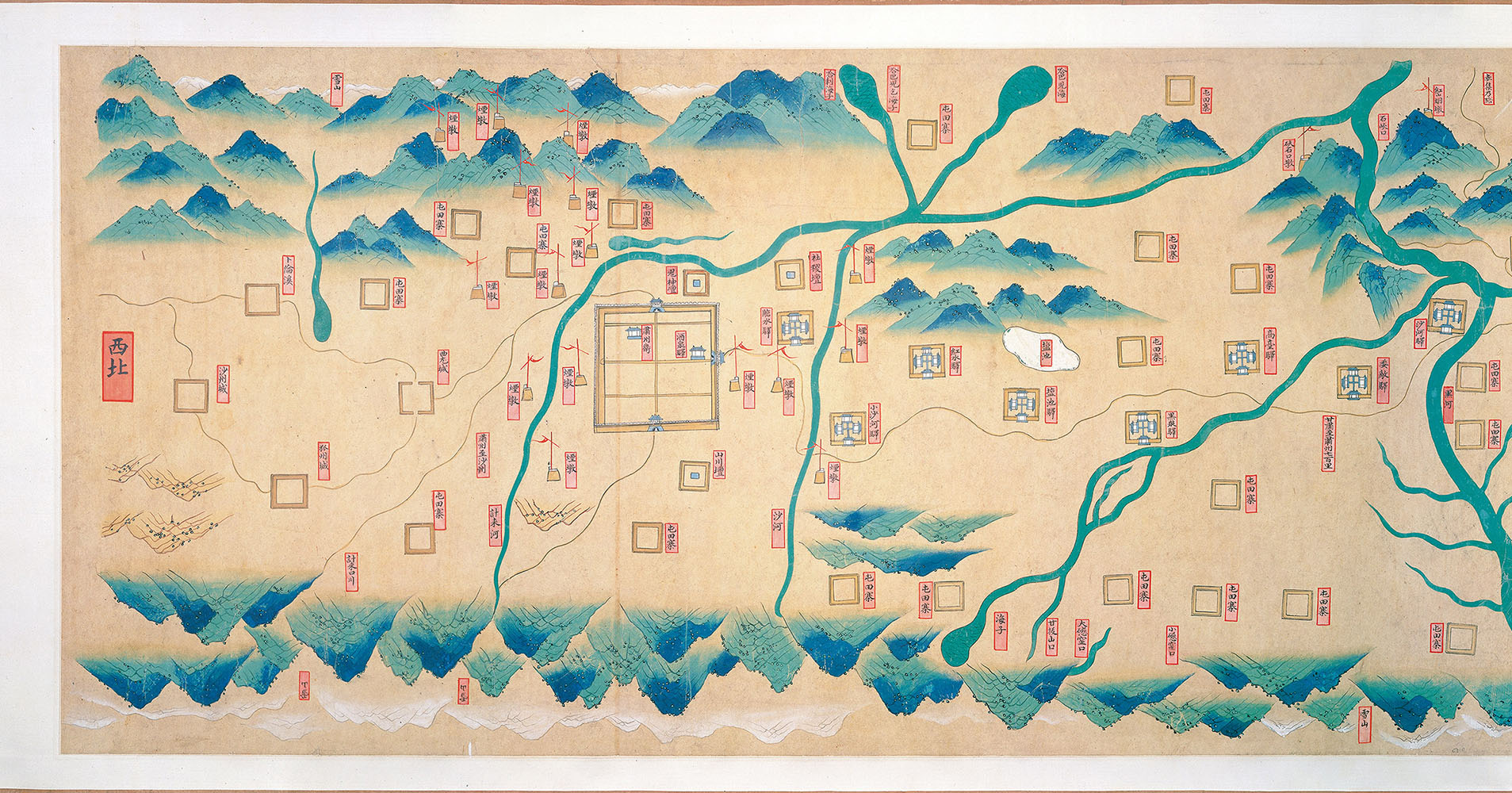
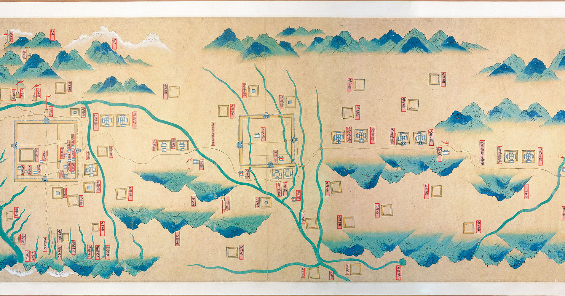
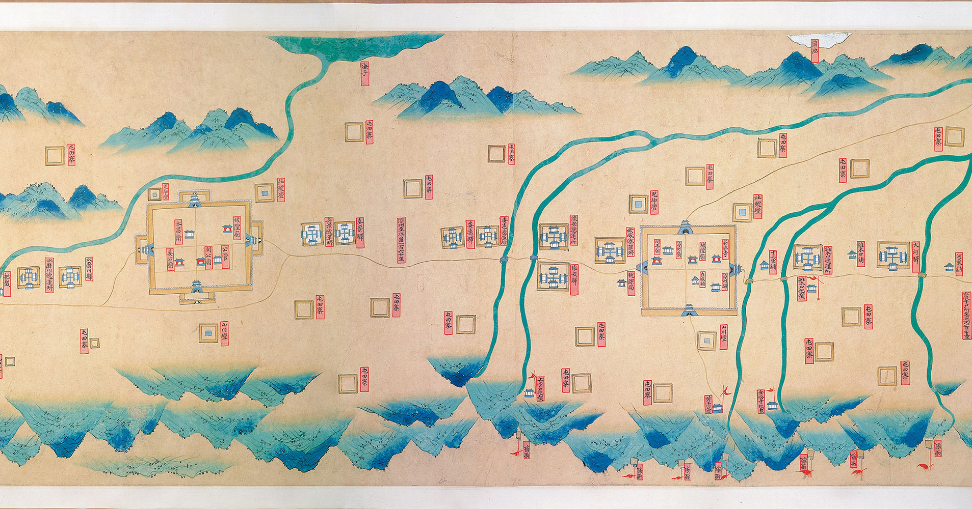
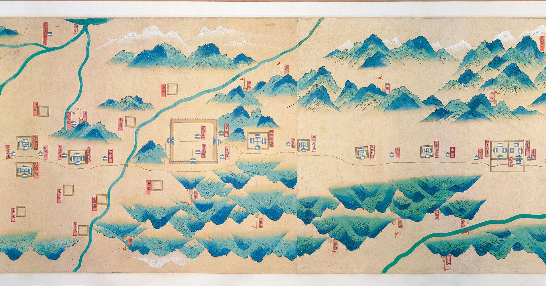
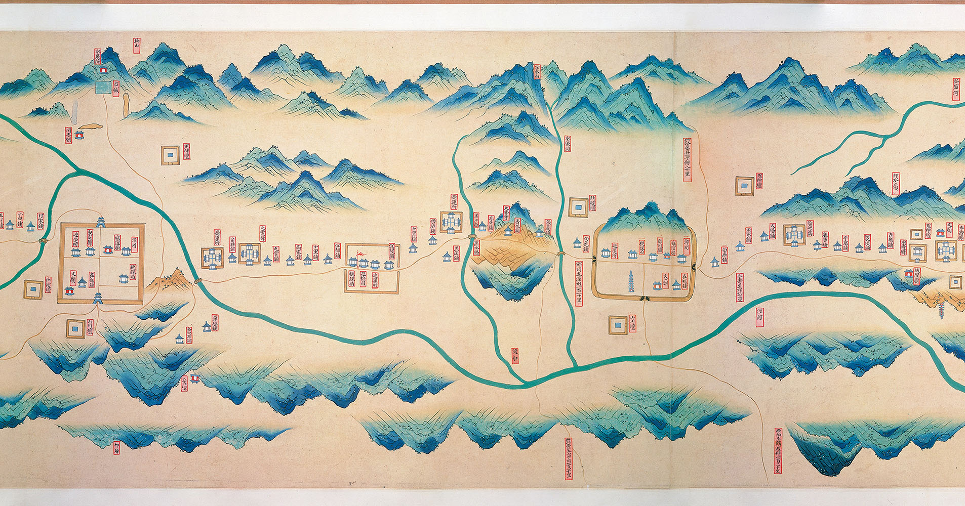
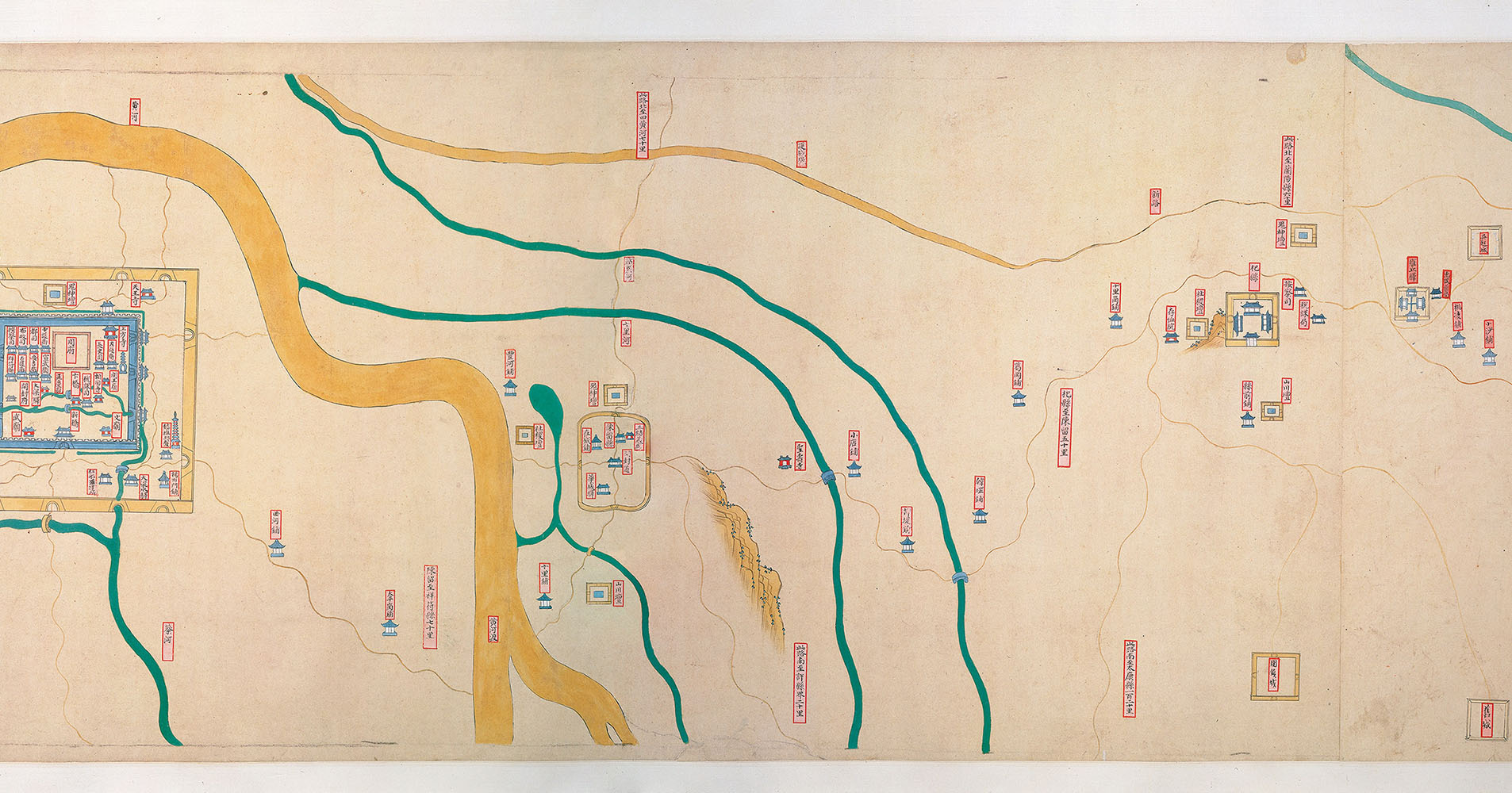
     In 1368, envoys of the king of Hami (Kumul) traveled to the Ming capital (present-day Nanjing), bringing with them a tribute of a large number of horses. How did the delegation make their way from their faraway kingdom, lying outside the frontier fortress at the western end of the Ming dynasty's Great Wall, all the way to the Ming Empire's capital in the southeast?

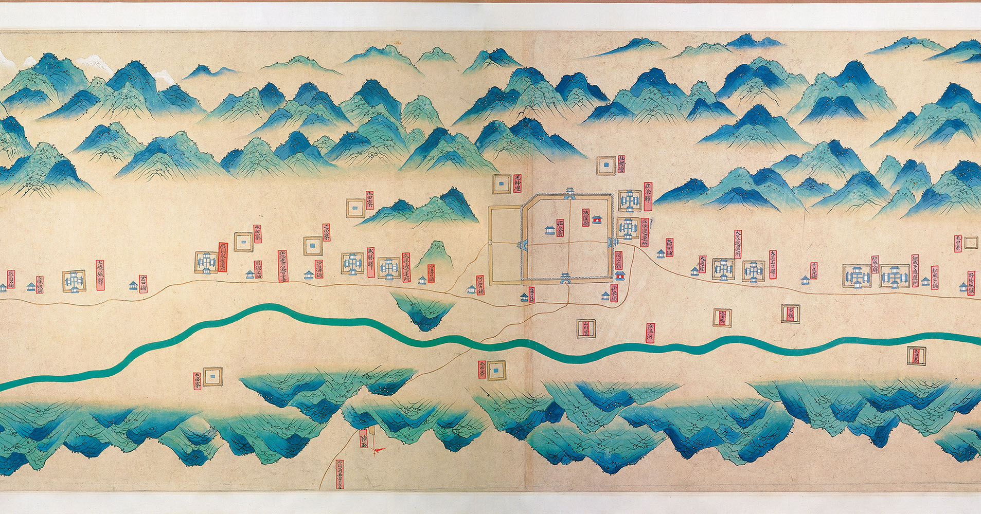
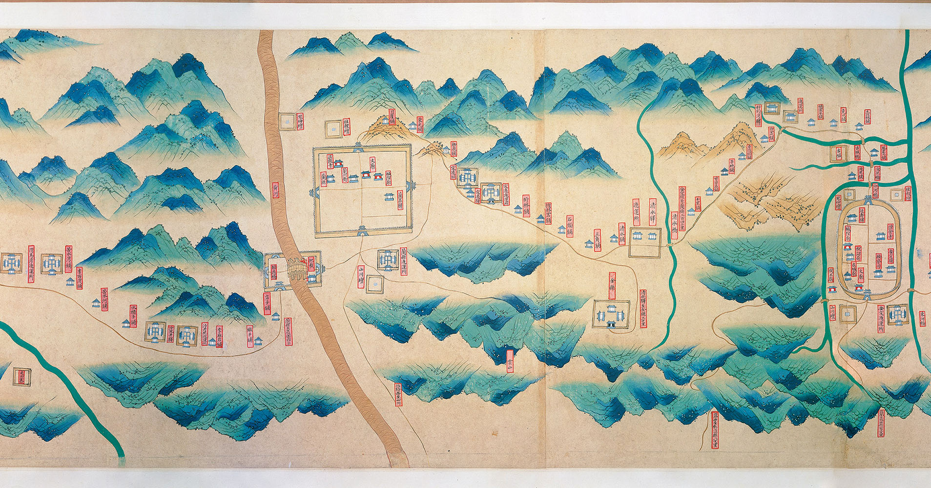
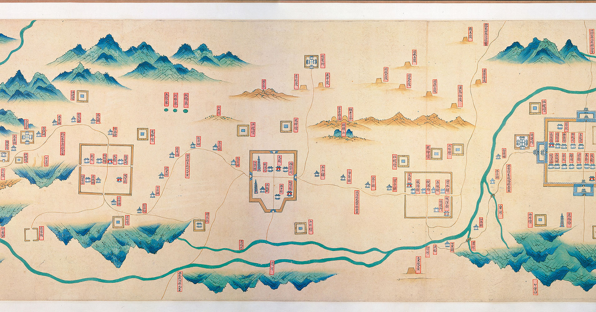
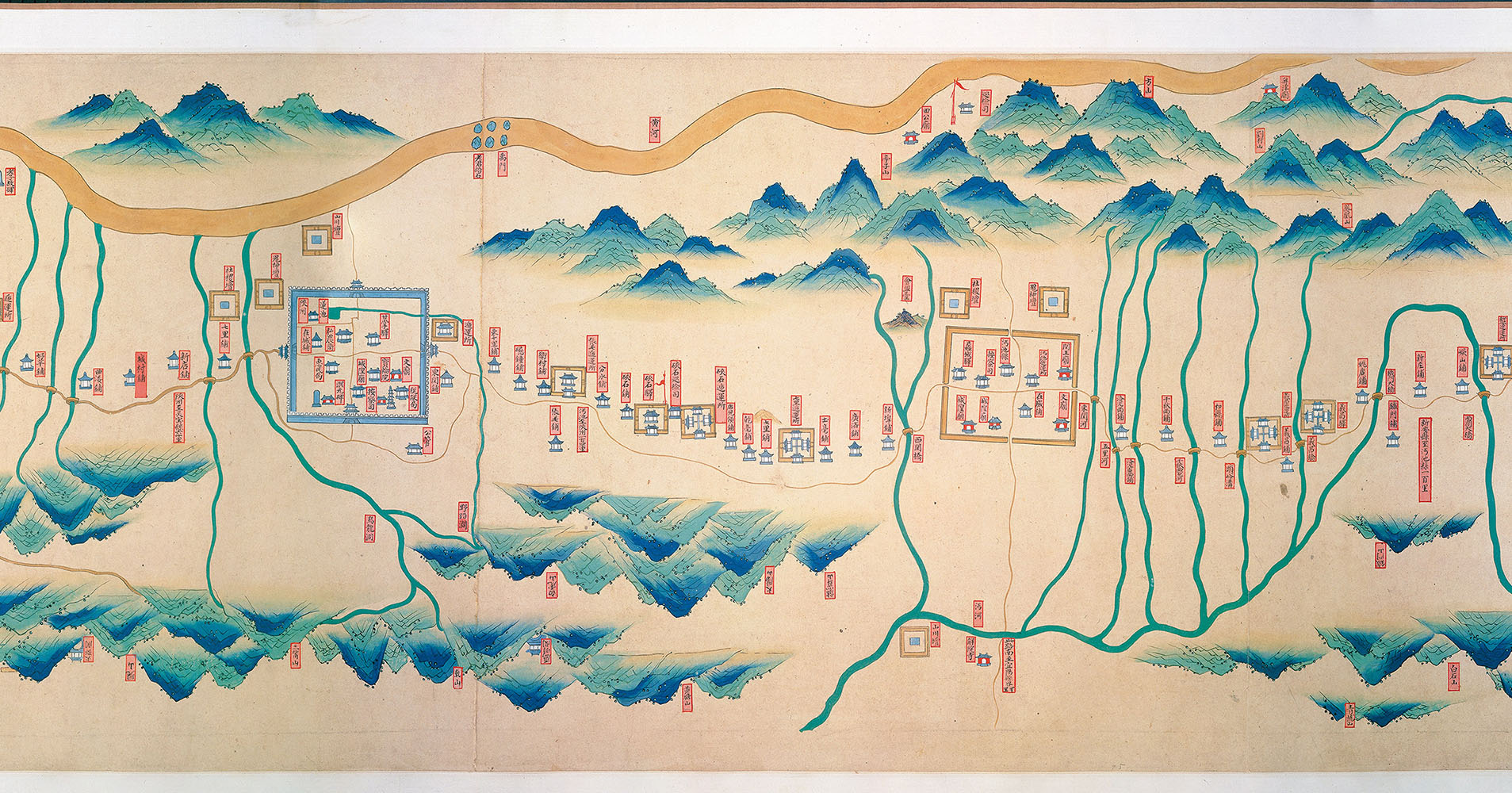
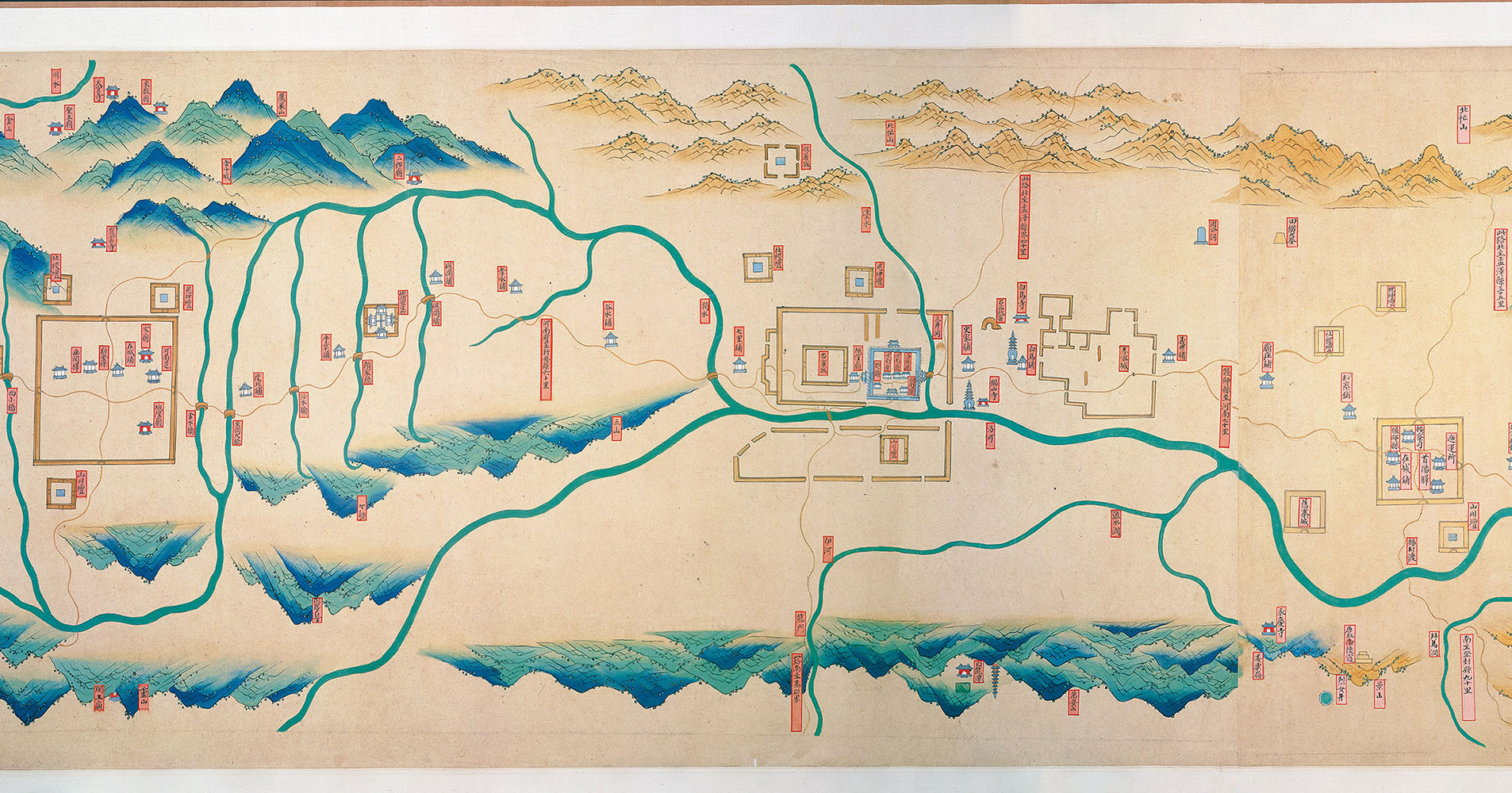
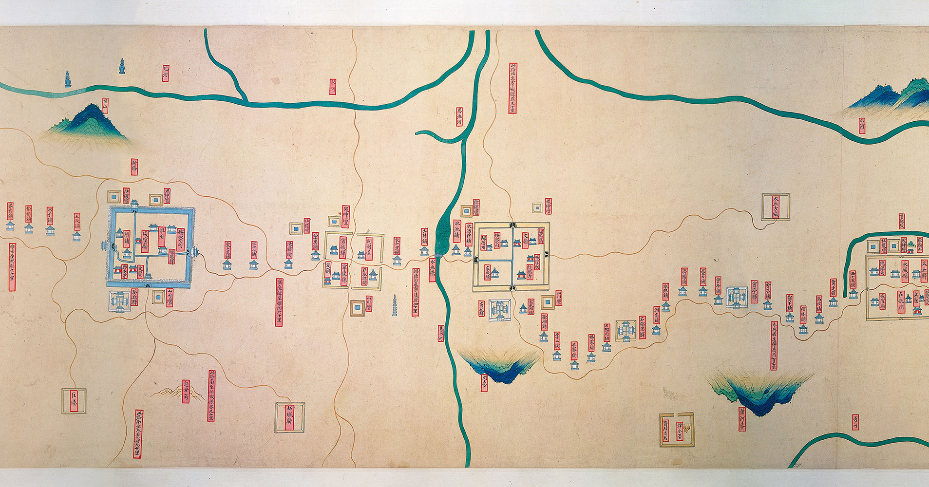
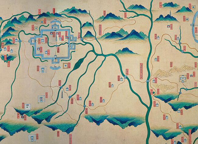
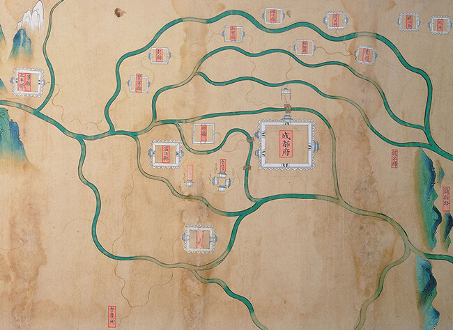
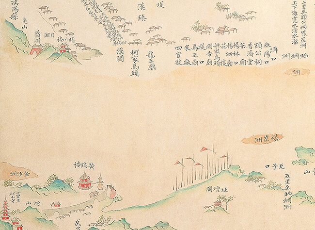
     One map on display here, Nanjing Zhi Gansu Yipu Tu (Map of the Relays from Nanjing to Gansu), traces just this route—extending from the Ming capital all the way to the northwest and ending in Shazhou (today's Dunhuang). Another map, Sichuansheng Silu Guanyi Tu (Map of the Passes and Relays of the Four Routes in Sichuan Province), produced in the Ming dynasty, depicts four routes starting from the regional military commission of Chengdu and extending north and south, thus constituting an extensive regional network of passes and relays.

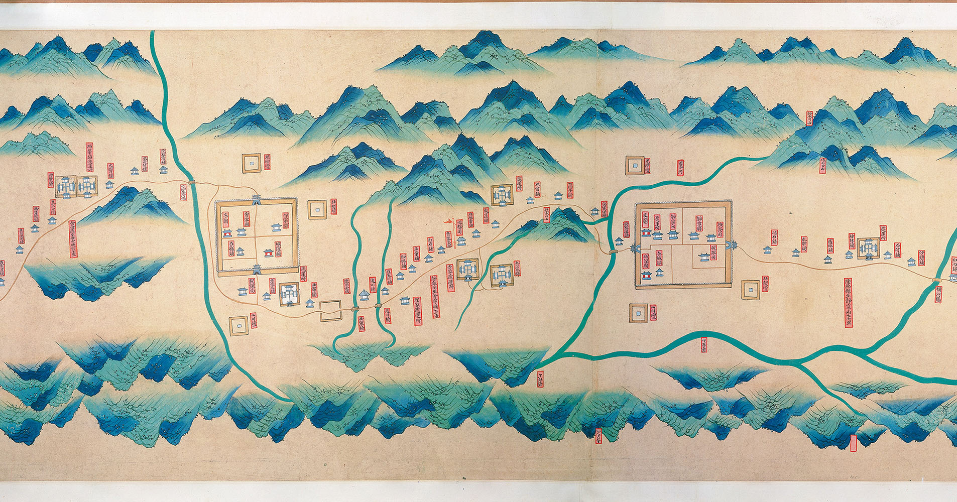
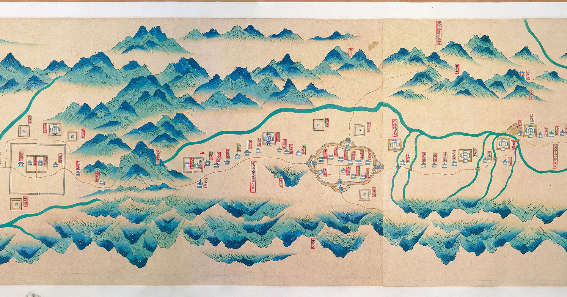
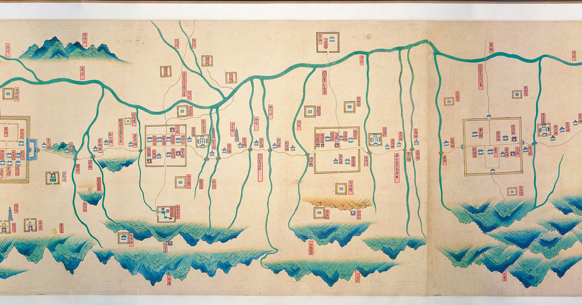
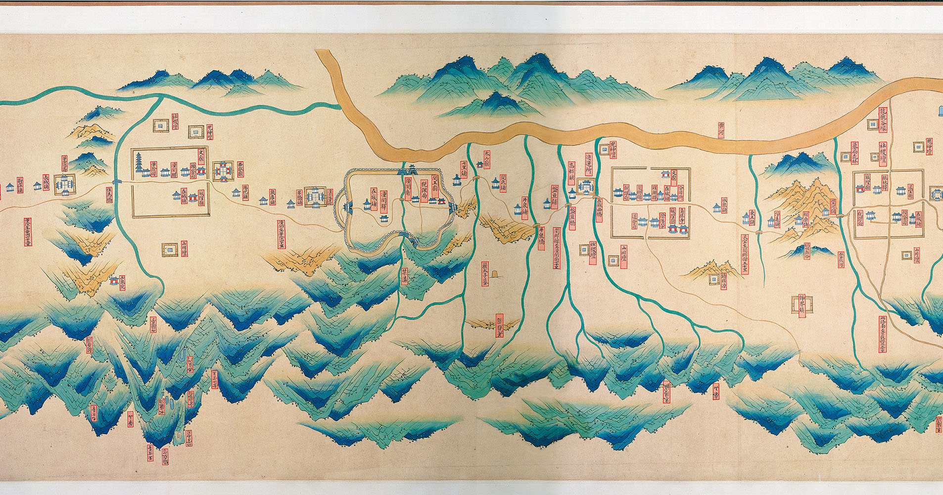
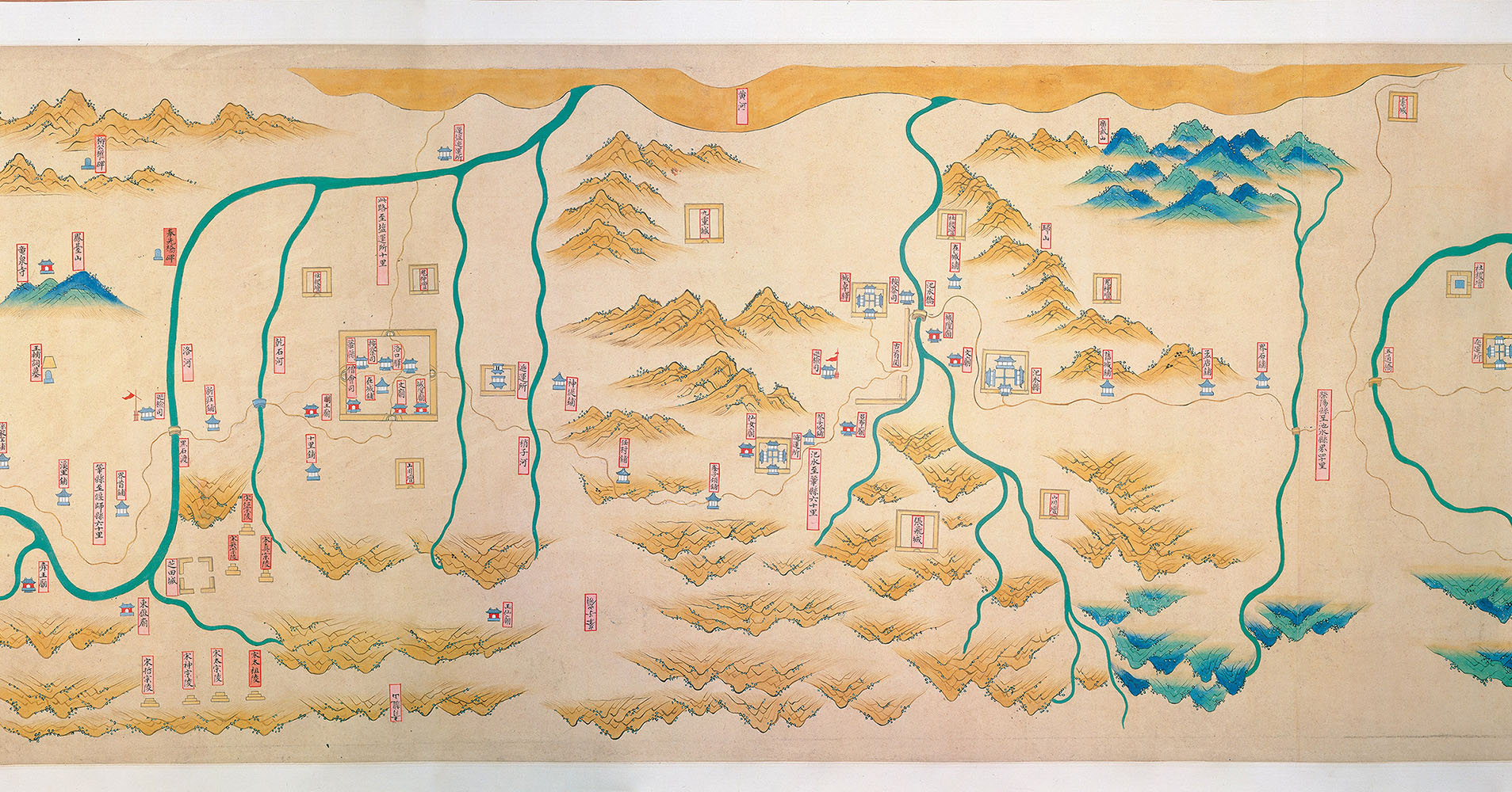
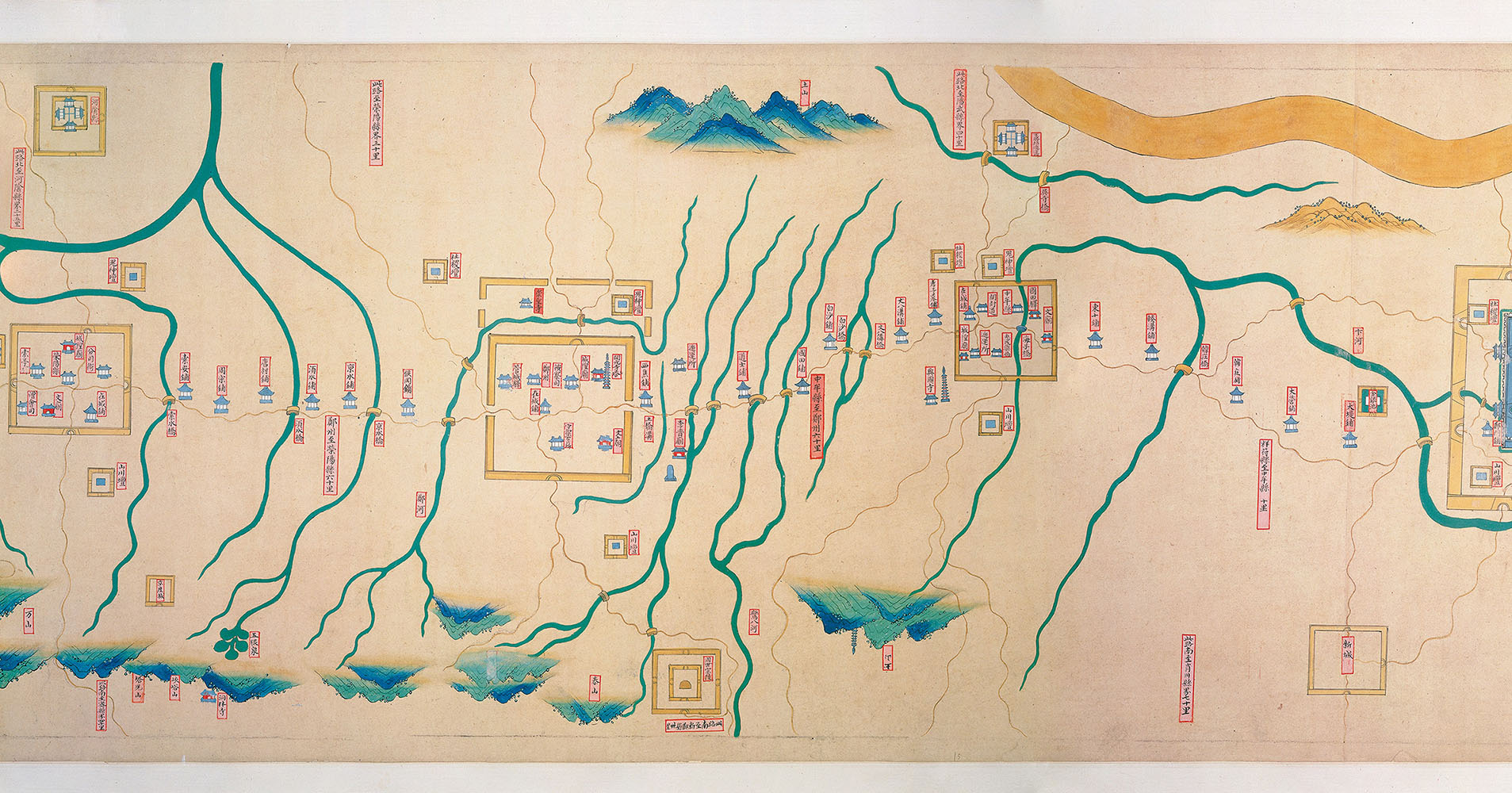
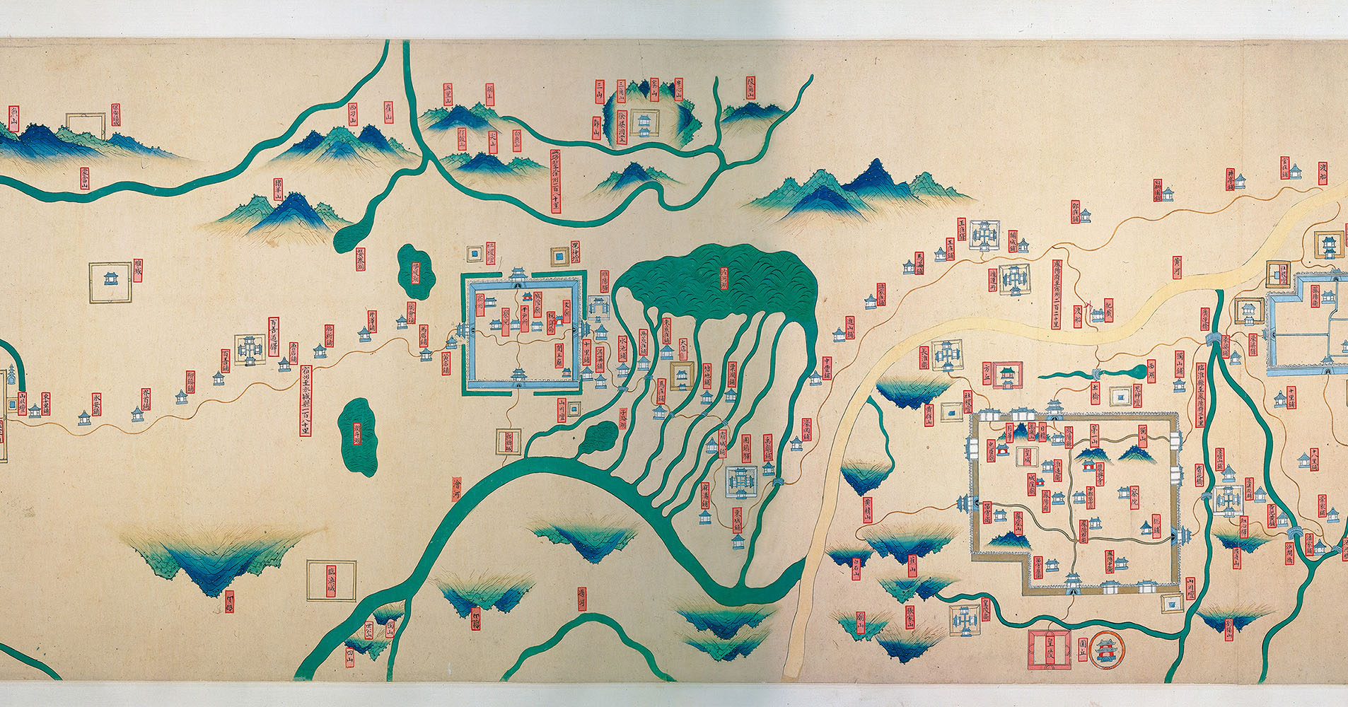
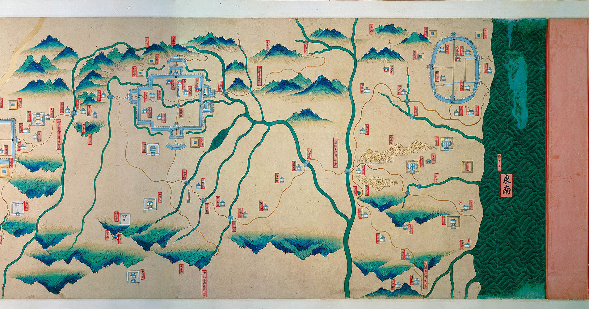
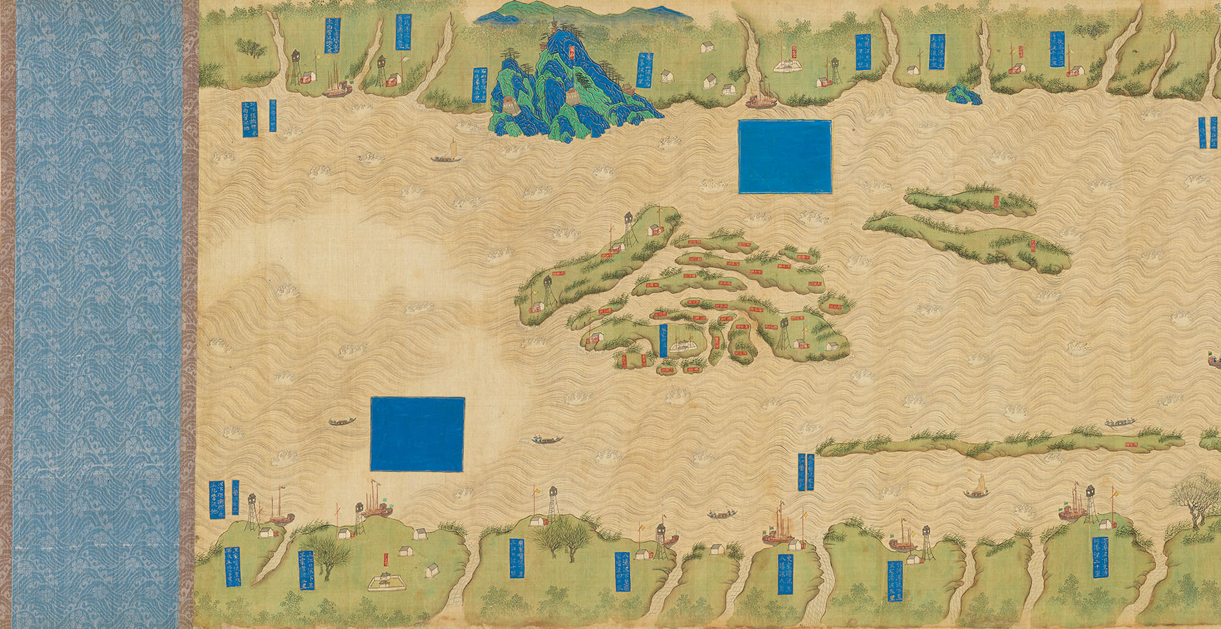
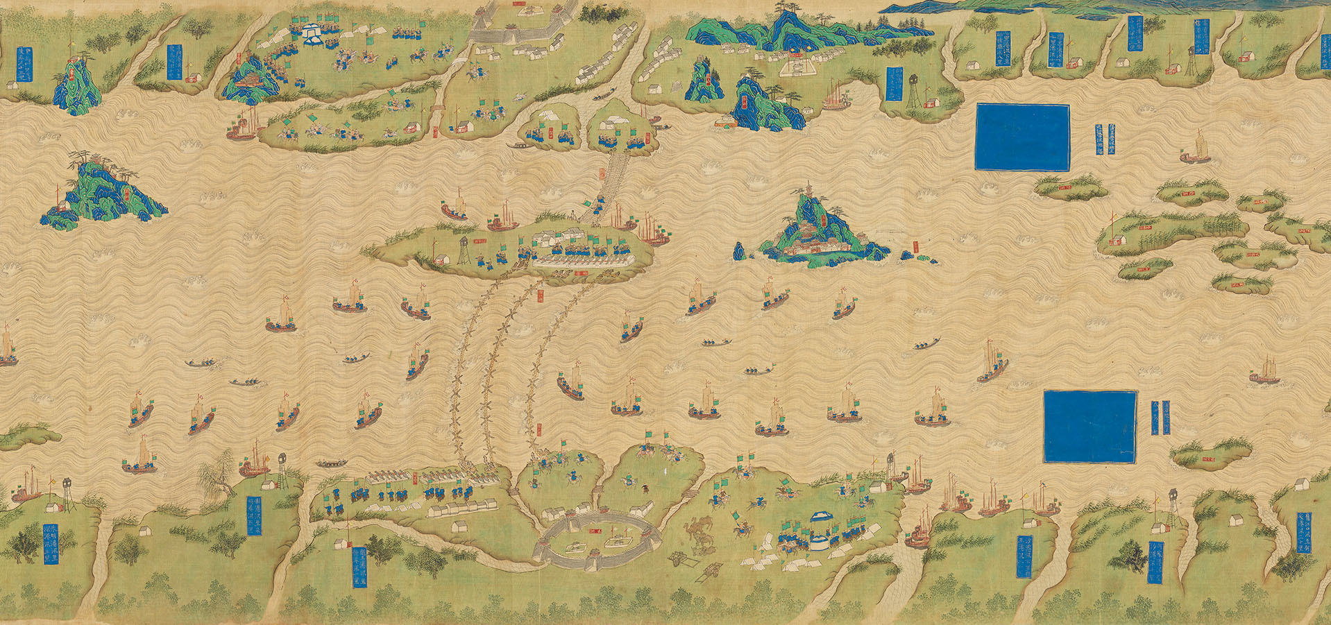
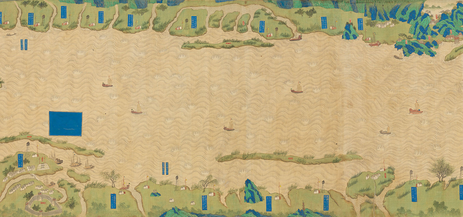
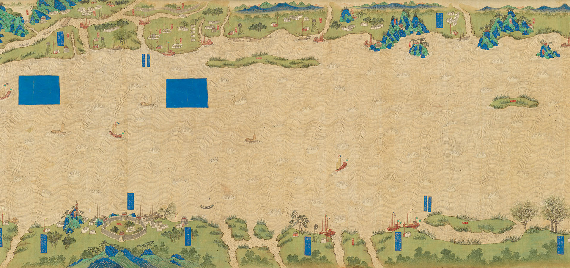
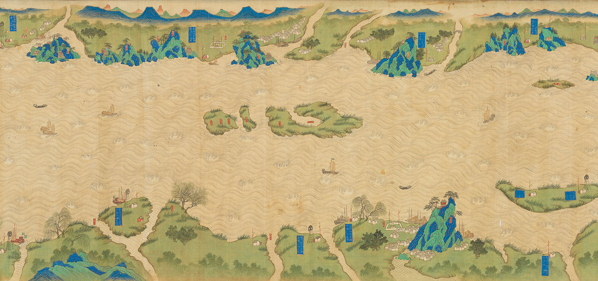
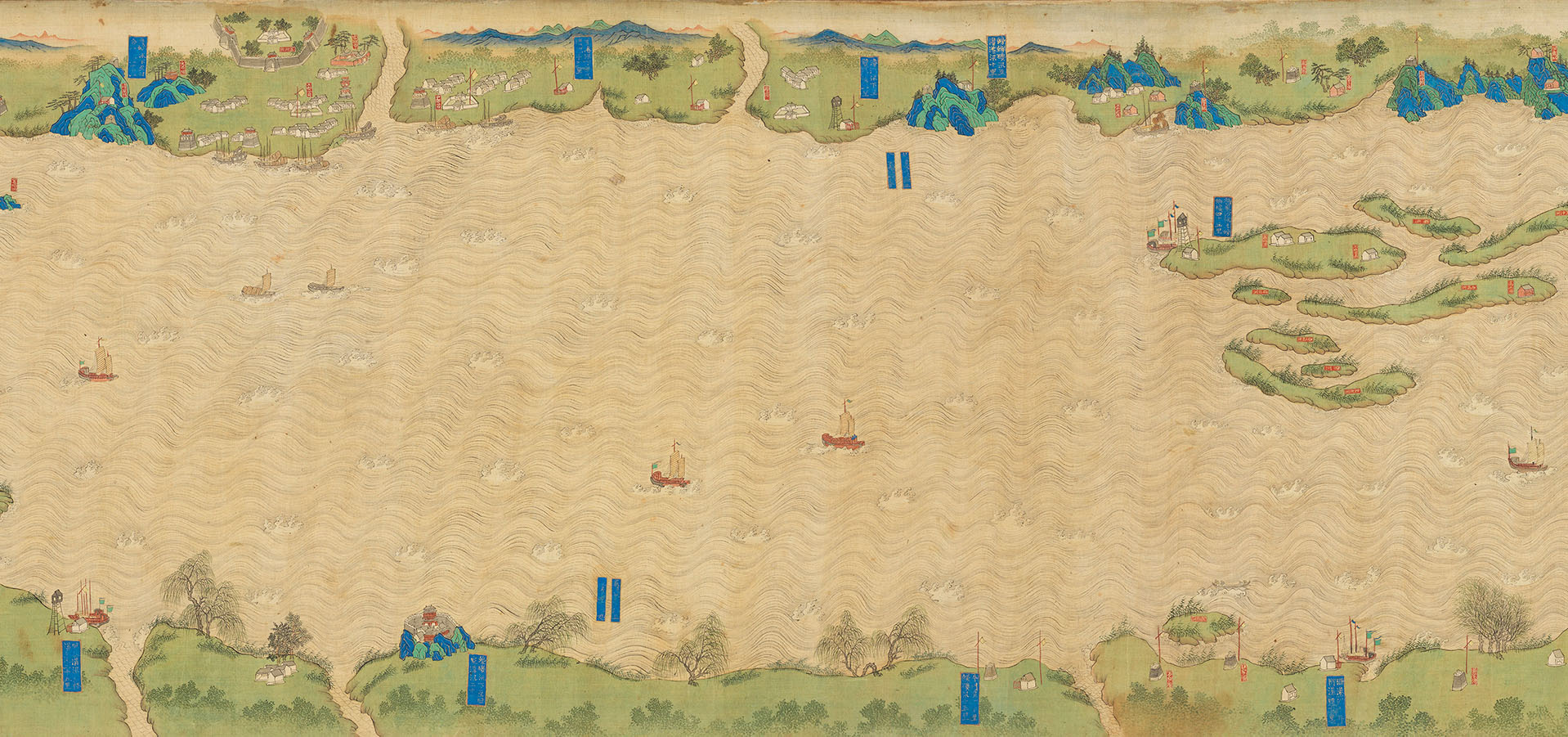
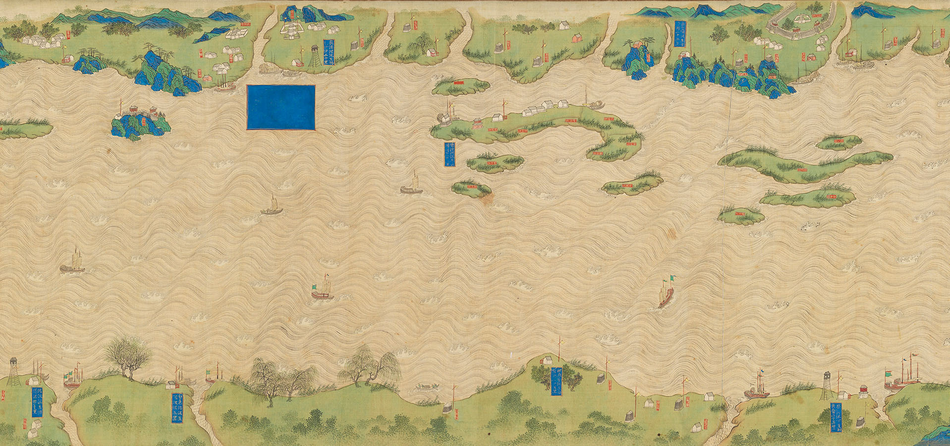
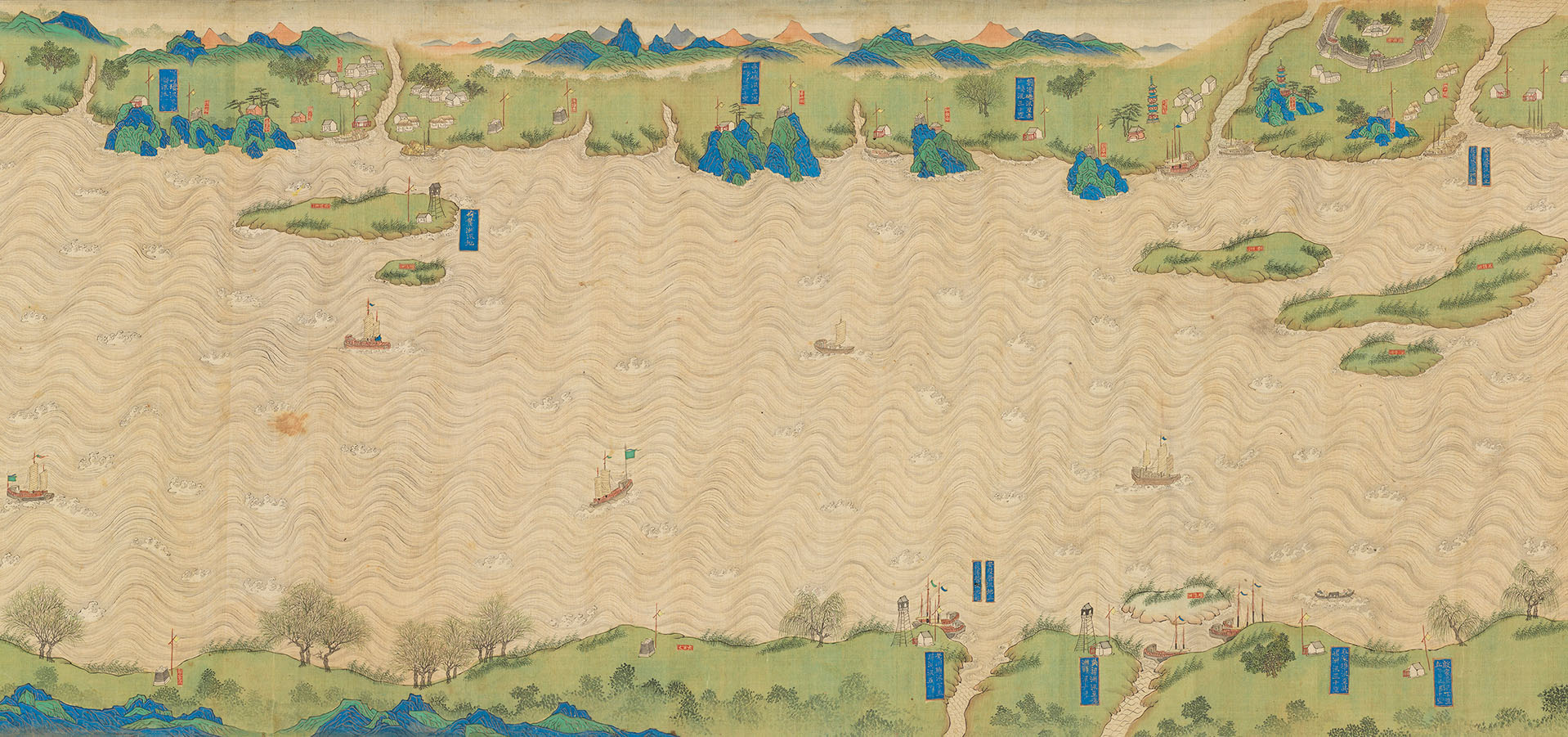
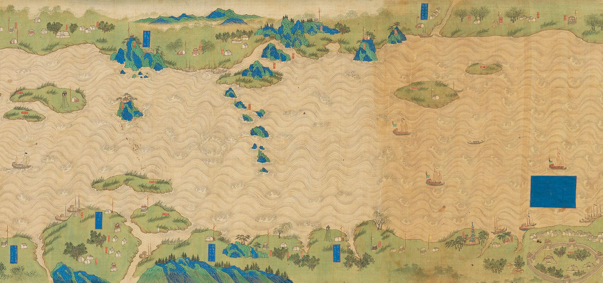
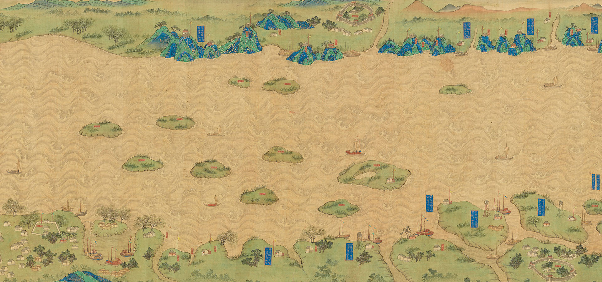
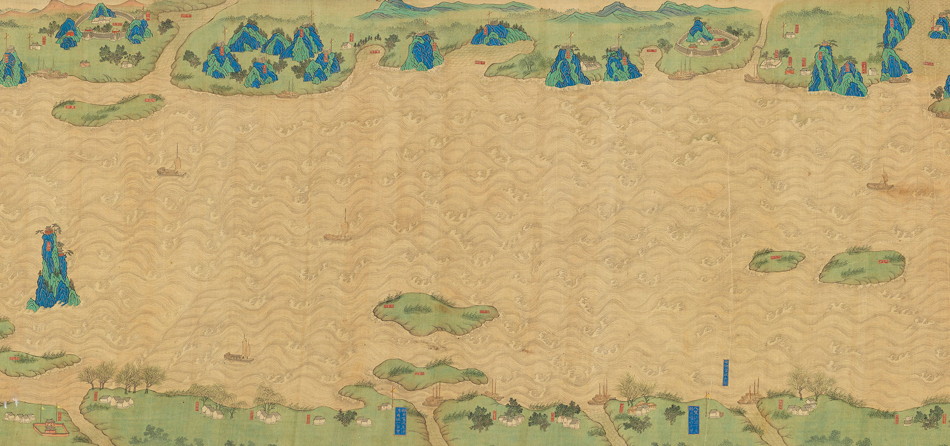
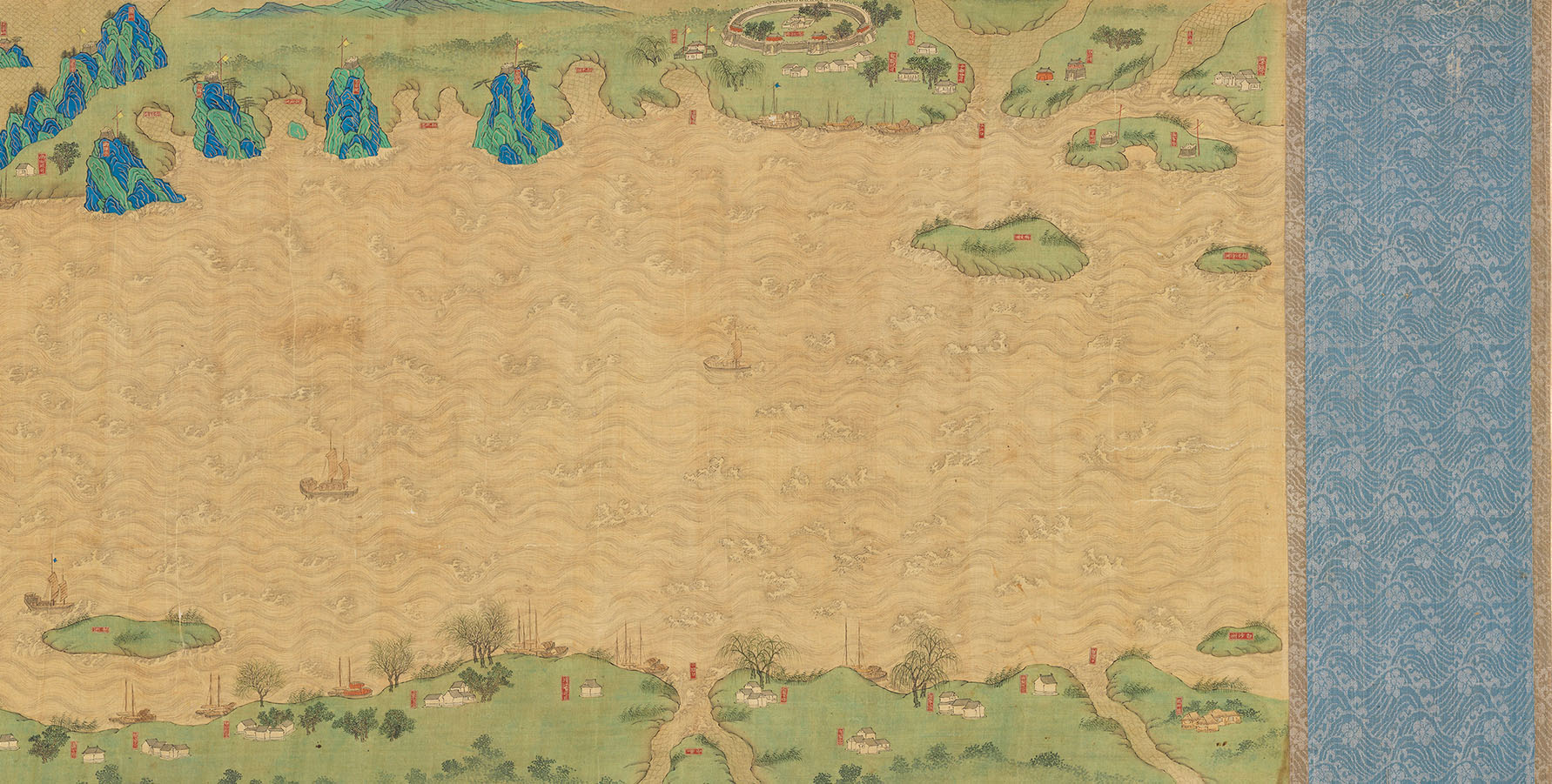
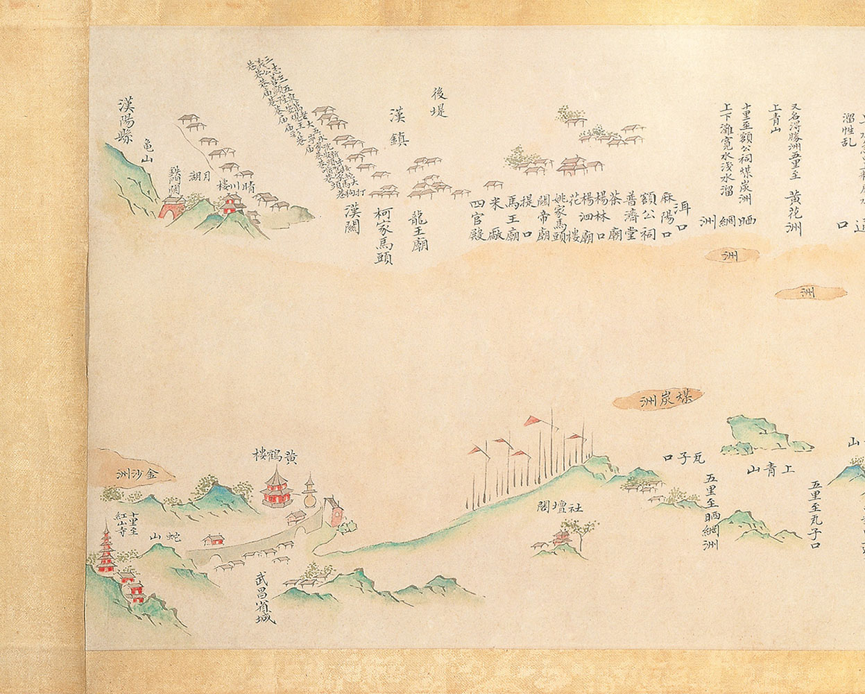
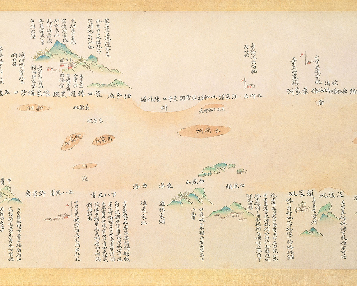
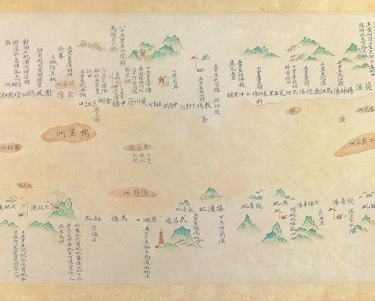
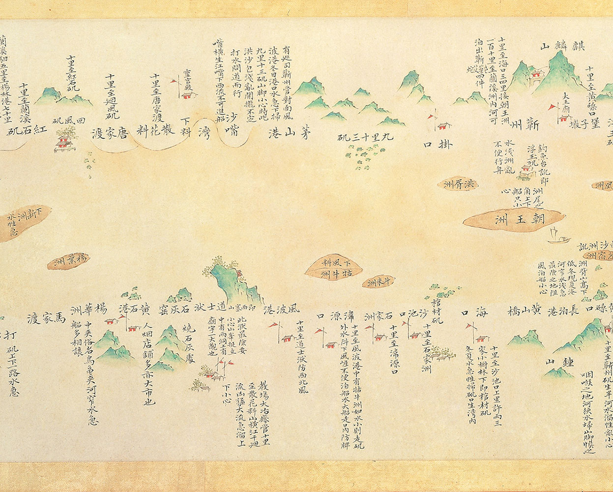
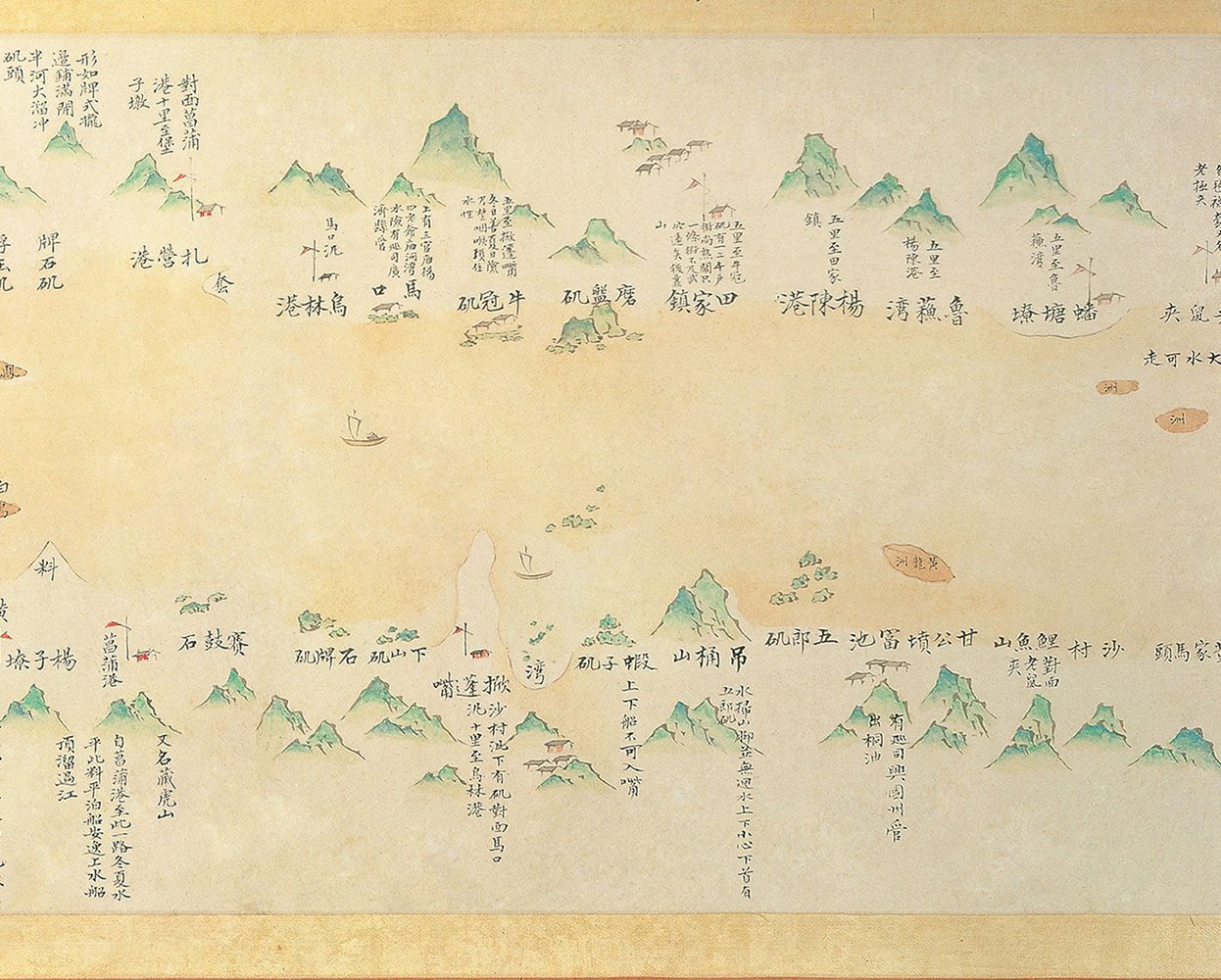
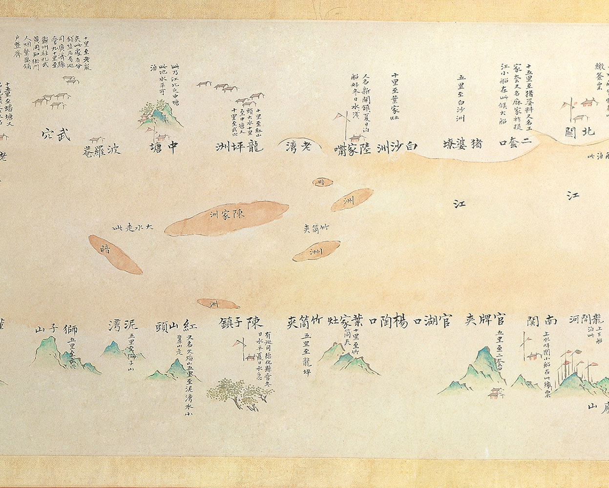
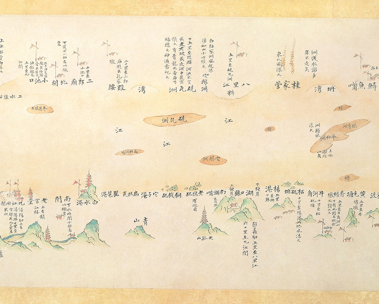
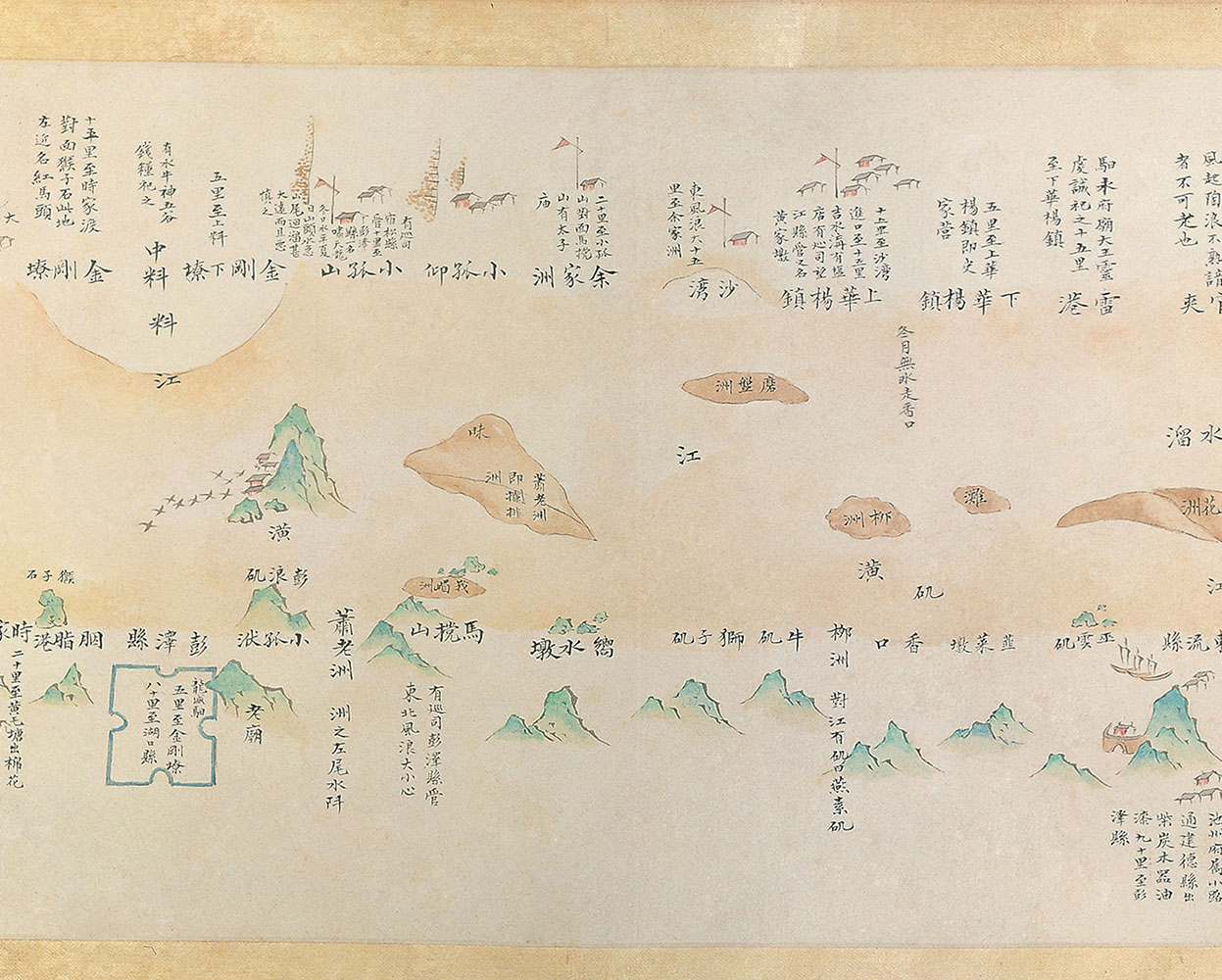
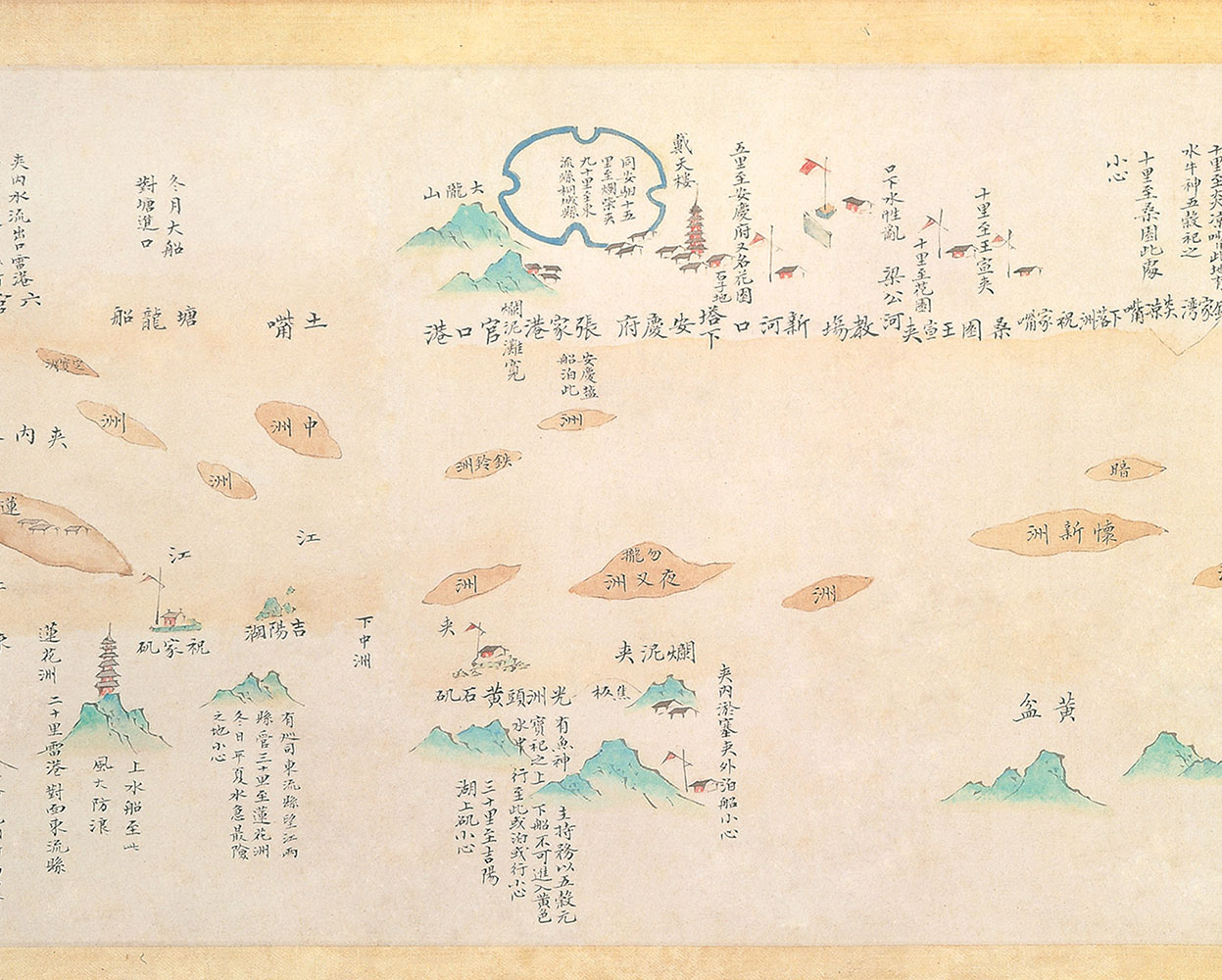
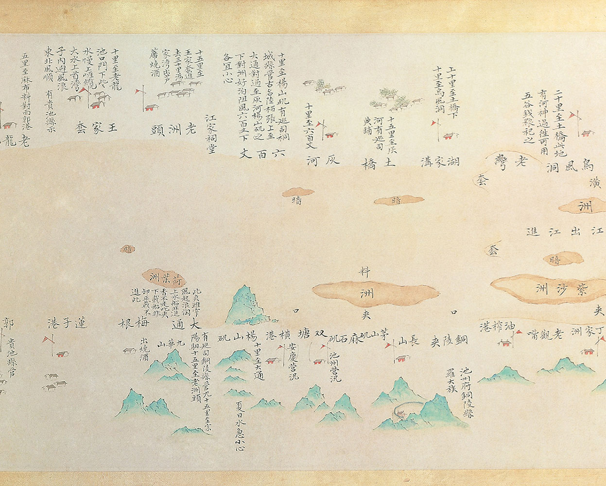
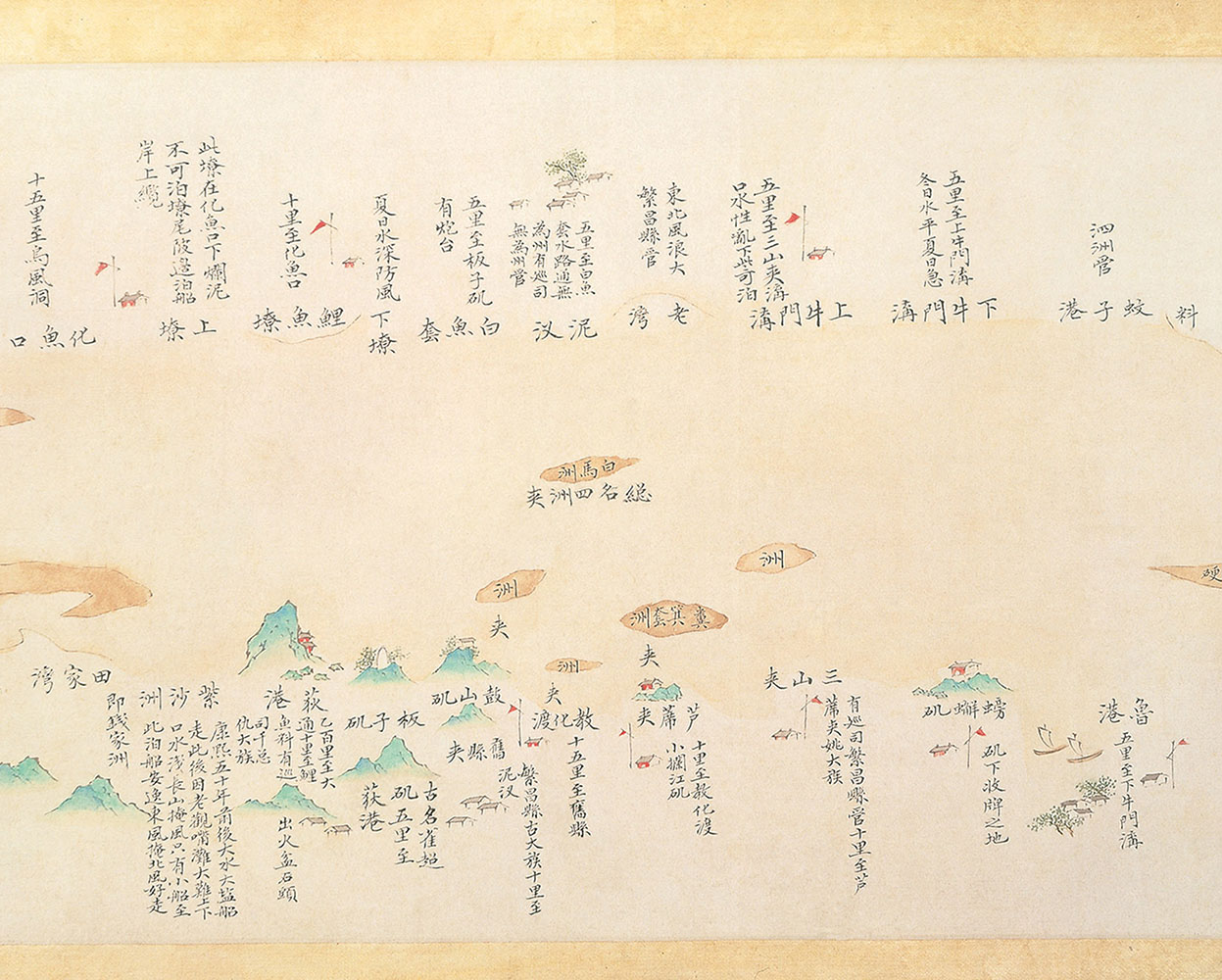
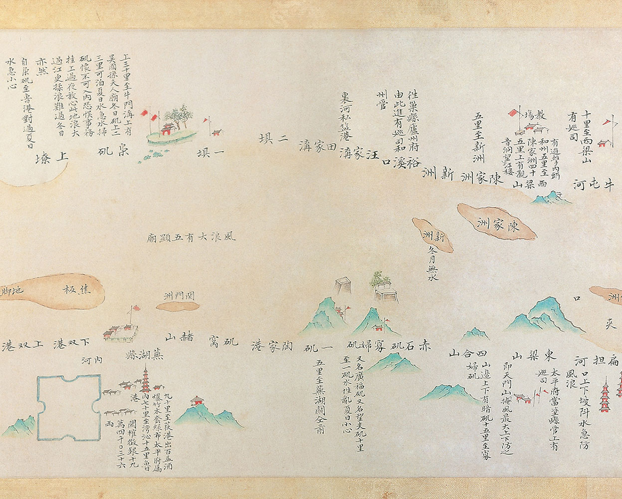
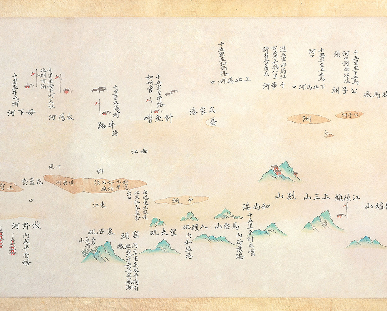
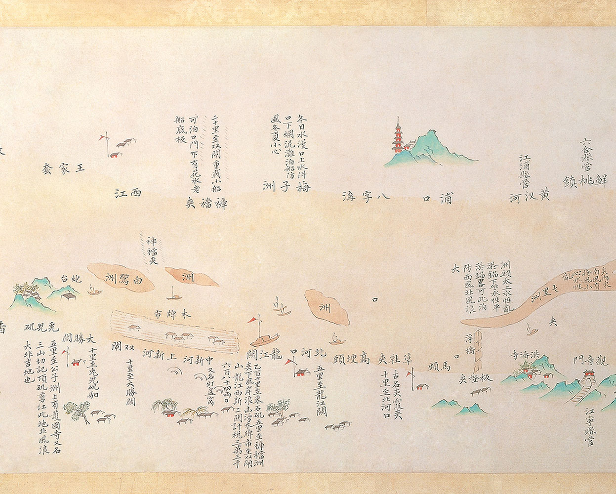
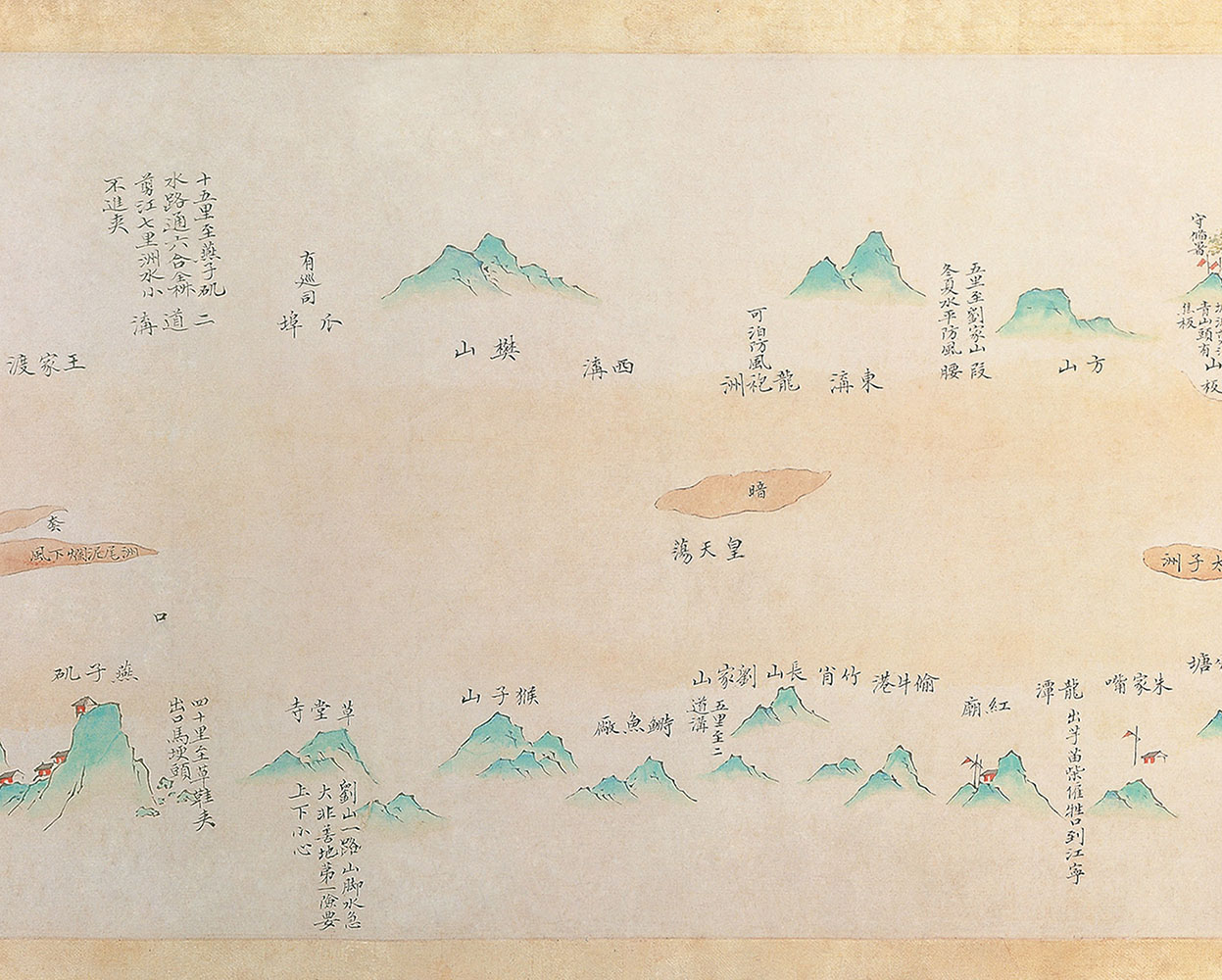
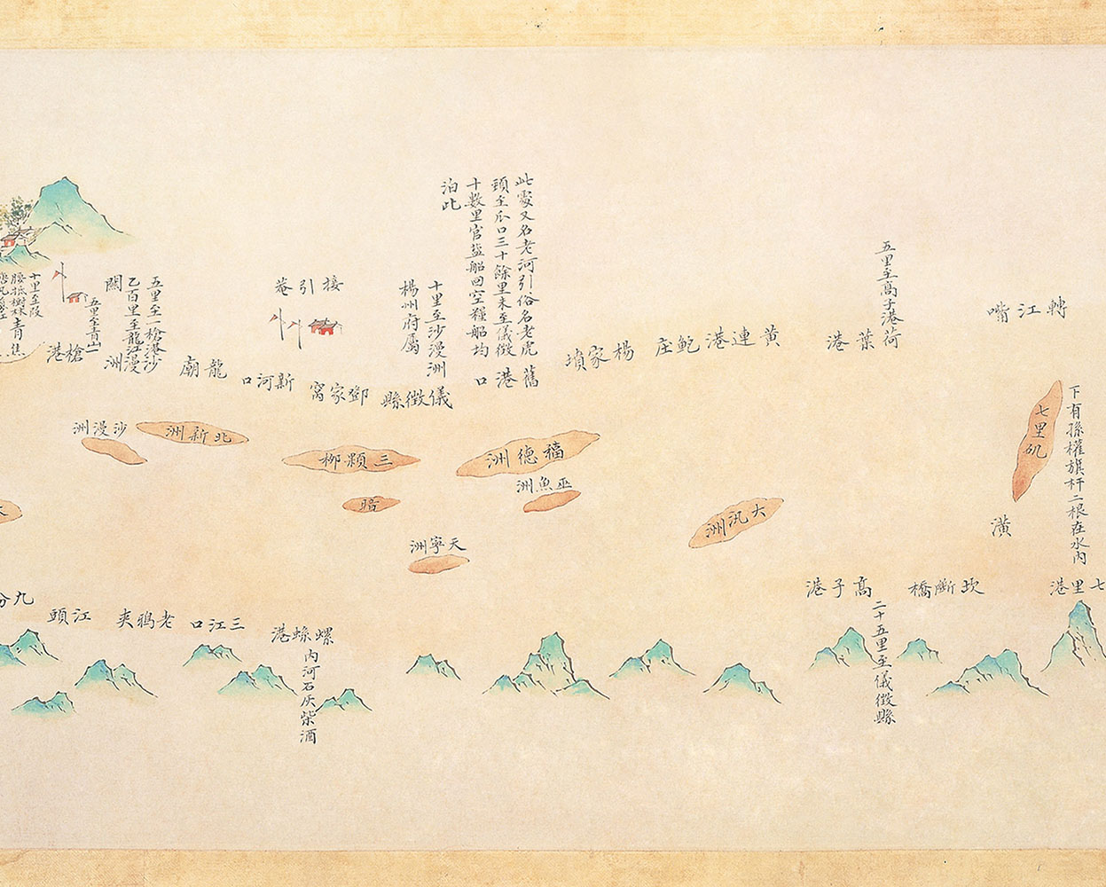
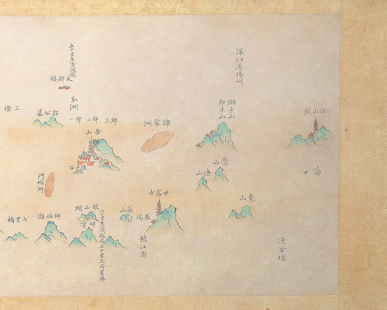
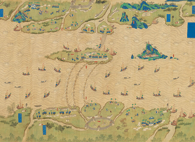
     In addition to land routes, natural waterways provided cheaper and more efficient transportation routes. The Yangtze River, China's longest river, has always been a transportation artery. The Changjiang Dili Tu (Geographical Map of the Yangtze River), on display in this exhibition, covers the middle and downstream stretches of the river. In addition to the riparian flood prevention works and military garrisons shown in the map, there are large number of boats attesting to the river's status as a major waterway. The Changjiang Tu (Map of the Yangtze River) details the cartographer's observation of river's mileage, water levels, sandbanks, and hidden rocks along the river from Wuchang to the estuary.

How to use your keyboard to browse the album:
  • Up: Show photo menu
  • Down: Hide photo menu
  • Left: Last photo
  • Right: Next photo
  • ESC: Leave album
    • Map of the Relays from Nanjing to Gansu-1
    • Map of the Relays from Nanjing to Gansu-2
    • Map of the Relays from Nanjing to Gansu-3
    • Map of the Relays from Nanjing to Gansu-4
    • Map of the Relays from Nanjing to Gansu-5
    • Map of the Relays from Nanjing to Gansu-6
    • Map of the Relays from Nanjing to Gansu-6
    • Map of the Relays from Nanjing to Gansu-7
    • Map of the Relays from Nanjing to Gansu-8
    • Map of the Relays from Nanjing to Gansu-9
    • Map of the Relays from Nanjing to Gansu-10
    • Map of the Relays from Nanjing to Gansu-11
    • Map of the Relays from Nanjing to Gansu-11
    • Map of the Relays from Nanjing to Gansu-12
    • Map of the Relays from Nanjing to Gansu-13
    • Map of the Relays from Nanjing to Gansu-14
    • Map of the Relays from Nanjing to Gansu-15
    • Map of the Relays from Nanjing to Gansu-16
    • Map of the Relays from Nanjing to Gansu-17
    • Map of the Relays from Nanjing to Gansu-18
    Map of the Relays from Nanjing to Gansu preview

    Map of the Relays from Nanjing to Gansu

    • Late 14th century (Ink and color on paper, early Ming dynasty)
    • Map of the Passes and Relays of the Four Routes in Sichuan Province-1
    • Map of the Passes and Relays of the Four Routes in Sichuan Province-2
    • Map of the Passes and Relays of the Four Routes in Sichuan Province-3
    • Map of the Passes and Relays of the Four Routes in Sichuan Province-4
    • Map of the Passes and Relays of the Four Routes in Sichuan Province-5
    • Map of the Passes and Relays of the Four Routes in Sichuan Province-6
    • Map of the Passes and Relays of the Four Routes in Sichuan Province-7
    • Map of the Passes and Relays of the Four Routes in Sichuan Province-8
    • Map of the Passes and Relays of the Four Routes in Sichuan Province-9
    • Map of the Passes and Relays of the Four Routes in Sichuan Province-10
    • Map of the Passes and Relays of the Four Routes in Sichuan Province-11
    • Map of the Passes and Relays of the Four Routes in Sichuan Province-12
    Map of the Passes and Relays of the Four Routes in Sichuan Province preview

    Map of the Passes and Relays of the Four Routes in Sichuan Province

    • Late 14th to the 15th century (Ink and color on paper, Ming dynasty)
    • Geographical Map of the Yangtze River-1
    • Geographical Map of the Yangtze River-2
    • Geographical Map of the Yangtze River-3
    • Geographical Map of the Yangtze River-4
    • Geographical Map of the Yangtze River-5
    • Geographical Map of the Yangtze River-6
    • Geographical Map of the Yangtze River-7
    • Geographical Map of the Yangtze River-8
    • Geographical Map of the Yangtze River-9
    • Geographical Map of the Yangtze River-10
    • Geographical Map of the Yangtze River-11
    • Geographical Map of the Yangtze River-12
    Geographical Map of the Yangtze River preview

    Geographical Map of the Yangtze River

    • c. 1659 (Ink and color on silk, Shunzhi period, Qing dynasty)
    • Map of the Yangtze River-1
    • Map of the Yangtze River-2
    • Map of the Yangtze River-3
    • Map of the Yangtze River-4
    • Map of the Yangtze River-5
    • Map of the Yangtze River-6
    • Map of the Yangtze River-7
    • Map of the Yangtze River-8
    • Map of the Yangtze River-9
    • Map of the Yangtze River-10
    • Map of the Yangtze River-11
    • Map of the Yangtze River-12
    • Map of the Yangtze River-13
    • Map of the Yangtze River-14
    • Map of the Yangtze River-15
    • Map of the Yangtze River-16
    • Map of the Yangtze River-17
    • Map of the Yangtze River-18
    Map of the Yangtze River preview

    Map of the Yangtze River

    • First half of the 18th century (Qing dynasty)
TOP