Beyond the Sea: Ancient Maps of Taiwan
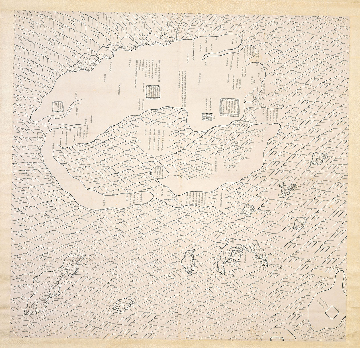
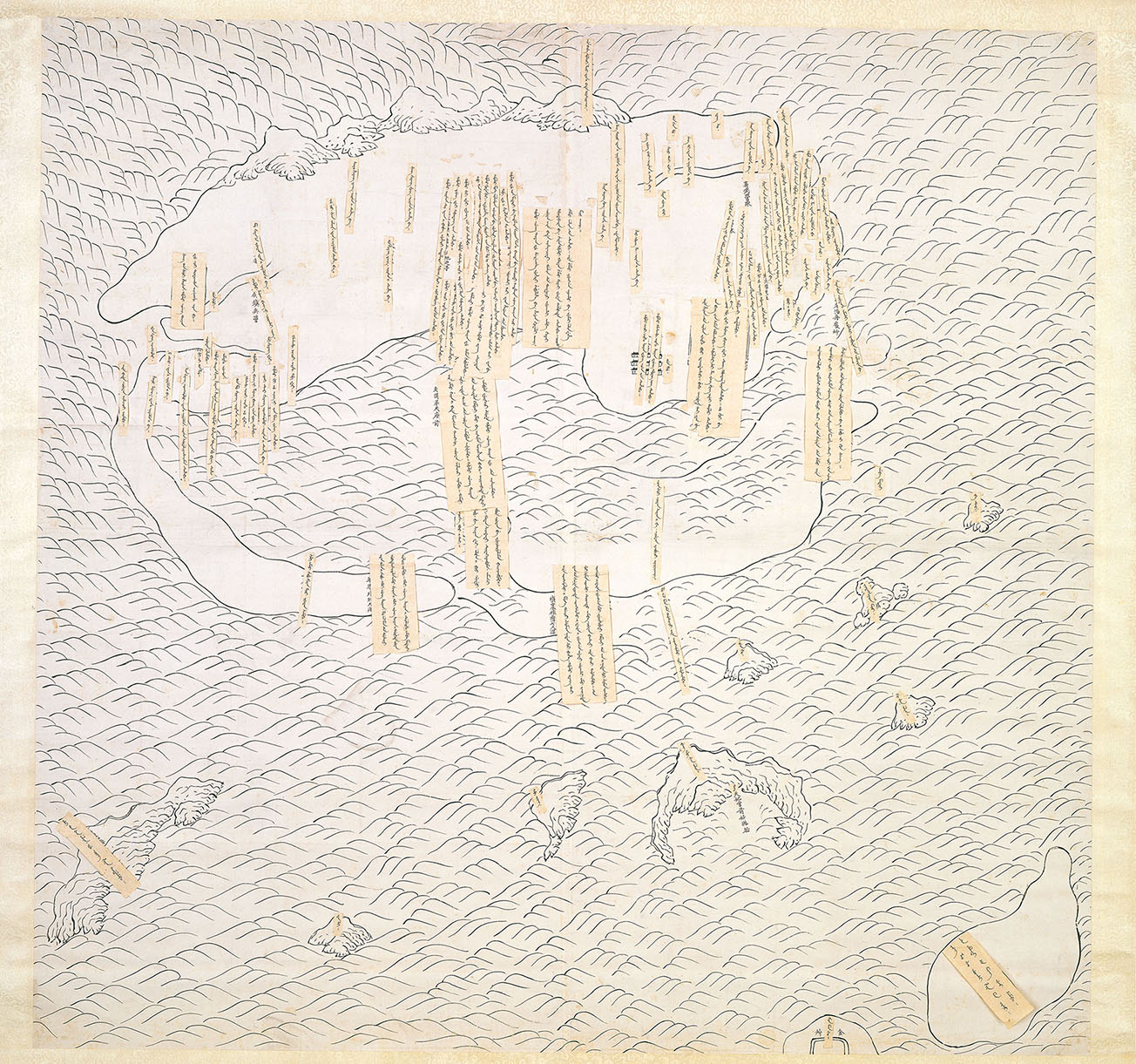
The Kingdom of Tungning was founded in Taiwan in 1662 by Ming loyalist Koxinga (Zheng Chenggong, 1624–1662) after he defeated the Dutch East India Company. During this period, the Qing government knew very little about this far-away place. The Taiwan Luetu (Sketch Map of Taiwan Prefecture), produced around 1666 in both the Manchu and Chinese languages and on display in this exhibition, only covers a few parts of what is today Tainan, which included Luermen Channel, Chikan Tower and Chengtian Prefecture, and focuses on the Koxinga period's military garrisons.
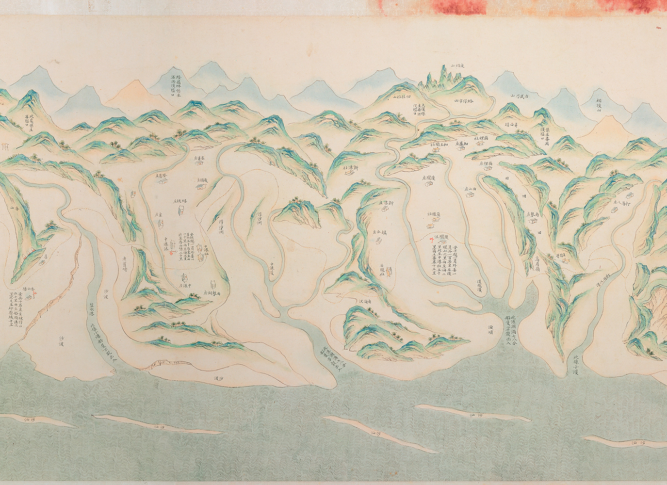
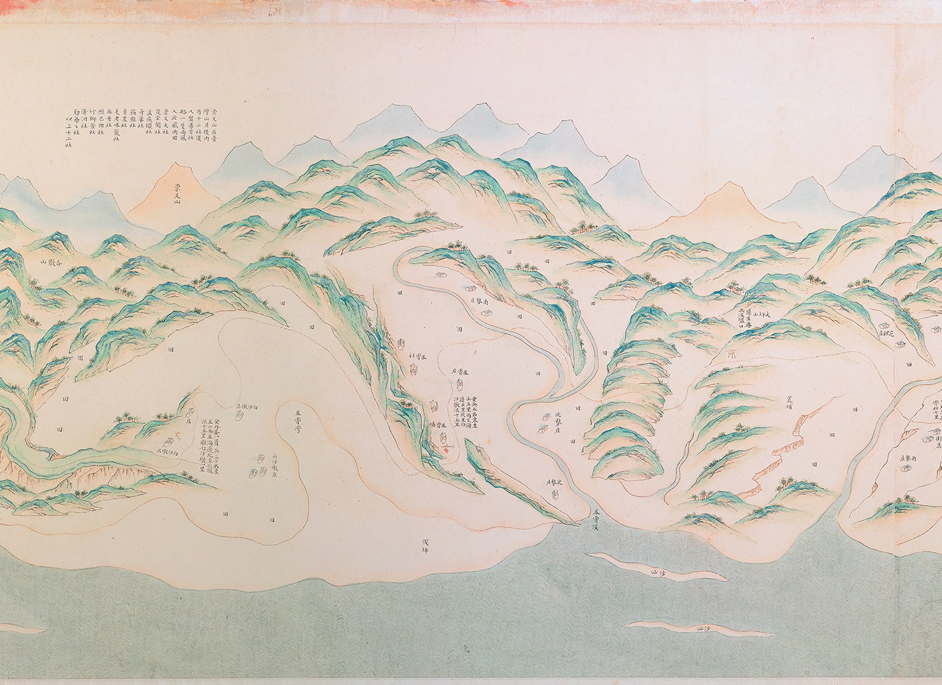
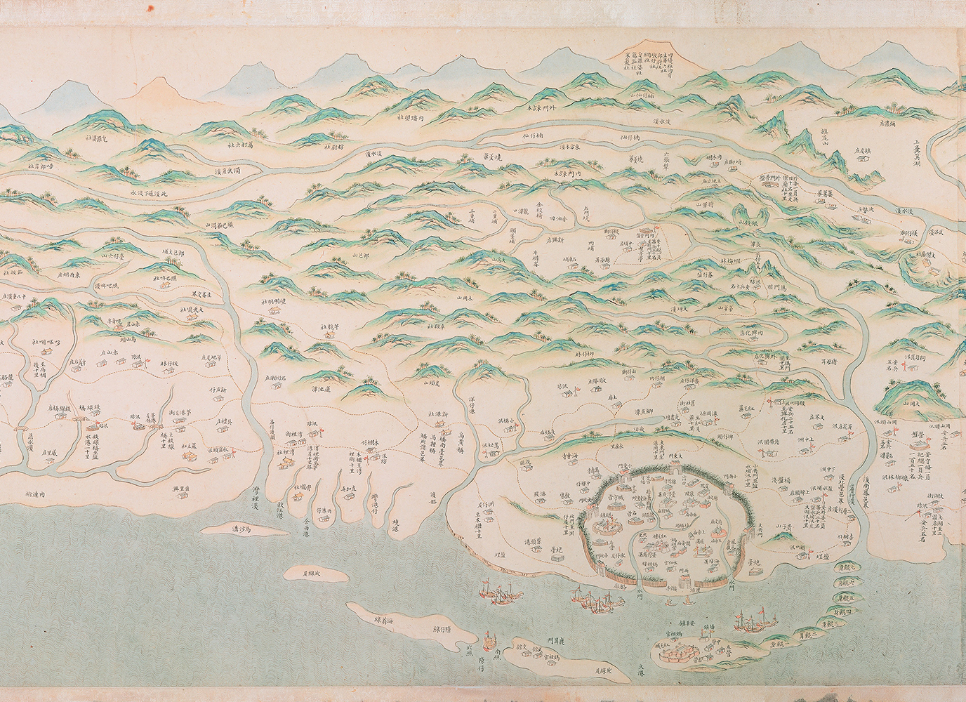
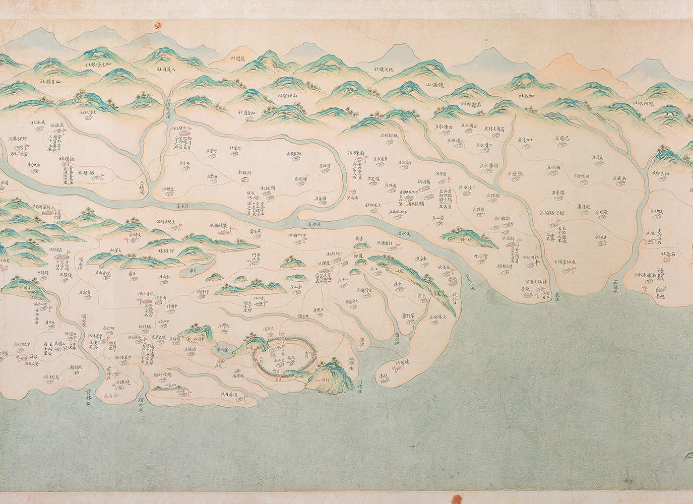
But by the end of the 17th century (mid-Kangxi reign), the situation had changed dramatically. The Kangxi Taiwan Yutu (Kangxi Taiwan Map) in the National Taiwan Museum collection records the natural and cultural landscapes of western Taiwan at that time from north to south. The depiction of indigenous peoples and their customs also indicates a fair understanding of Taiwan's society, culture, and overall geography.
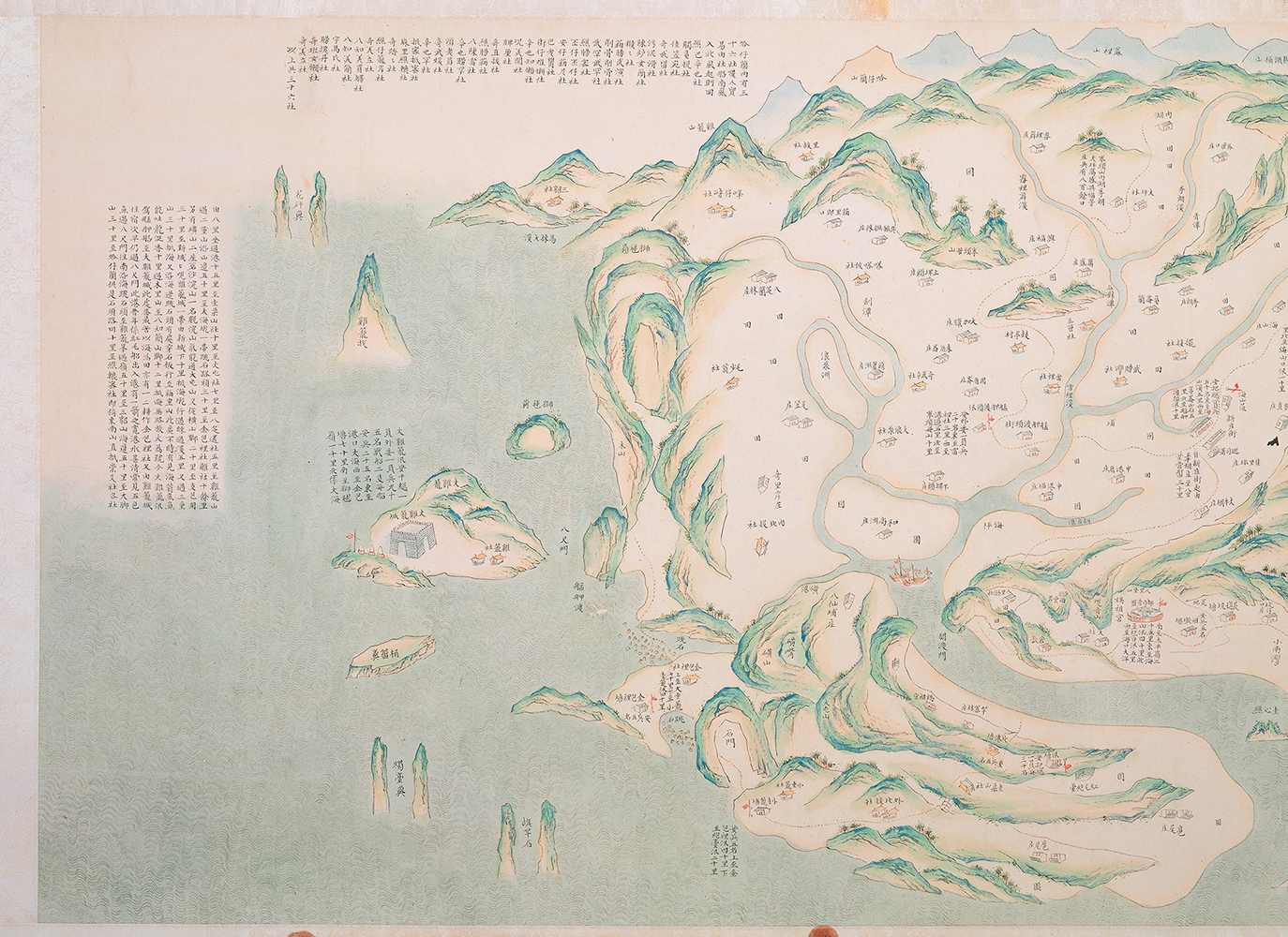
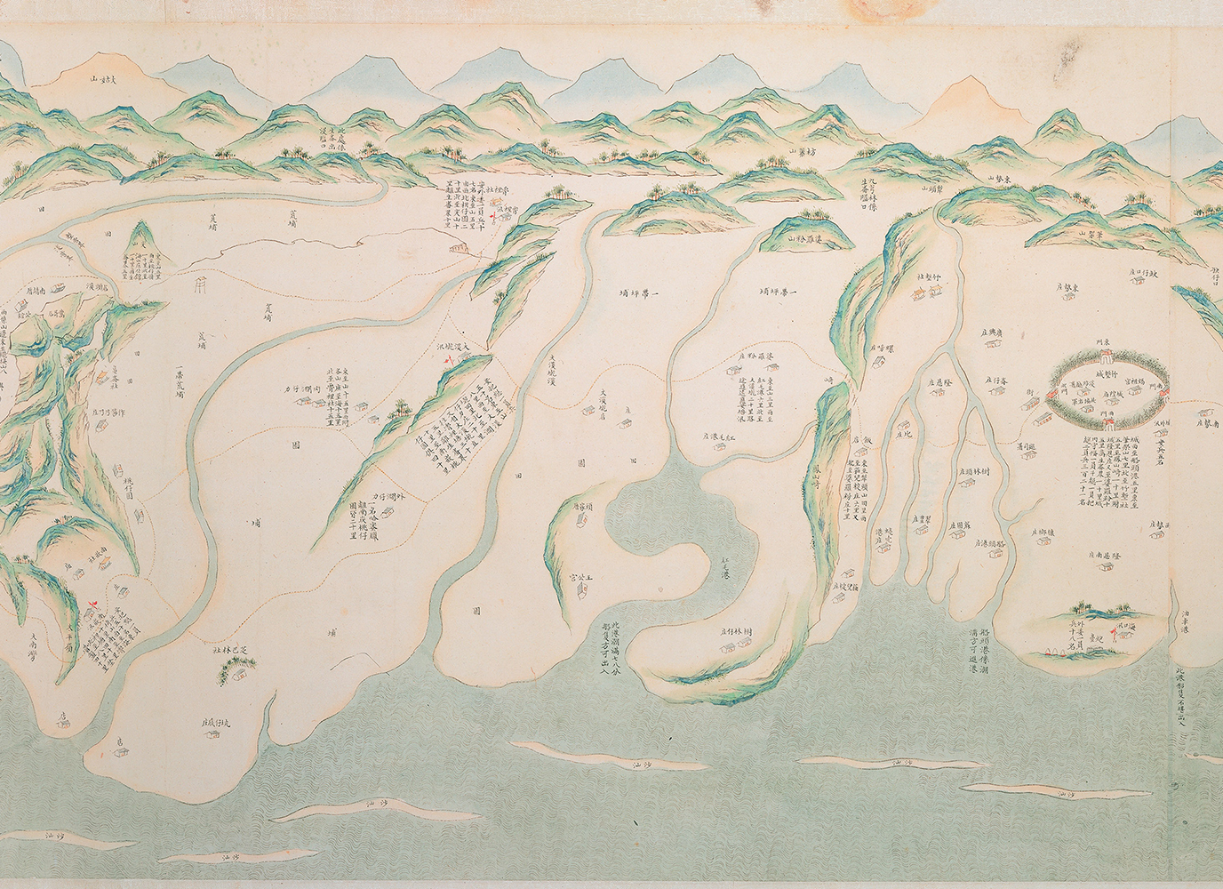
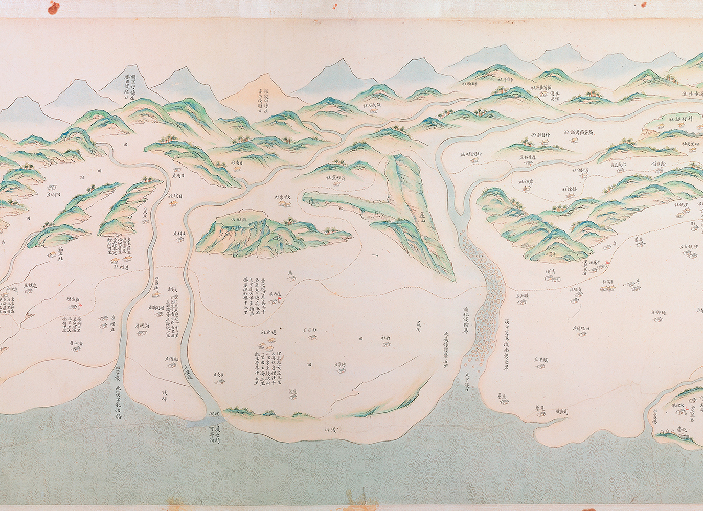
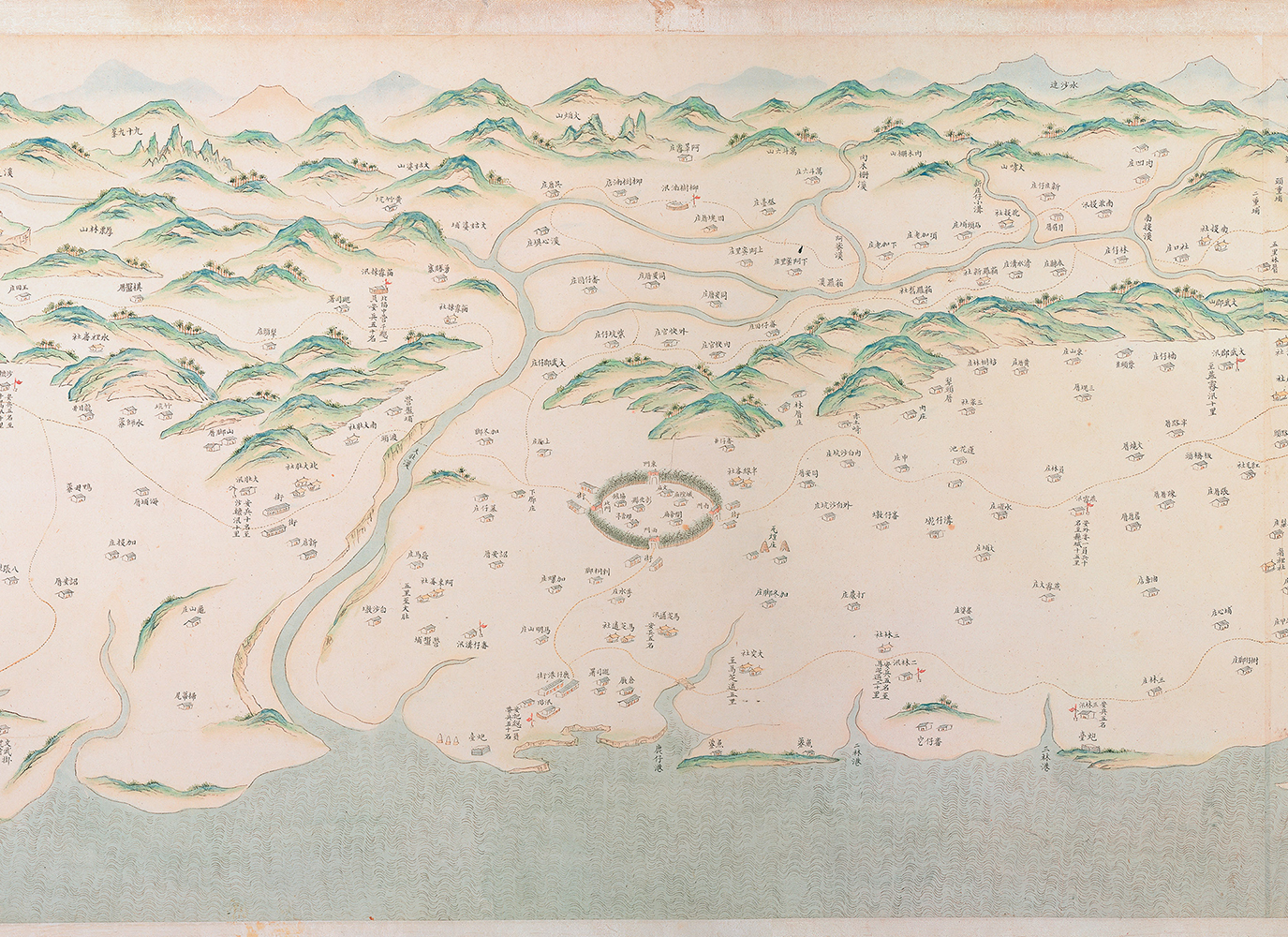
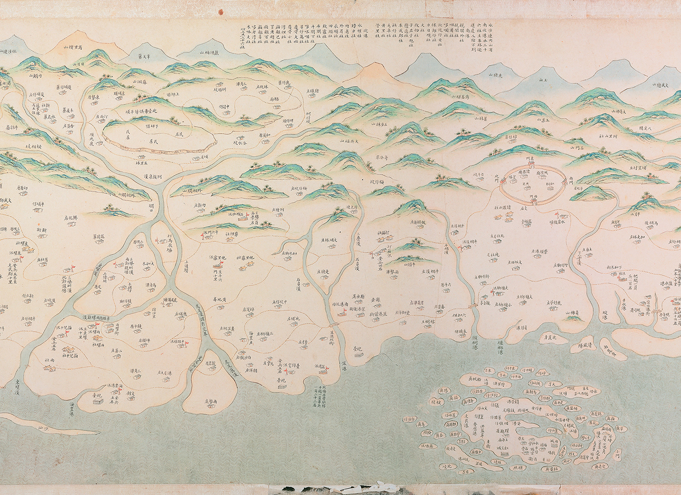
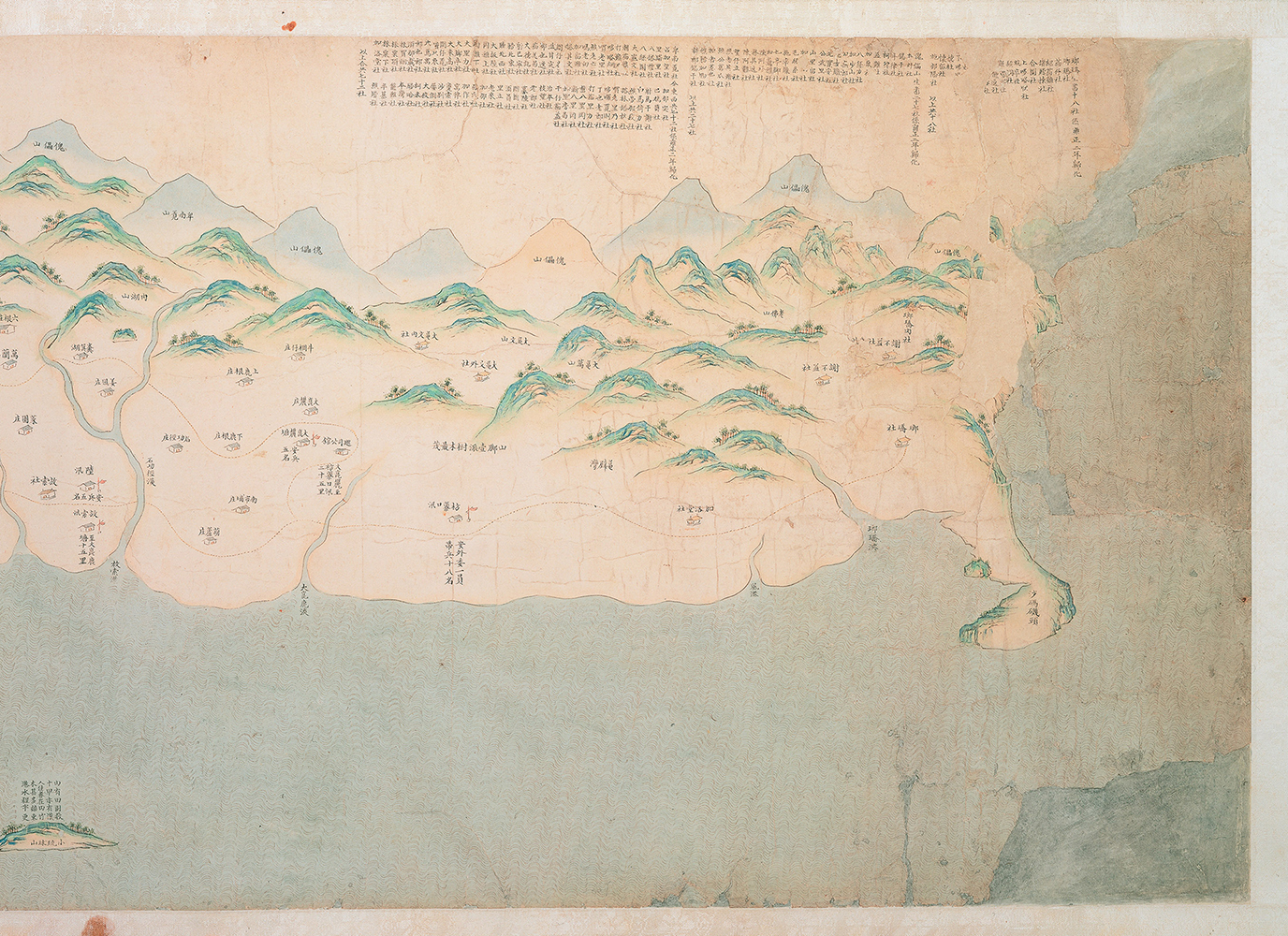
The Qianlong Emperor's loosening of restrictions on immigration to Taiwan led to an influx of Han Chinese settlers onto the island. The Qianlong Taiwan Ditu (Qianlong Map of Taiwan), produced in the mid-18th century, shows more than 600 Han Chinese settlements and over 300 aboriginal ones, suggesting rapid population growth. The descriptions "in the mountains" and "beyond the mountains" that accompany with the names of indigenous settlements suggest that the Han Chinese already had certain understanding of Taiwan's eastern coast.
-
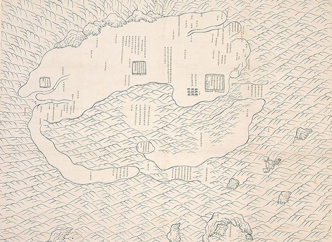
Sketch Map of Taiwan Prefecture
- c. 1666 (Ink on paper, early Kangxi period, Qing dynasty)
-
-
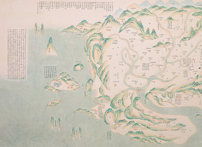
Qianlong Map of Taiwan
- Mid-18th century (Ink and color on paper, mid-Qianlong period, Qing dynasty)
-