Demarcating and Dividing
After the peasant uprising of the Zhu Yigui Incident in Taiwan during 1721, the Qing Empire erected stone markers in the foothills and important entry points into the mountains, gradually using a line of trenches and fortifications to delineate its boundaries "within" government control and those "outside" it. In the area "within the boundary," the government set up offices and considered it part of Qing territory, while that "outside the boundary"was viewed as beyond civilization, and travel was forbidden there.
 llustrations and Discourses on the Restoration of Official Buildings in the Prefecture of Taiwan
Construction of K'uei-lei aborigine pass buildings- Qianlong reign(1736-1795), Qing Dynasty
- Album leaf, colour on paper
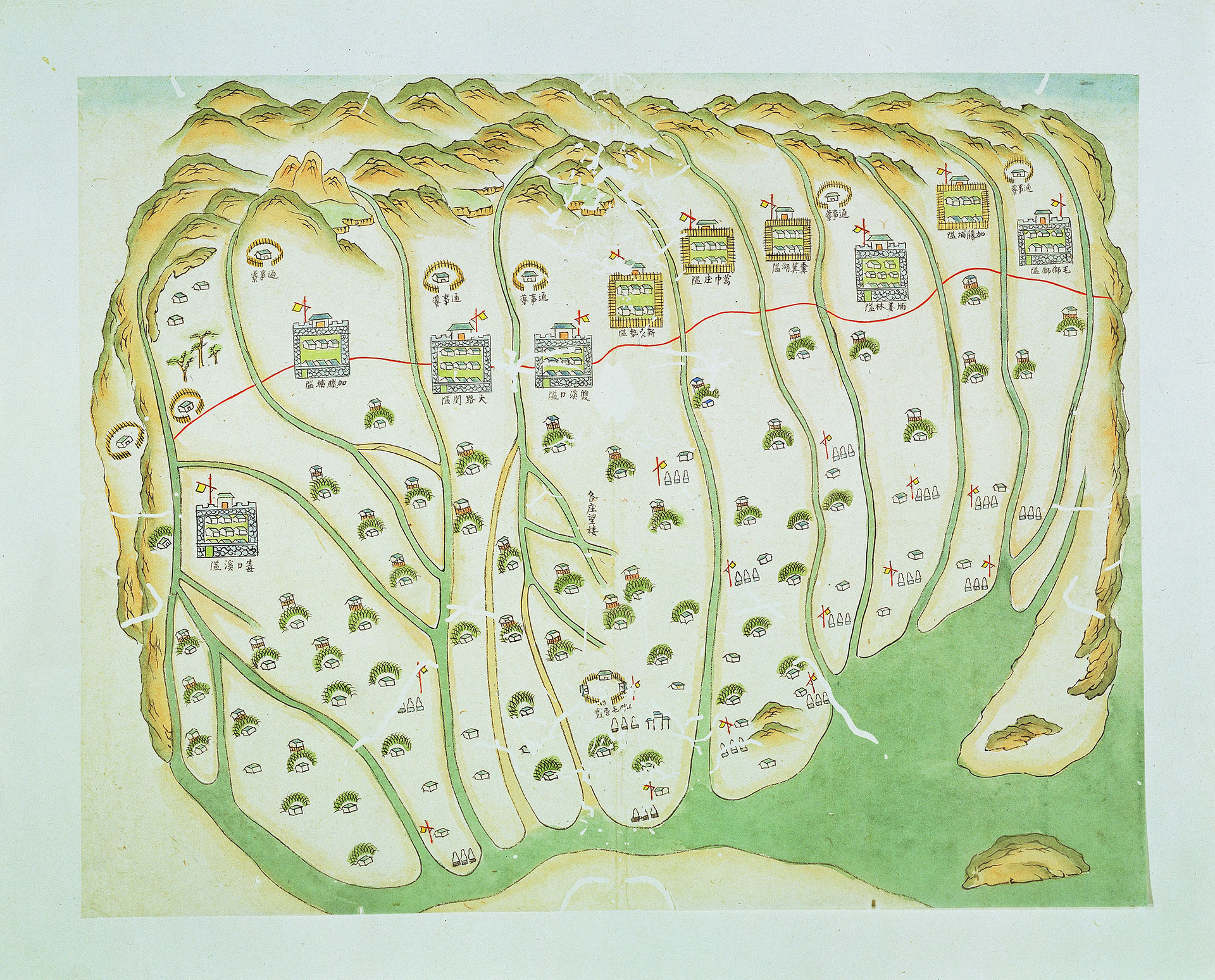
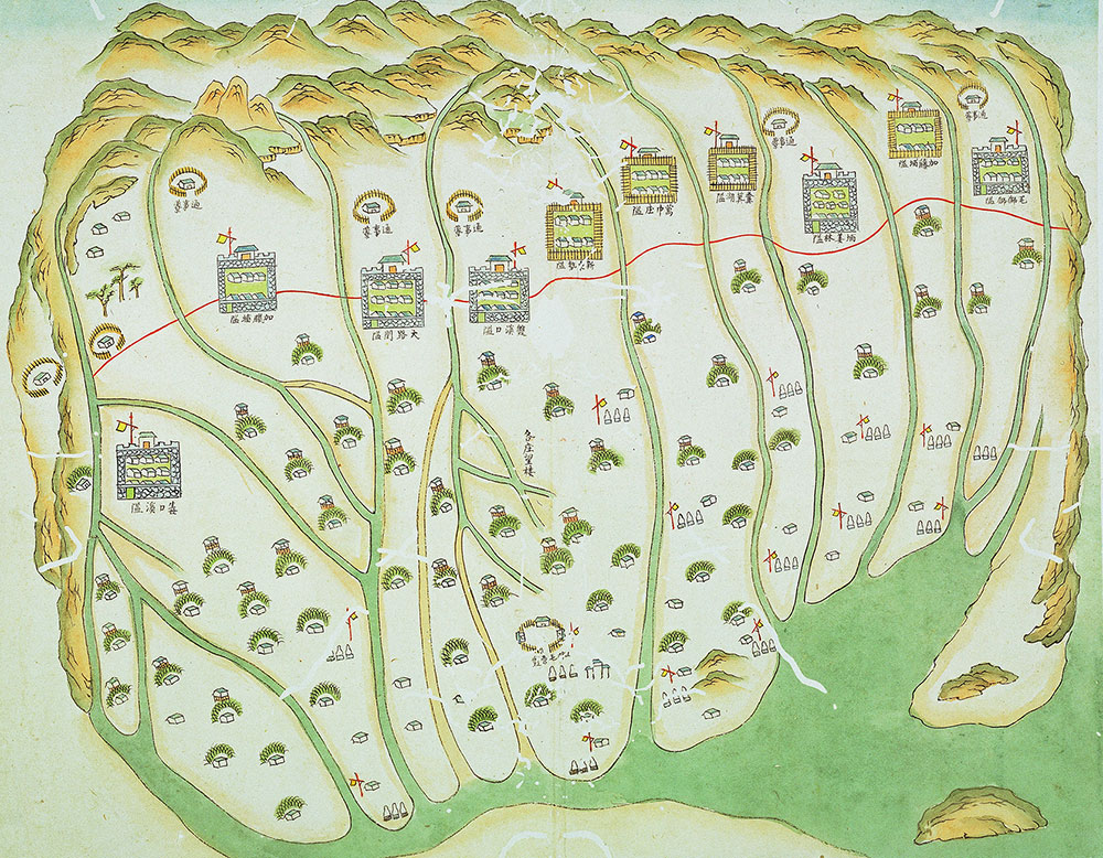
The "Image of Barbarian Houses Built on a Mountain Pass" is one of the forty illustrations in the "Diagram of the Reconstruction of Structures in Taiwan Province" made by the Qing dynasty (Qianlong period) Taiwan prefect Chiang Yuan-Shu (1738-1781). The drawing depicts mountain passes where "wild barbarians" appear in Southern Taiwan. The red line shows the separation of peoples between today's Pingtung and Taichung in 1750.
 llustrations and Discourses on the Restoration of Official Buildings in the Prefecture of Taiwan
Construction of the Tamshi subprefecture watchtower- Qianlong reign(1736-1795), Qing Dynasty
- Album leaf, colour on paper
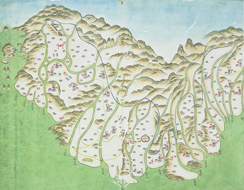
The "Illustration of the Construction of the Tamsui Hall Tower" is one of the 40 drawings in the "Diagram of the Reconstruction of Structures in Taiwan Province." This drawing depicts a tower in northern Taiwan and the blue lines shows the separation of peoples between today's Pingtung and Keelung in 1760.