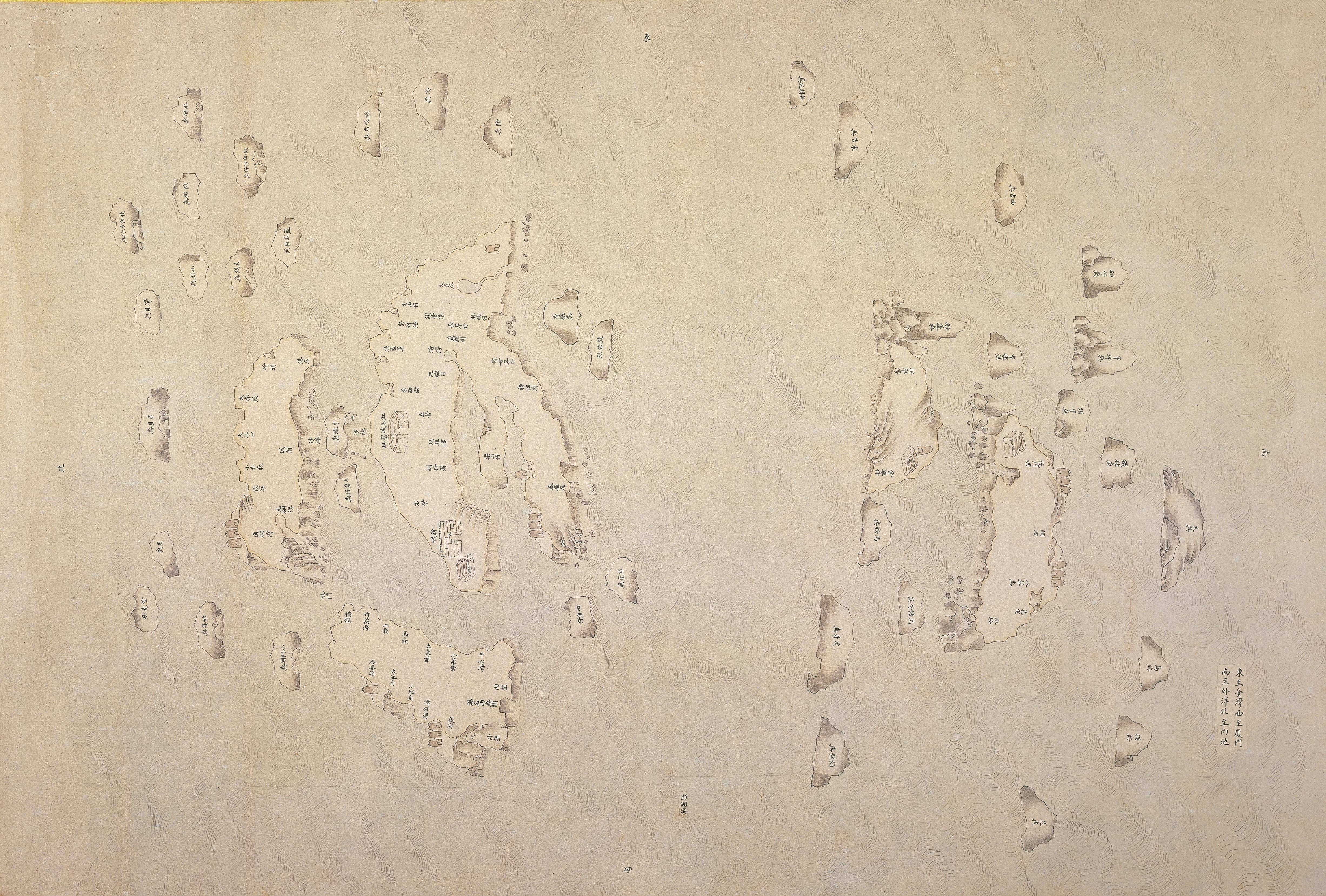
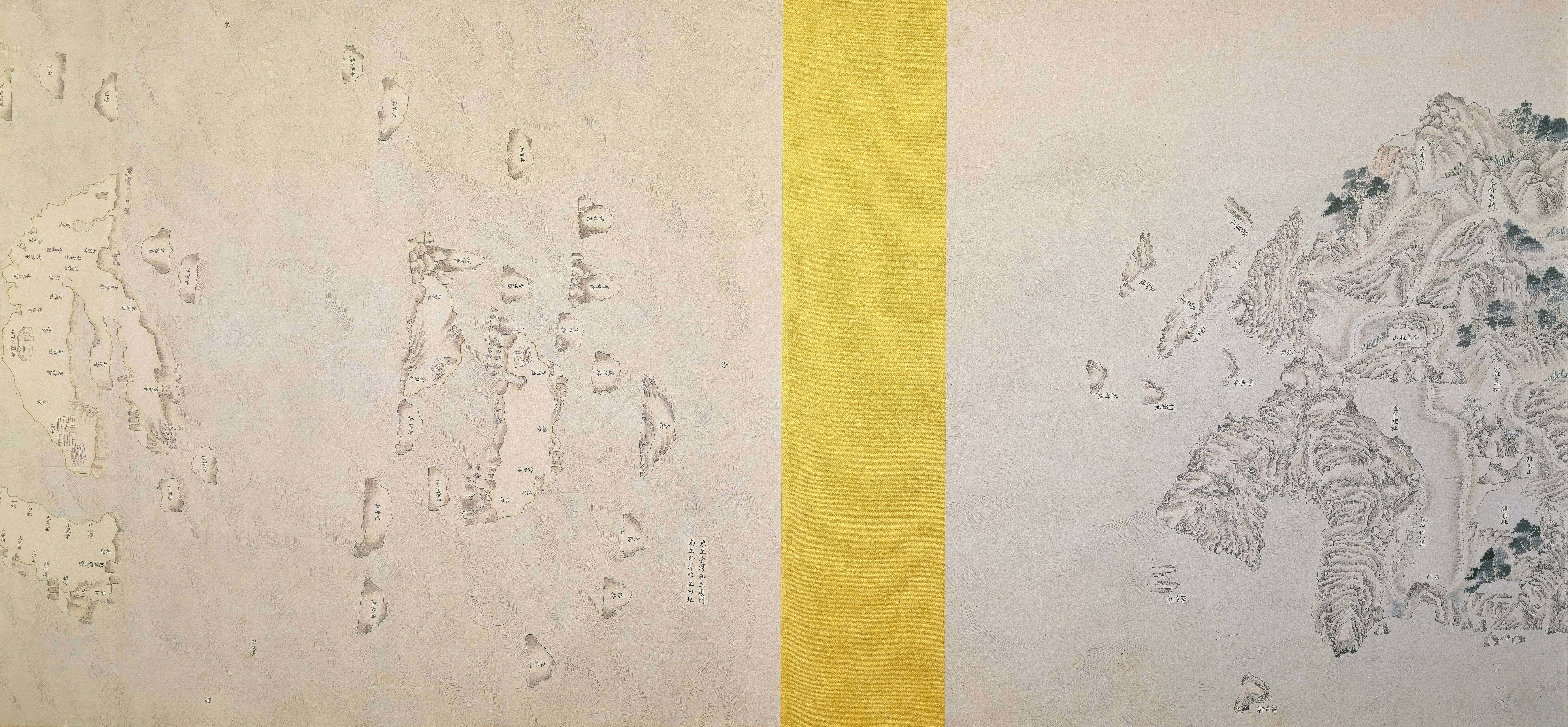
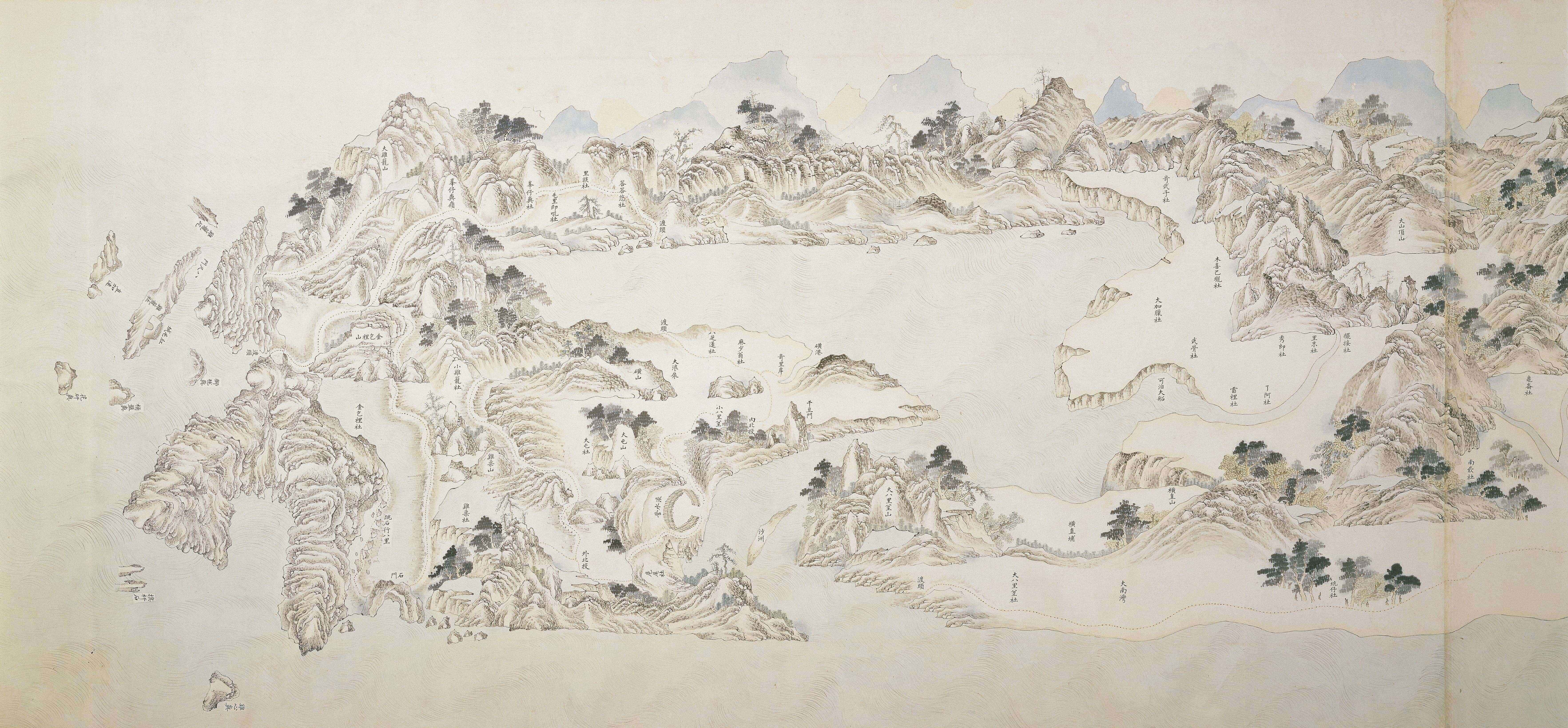
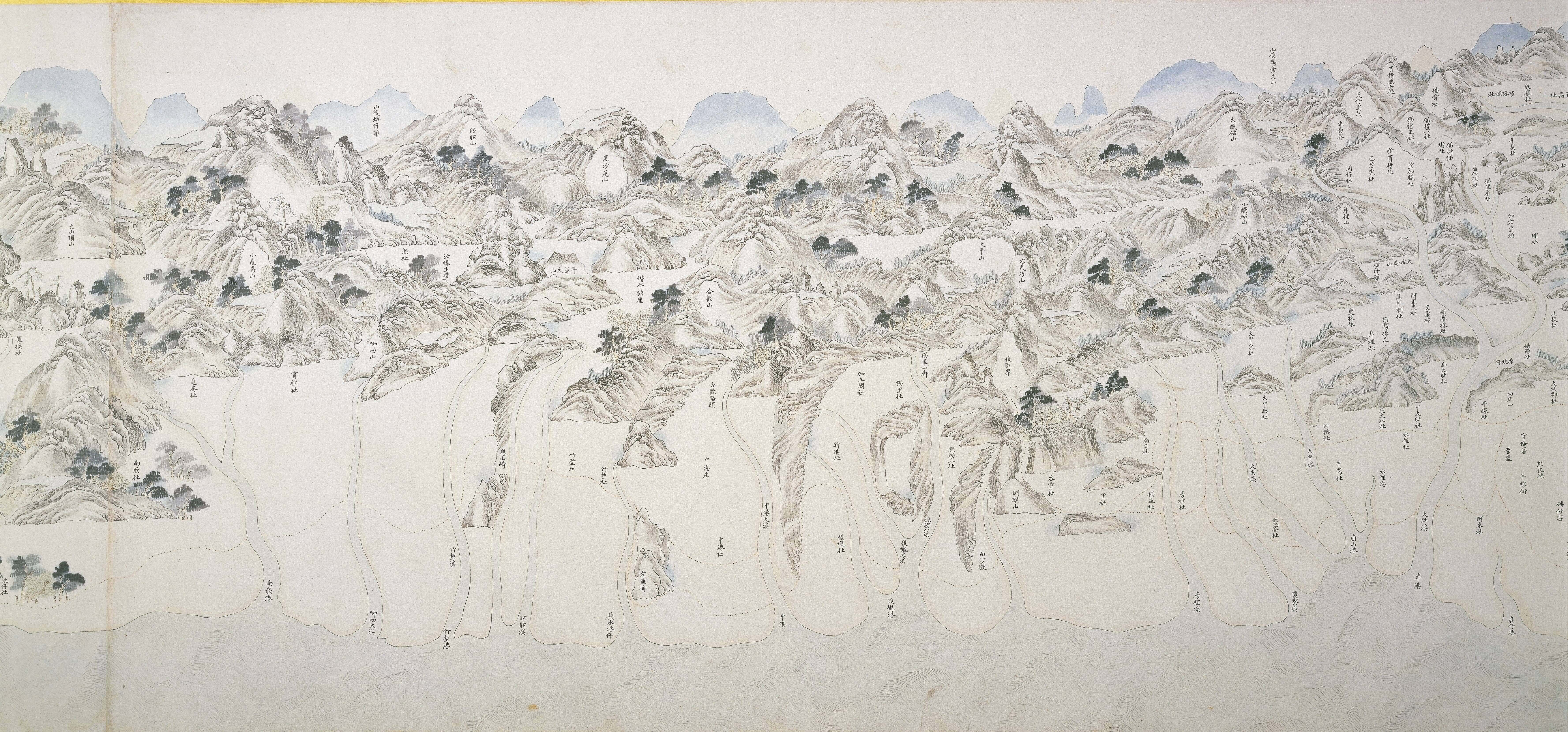
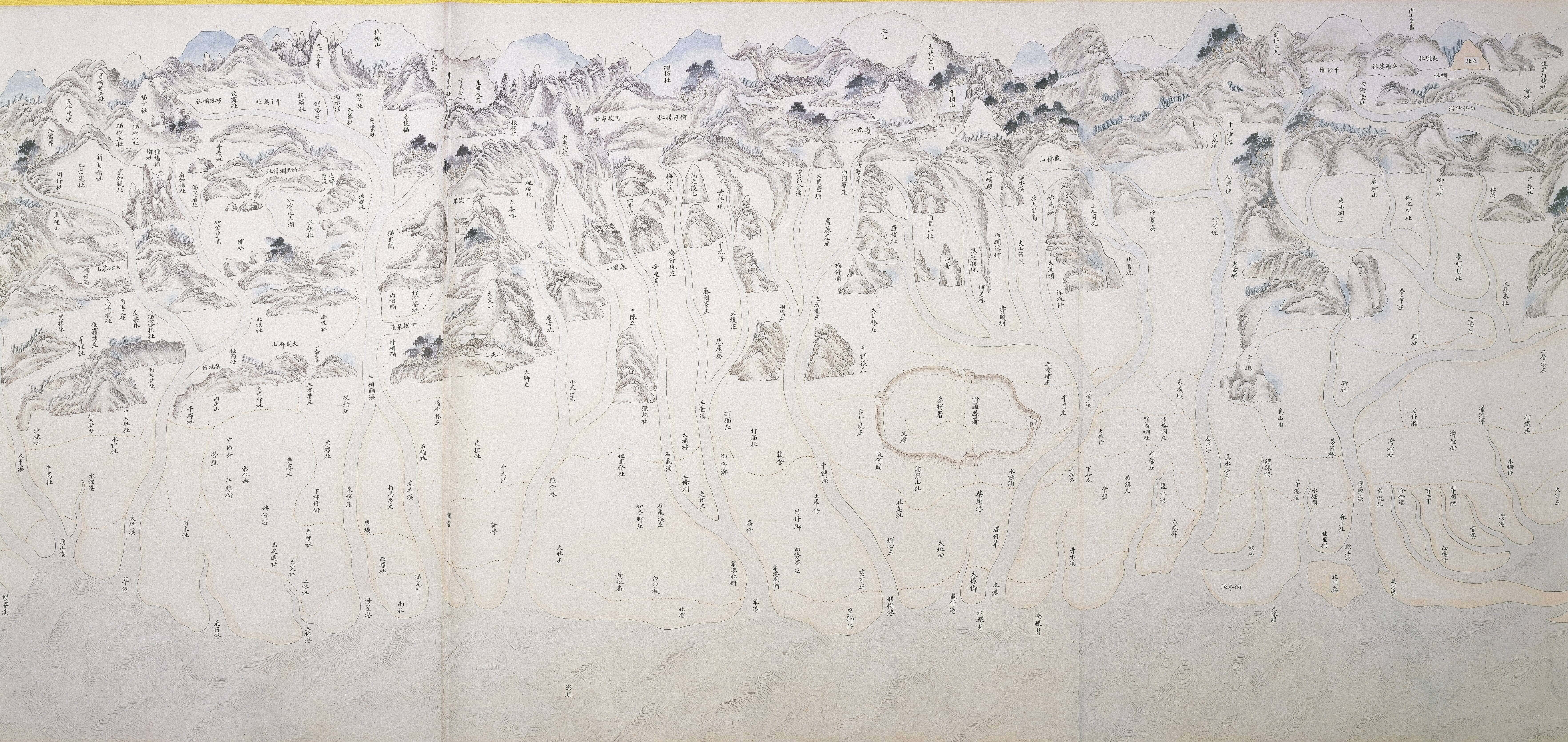
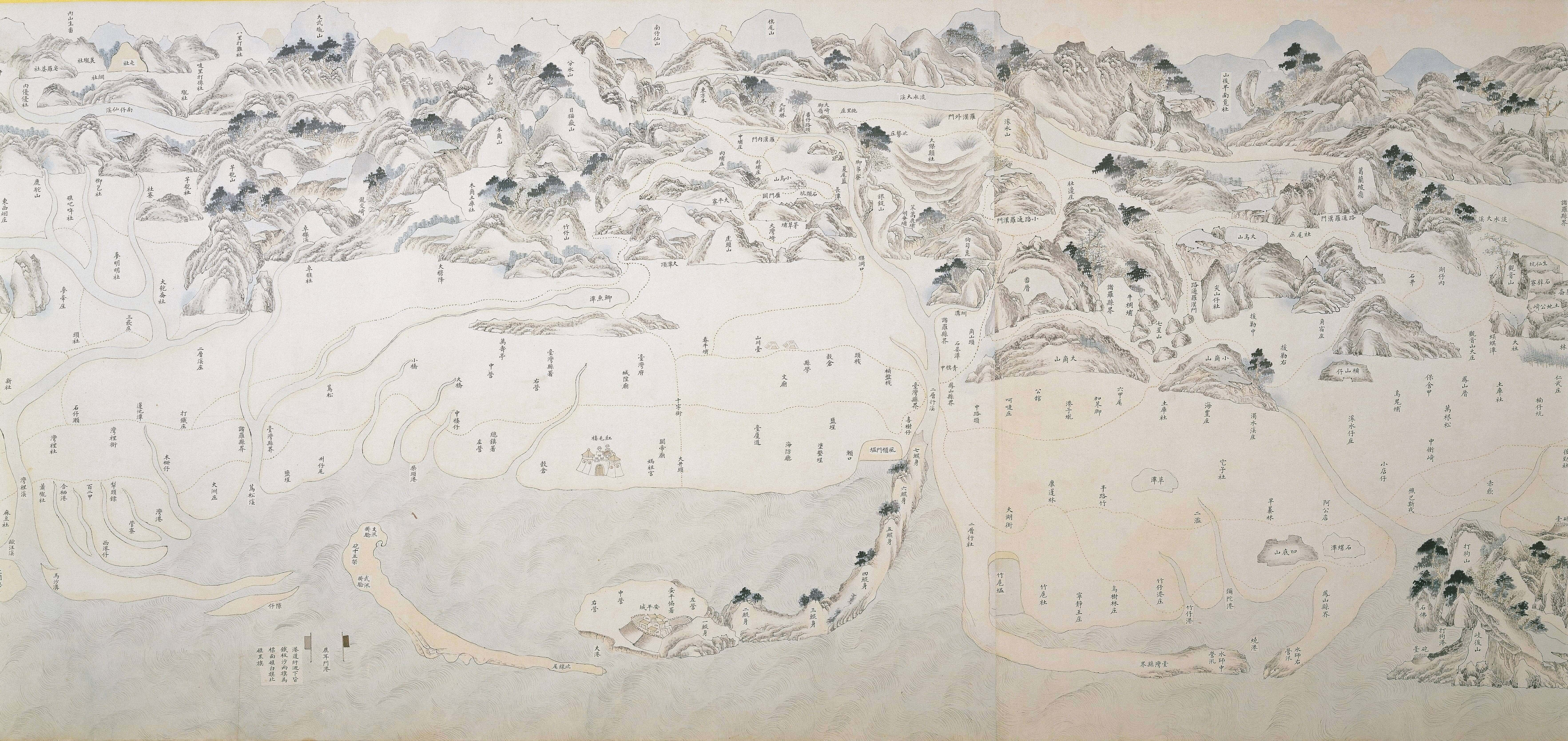
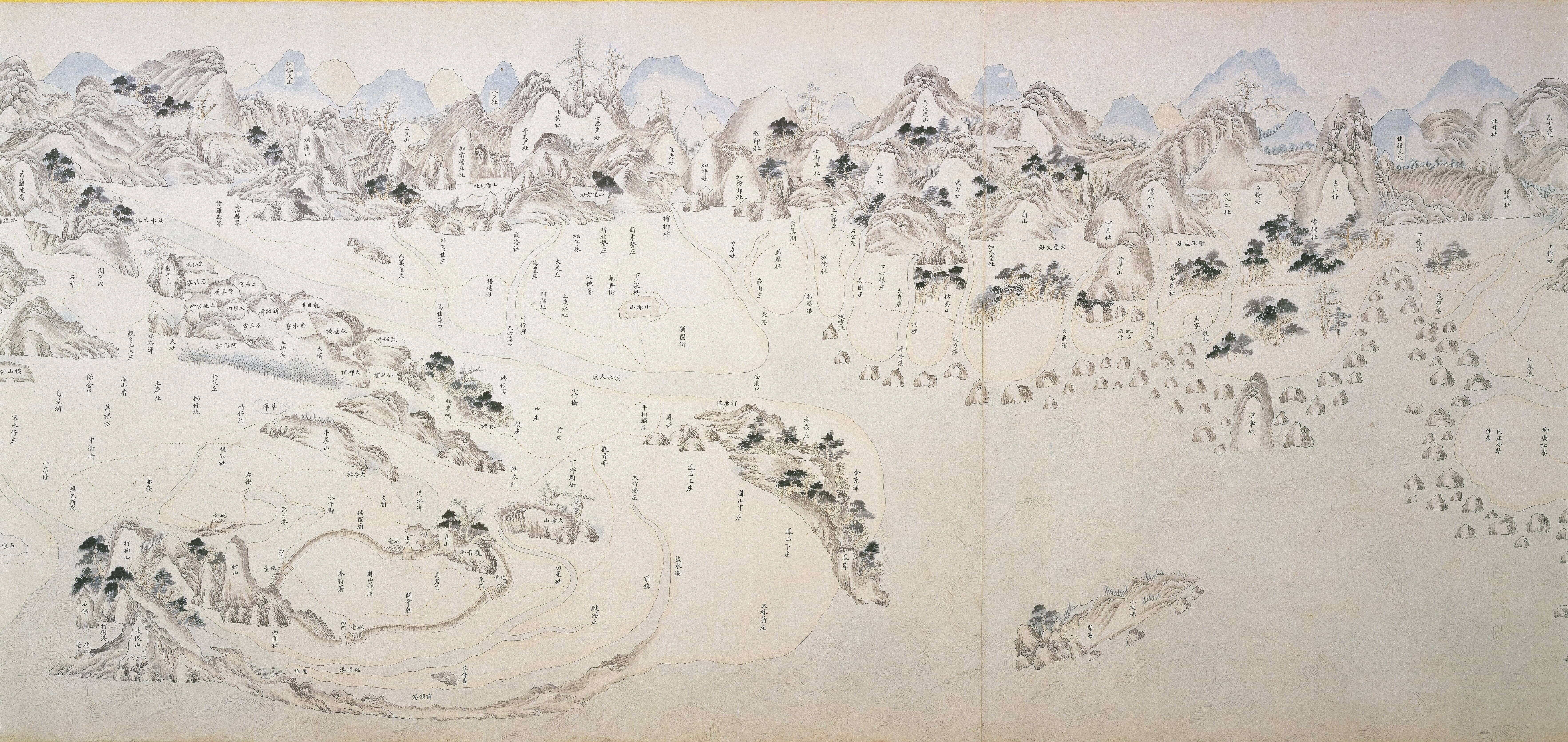
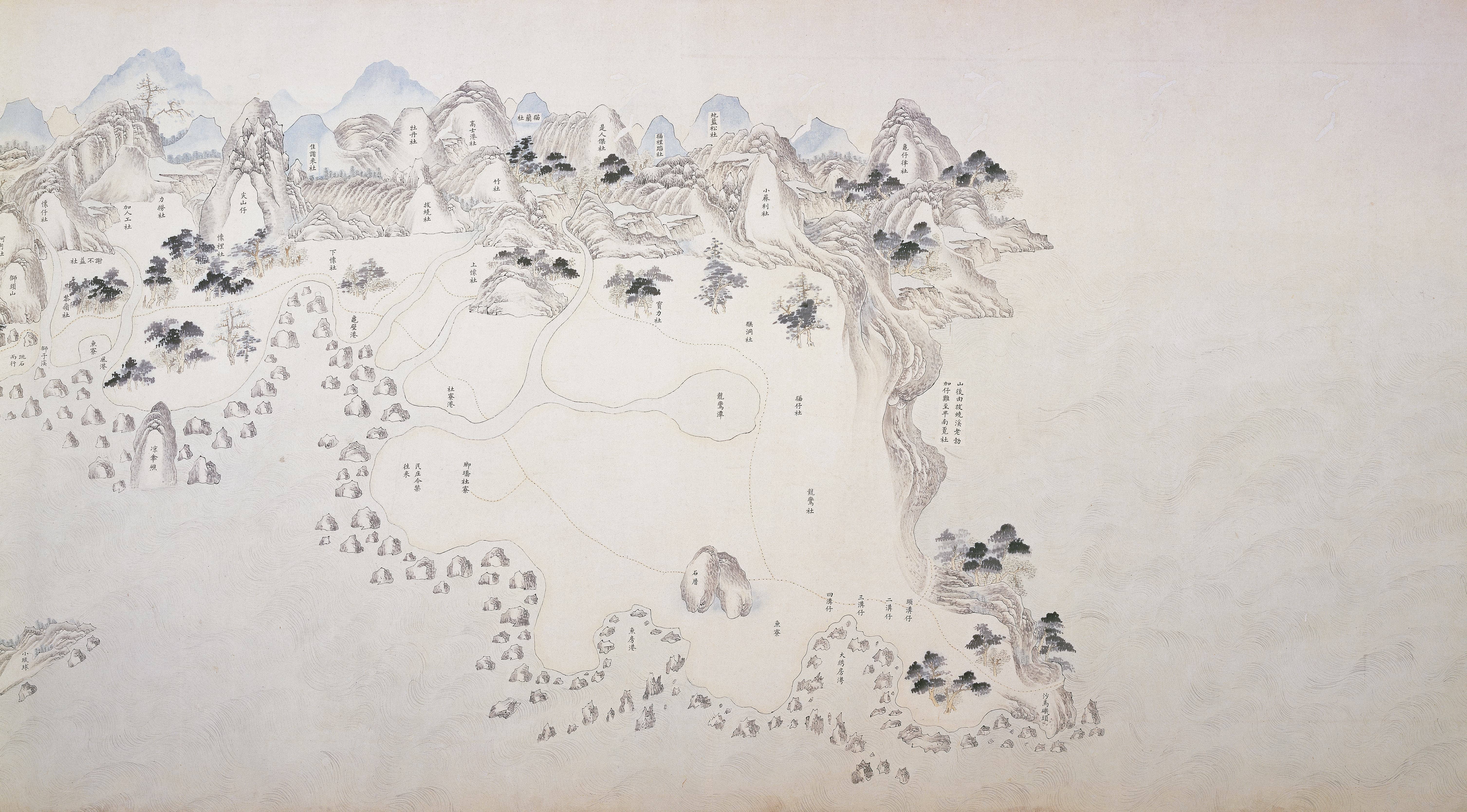
The exhibition brings us back to Taiwan with a reproduction of the Qing Dynasty era "Map of Taiwan and the Penghu Archipelago." By examining this map from the reign of the Yongzheng Emperor, the differences between past official positions and our current awareness of Taiwan become clear. The introduction of precision measuring instruments and graphic sciences led to the printing of more accurate maps. Aerial photography and satellite images followed to provide accurate color images. Before the age of flight, however, mapmakers limited to views from the ground and simple instrumentation had to use their imaginations to fill in knowledge gaps. Choices made about what information to gather was vital, with priority given to requests from rulers. The "Map of Taiwan and the Penghu Archipelago" looks at Taiwan from the perspective of the mainland China. While it lacks the accuracy of modern maps, which typically adopt a bird's eye view perspective, the drawing style and subjective presentation represent the custom-made nature of ancient maps, highlighted by the inclusion of select natural landscapes, military installations, and everyday lifestyle scenes. A modern 3D model of Taiwan is included for comparison to help viewers look for familiar sights to see how ancient perspectives differ from the present-day state of the land.
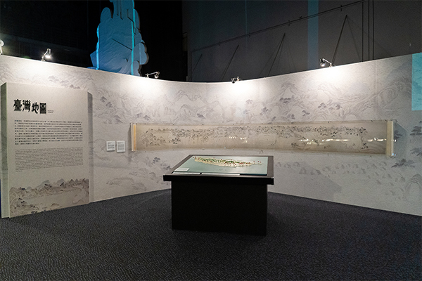
Map of Taiwan and the Penghu Archipelago
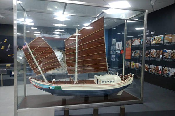
Free China Traditional Chinese Sailing Junk
Conclusion
The stories told by Imagining the World represent how humans acquire knowledge and use aesthetic methods to create records. The exhibition underscores the museum's diverse collection and the cultural importance of its artifacts to mankind. Over the course of history, people have leveraged their imaginations and technological progress to make marvelous achievements. Countless artistic masterpieces explore the wonders of the universe while examining the scientific and technological advances that support human civilization. Knowledge and art that has been accumulated since ancient times influences people to this day. Imagining the World hopes that people can be moved in ways that encourage them to use an open mind and a limitless imagination. Sometimes, a little bit of creativity can become a seed that spreads, inspiring the next scientist who changes people's lives or an artist who preserves memories for posterity in beautiful ways.