:::

Surveying the Sino-Vietnamese Border in Guangxi and Guangdong

Discussions to demarcate the Sino-Vietnamese border stemmed from Articles 1, 2, and 3 of the Treaty of Peace, Friendship, and Commerce between France and China. Article 3 stipulates that the Qing court and France send officials to conduct joint surveys of the border within six months of the signing of the Treaty. The Chinese provinces of Guangdong, Guangxi, and Yunnan shared a border with Vietnam, thus the border survey and demarcation was divided into the three sections of Guangxi-Vietnam, Guangdong-Vietnam, and Yunnan-Vietnam.

In accordance with the Treaty, the Qing court sent Chief Minister Deng Chengxiu (1841-1892) of the Office of Diplomatic Reception to Guangxi, where he and Viceroy Zhang Zhidong (1837-1909) of Guangdong and Guangxi, Governor Ni Wenwei (n.d.) of Guangdong, and Acting Governor Li Bingheng (1830-1900) of Guangxi supervised the surveying of the border between China and Vietnam. Between the 12th and the 19th years of the Guangxu reign (1886-1893), China and France completed the survey of the Guangxi-Vietnam and Guangdong-Vietnam borders and signposting. This section features the Treaty of Peace, Friendship, and Commerce between France and China and the Convention between China and France Respecting the Delimitation of the Frontier between China and Tonkin, along with border survey records and accompanying maps.

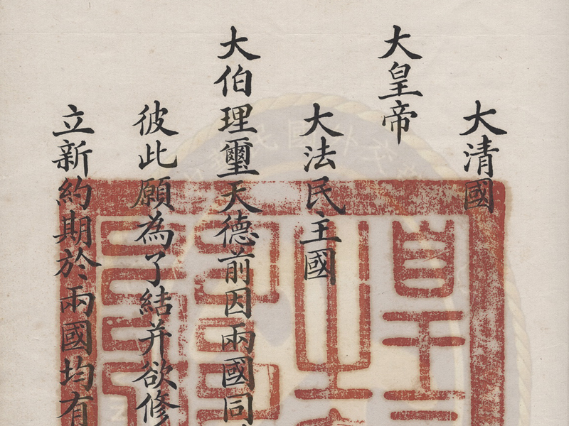
Treaty of Peace, Friendship and Commerce between France and China

Treaty of Peace, Friendship and Commerce between France and China

  1. Signed on the 27th day of the 4th month in the 11th year of the Guangxu reign
  2. Qing dynasty (June 9, 1885), in Tianjin
  3. Exchanged on the 7th day of the 6th month in the 11th year of the Guangxu reign
  4. Qing dynasty (July 18, 1885), in Beijing
  5. 36 x 22.7 cm
France signed the Treaty of Saigon with Vietnam in the first year of Qing China's Tongzhi reign (1862), securing rights to trade in and send missionaries to Vietnam, and taking charge of its foreign relations. In the 12th year (1874) the two countries signed another agreement, with France gaining nearly full control over Vietnam. However, in claiming suzerainty over Vietnam, the Qing court refused to recognize the Treaty. In the 8th year of the Guangxu reign (1882), China went to war with France, and two years later (1884) the French navy attacked Fuzhou and blocked important ports along the Yangtze River. The following year (1885), French military lost momentum with its defeat at the Battle of Lạng Sơn, and the Qing court immediately sent Li Hongzhang (1823-1901) to negotiate with the French envoy to Beijing, Jules Patenôtre des Noyers (1845-1925), and the two sides signed the Treaty of Peace, Friendship, and Commerce between France and China, which forced China to recognize the validity of all treaties signed between France and Vietnam, and stipulated that the two sides send officials to the border between China and Tonkin to demarcate the boundary. In addition to the version approved by China and France, the Treaty is accompanied by a French version initialed by a plenipotentiary envoy, a receipt of the exchange of the Treaty, and a translation of the approval by the French.
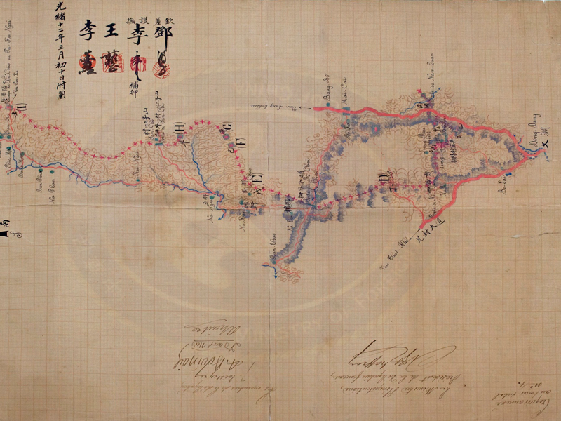
Map for the Preliminary Demarcation of the Sino-Vietnamese Border in Eastern Guangdong (Guangxi)

Map for the Preliminary Demarcation of the Sino-Vietnamese Border in Eastern Guangdong (Guangxi)

  1. 12th year of the Guangxu reign, Qing dynasty (1886)
  2. 88.5 x 34 cm
After completing the border survey of the Nam-quan to Ai-tien-ai section, Deng Chengxiu and M. Bourcier Saint-Chaffray led their delegations to demarcate the section between Nam-quan and Bi-nhi; they went on to sign the fourth border survey record and produce border maps. The borderline marked with red crosses on this map starts from the small bridge in front of Nam-quan (north of Đồng Đăng at the bottom) and extends west to locations marked A, B, C, and D, before reaching the outer fences of Long-ngau and Ki-da-ai. Then, the line goes north to the outer fence of Bo-chaï and passes through locations marked E, F, G, and H to arrive at the village of San-chi. From there the line extends northwards to Pa-keo-ngai, the outer fences of Thuong-duong and Ban-cuyen, and locations marked J, K, L, M, and N, before ending at Bi-nhi, to the east of the location marked N.